Page Summary
-
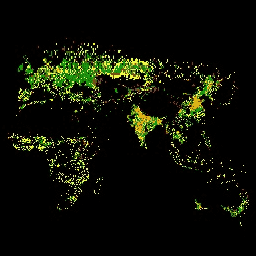
Google Earth Engine offers a variety of land cover and land use datasets derived from satellite imagery and other sources.
-
These datasets cover global, regional, and specific thematic areas like agriculture, forestry, and urban environments.
-
Data resolutions and temporal coverages vary, ranging from high-resolution 10m data to broader 0.05-degree coverage.
-
The datasets are produced by numerous international organizations and initiatives, providing diverse perspectives and applications.
-
Examples of available datasets include global settlement maps, US forest characteristics, and regional ecosystem classifications.
-
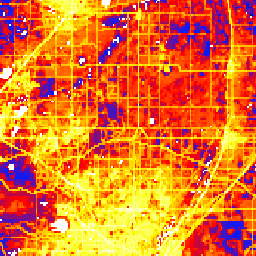
CSP gHM: Global Human Modification
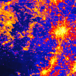
The global Human Modification dataset (gHM) provides a cumulative measure of human modification of terrestrial lands globally at 1 square-kilometer resolution. The gHM values range from 0.0-1.0 and are calculated by estimating the proportion of a given location (pixel) that is modified, the estimated intensity … csp fragmentation human-modification landcover landscape-gradient population -
Canada AAFC Annual Crop Inventory
Starting in 2009, the Earth Observation Team of the Science and Technology Branch (STB) at Agriculture and Agri-Food Canada (AAFC) began the process of generating annual crop type digital maps. Focusing on the Prairie Provinces in 2009 and 2010, a Decision Tree (DT) based methodology … agriculture canada crop landcover -
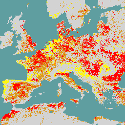
Copernicus CORINE Land Cover
The CORINE (coordination of information on the environment) Land Cover (CLC) inventory was initiated in 1985 to standardize data collection on land in Europe to support environmental policy development. The project is coordinated by the European Environment Agency (EEA) in the frame of the EU … copernicus eea esa eu landcover landuse-landcover -
Copernicus Global Land Cover Layers: CGLS-LC100 Collection 3
The Copernicus Global Land Service (CGLS) is earmarked as a component of the Land service to operate a multi-purpose service component that provides a series of bio-geophysical products on the status and evolution of land surface at global scale. The Dynamic Land Cover map at … copernicus eea esa eu landcover landuse-landcover -
Cote d'Ivoire BNETD 2020 Land Cover Map
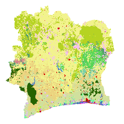
The Cote d'Ivoire BNETD 2020 Land Cover Map was produced by the Ivorian Government through a national institution, the Center for Geographic Information and Digital from the National Study Office Techniques and Development (BNETD-CIGN), with technical and financial support from the European Union. The methodology … classification deforestation forest landcover landuse-landcover -
DESS China Terrace Map v1
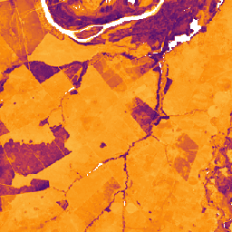
This dataset is a China terrace map at 30 m resolution in 2018. It was developed through supervised pixel-based classification using multisource and multi-temporal data based on the Google Earth Engine platform. The overall accuracy and kappa coefficient achieved 94% and 0.72, respectively. This first … agriculture landcover landuse landuse-landcover tsinghua -
Dynamic World V1
Dynamic World is a 10m near-real-time (NRT) Land Use/Land Cover (LULC) dataset that includes class probabilities and label information for nine classes. Dynamic World predictions are available for the Sentinel-2 L1C collection from 2015-06-27 to present. The revisit frequency of Sentinel-2 is between 2-5 days … global google landcover landuse landuse-landcover nrt -
EC JRC global map of forest types 2020, V1
The global map of forest types provides a spatially explicit representation of primary forest, naturally regenerating forest and planted forest (including plantation forest) for the year 2020 at 10m spatial resolution. The base layer for mapping these forest types is the extent of forest cover … eudr forest forest-biomass jrc landcover primary-forest -
ESA WorldCereal 10 m v100
The European Space Agency (ESA) WorldCereal 10 m 2021 product suite consists of global-scale annual and seasonal crop maps and their related confidence. They were generated as part of the ESA-WorldCereal project. More information on the content of these products and the methodology used to … agriculture copernicus crop esa global landcover -
ESA WorldCereal Active Cropland 10 m v100
The European Space Agency (ESA) WorldCereal Active Cropland 10 m 2021 product suite contains global-scale seasonal active cropland markers. They were generated as part of the ESA-WorldCereal project. The active cropland products indicate whether or not a pixel identified as temporary crops has been actively … agriculture copernicus crop esa global landcover -
ESA WorldCover 10m v100
The European Space Agency (ESA) WorldCover 10 m 2020 product provides a global land cover map for 2020 at 10 m resolution based on Sentinel-1 and Sentinel-2 data. The WorldCover product comes with 11 land cover classes and has been generated in the framework of … esa landcover landuse landuse-landcover sentinel1-derived sentinel2-derived -
ESA WorldCover 10m v200

The European Space Agency (ESA) WorldCover 10 m 2021 product provides a global land cover map for 2021 at 10 m resolution based on Sentinel-1 and Sentinel-2 data. The WorldCover product comes with 11 land cover classes and has been generated in the framework of … esa landcover landuse landuse-landcover sentinel1-derived sentinel2-derived -
FireCCI51: MODIS Fire_cci Burned Area Pixel Product, Version 5.1
The MODIS Fire_cci Burned Area pixel product version 5.1 (FireCCI51) is a monthly global ~250m spatial resolution dataset containing information on burned area as well as ancillary data. It is based on surface reflectance in the Near Infrared (NIR) band from the MODIS instrument onboard … burn cci climate-change copernicus esa fire -
GFSAD1000: Cropland Extent 1km Multi-Study Crop Mask, Global Food-Support Analysis Data
The GFSAD is a NASA-funded project to provide high-resolution global cropland data and their water use that contributes towards global food security in the twenty-first century. The GFSAD products are derived through multi-sensor remote sensing data (e.g., Landsat, MODIS, AVHRR), secondary data, and field-plot data … agriculture crop landcover usgs -
GHSL: Global built-up surface 10m (P2023A)
This raster dataset depicts the distribution of built-up surfaces, expressed in square metres per 10 m grid cell, for 2018 as observed from the S2 image data. The datasets measure: a) the total built-up surface, and b) the built-up surface allocated to grid cells of … built built-environment builtup copernicus ghsl jrc -
GHSL: Global built-up surface 1975-2030 (P2023A)
This raster dataset depicts the distribution of built-up surfaces, expressed in square metres per 100 m grid cell. The dataset measures: a) the total built-up surface, and b) the built-up surface allocated to grid cells of predominant non-residential (NRES) use. Data are spatially-temporally interpolated or … built built-environment builtup copernicus ghsl jrc -
GHSL: Global settlement characteristics (10 m) 2018 (P2023A)
This spatial raster dataset delineates human settlements at 10 m resolution, and describes their inner characteristics in terms of the functional and height-related components of the built environment. More information about the GHSL data products can be found in the GHSL Data Package 2023 report … building built builtup copernicus ghsl height -
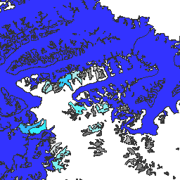
GLIMS 2023: Global Land Ice Measurements From Space

Global Land Ice Measurements from Space (GLIMS) is an international initiative with the goal of repeatedly surveying the world's estimated 200,000 glaciers. The project seeks to create a globally comprehensive inventory of land ice, including measurements of glacier area, geometry, surface velocity, and snow line … cryosphere glacier glims ice landcover nasa -
GLIMS Current: Global Land Ice Measurements From Space
Global Land Ice Measurements from Space (GLIMS) is an international initiative with the goal of repeatedly surveying the world's estimated 200,000 glaciers. The project seeks to create a globally comprehensive inventory of land ice, including measurements of glacier area, geometry, surface velocity, and snow line … cryosphere glacier glims ice landcover nasa -
GPW Annual Dominant Class of Grasslands v1
This dataset provides global annual dominant class maps of grasslands (cultivated and natural/semi-natural) from 2000 to 2022 at 30-m spatial resolution. Produced by the Land & Carbon Lab Global Pasture Watch initiative, the mapped grassland extent includes any land cover type, which contains at least … global global-pasture-watch land landcover landuse landuse-landcover -
GPW Annual Probabilities of Cultivated Grasslands v1
This dataset provides global annual probability maps of cultivated grassland from 2000 to 2022 at 30-m spatial resolution. Produced by the Land & Carbon Lab Global Pasture Watch initiative, the mapped grassland extent includes any land cover type, which contains at least 30% of dry … global global-pasture-watch land landcover landuse landuse-landcover -
GPW Annual Probabilities of Natural/Semi-natural Grasslands v1
This dataset provides global annual probability maps of natural/semi-natural grassland from 2000 to 2022 at 30-m spatial resolution. Produced by the Land & Carbon Lab Global Pasture Watch initiative, the mapped grassland extent includes any land cover type, which contains at least 30% of dry … global global-pasture-watch land landcover landuse landuse-landcover -
GPW Annual short vegetation height v1
This dataset provides global median vegetation height from 2000 at 30-m spatial resolution. Produced by the Land & Carbon Lab’s Global Pasture Watch initiative, this dataset provides median vegetation height values (50th percentile) globally at 30-m spatial resolution from 2000 onwards. The dataset is based … canopy global global-pasture-watch land landcover plant-productivity -
GPW Annual uncalibrated Gross Primary Productivity (uGPP) v1
This dataset provides global uncalibrated EO-based Gross Primary Productivity from 2000 at 30-m spatial resolution. Produced by the Land & Carbon Lab Global Pasture Watch initiative, the current dataset provides Gross Primary Productivity (GPP) values globally at 30-m spatial resolution from 2000 onwards. GPP values … global global-pasture-watch land landcover landuse plant-productivity -
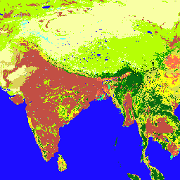
GlobCover: Global Land Cover Map
GlobCover 2009 is a global land cover map based on ENVISAT's Medium Resolution Imaging Spectrometer (MERIS) Level 1B data acquired in full resolution mode with a spatial resolution of approximately 300 meters. esa landcover landuse-landcover -
Global 3-class PALSAR-2/PALSAR Forest/Non-Forest Map
A newer version of this dataset with 4 classes for 2017-2020 can be found in JAXA/ALOS/PALSAR/YEARLY/FNF4 The global forest/non-forest map (FNF) is generated by classifying the SAR image (backscattering coefficient) in the global 25m resolution PALSAR-2/PALSAR SAR mosaic so that strong and low backscatter pixels … alos alos2 classification eroc forest forest-biomass -
Global 4-class PALSAR-2/PALSAR Forest/Non-Forest Map
The global forest/non-forest map (FNF) is generated by classifying the SAR image (backscattering coefficient) in the global 25m resolution PALSAR-2/PALSAR SAR mosaic so that strong and low backscatter pixels are assigned as "forest" and "non-forest", respectively. Here, "forest" is defined as the natural forest with … alos alos2 classification eroc forest forest-biomass -
Global map of Local Climate Zones, latest version
Since their introduction in 2012, Local Climate Zones (LCZs) emerged as a new standard for characterizing urban landscapes, providing a holistic classification approach that takes into account micro-scale land-cover and associated physical properties. This global map of Local Climate Zones, at 100m pixel size and … climate landcover landuse-landcover urban -
Google Global Landsat-based CCDC Segments (1999-2019)
This collection contains precomputed results from running the Continuous Change Detection and Classification (CCDC) algorithm on 20 years of Landsat surface reflectance data. CCDC is a break-point finding algorithm that uses harmonic fitting with a dynamic RMSE threshold to detect breakpoints in time-series data. The … change-detection google landcover landsat-derived landuse landuse-landcover -
Iran Land Cover Map v1 13-class (2017)
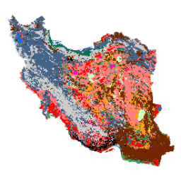
The Iran-wide land cover map was generated by processing Sentinel imagery within the Google Earth Engine Cloud platform. For this purpose, over 2,500 Sentinel-1 and over 11,000 Sentinel-2 images were processed to produce a single mosaic dataset for the year 2017. Then, an object-based Random … landcover landuse-landcover -
LUCAS Copernicus (Polygons with attributes, 2018) V1
The Land Use/Cover Area frame Survey (LUCAS) in the European Union (EU) was set up to provide statistical information. It represents a triennial in-situ landcover and land-use data-collection exercise that extends over the whole of the EU's territory. LUCAS collects information on land cover and … copernicus eu jrc landcover landuse landuse-landcover -
LUCAS Harmonized (Theoretical Location, 2006-2018) V1
The Land Use/Cover Area frame Survey (LUCAS) in the European Union (EU) was set up to provide statistical information. It represents a triennial in-situ landcover and land-use data-collection exercise that extends over the whole of the EU's territory. LUCAS collects information on land cover and … eu jrc landcover landuse landuse-landcover lucas -
LUCAS THLOC (Points with attributes, 2022) V1
The Land Use/Cover Area frame Survey (LUCAS) in the European Union (EU) was set up to provide statistical information. It represents a triennial in-situ landcover and land-use data-collection exercise that extends over the whole of the EU's territory. LUCAS collects information on land cover and … eu jrc landcover landuse landuse-landcover lucas -
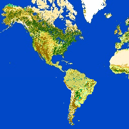
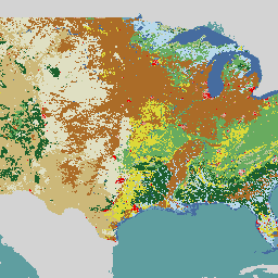
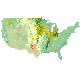
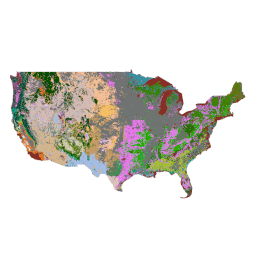
Land Cover of North America at 30 meters, 2020
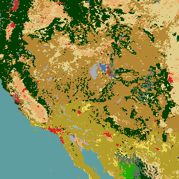
The 2020 North American Land Cover 30-meter dataset was produced as part of the North American Land Change Monitoring System (NALCMS), a trilateral effort between Natural Resources Canada, the United States Geological Survey, and three Mexican organizations including the National Institute of Statistics and Geography … landcover landsat landuse-landcover nlcd reflectance -
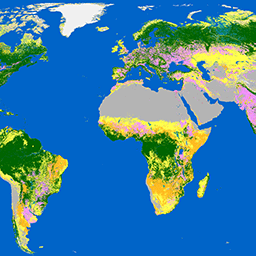
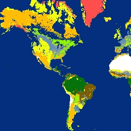
MCD12C1.061 MODIS Land Cover Type Yearly Global 0.05 Deg CMG
The Terra and Aqua combined Moderate Resolution Imaging Spectroradiometer (MODIS) Land Cover Climate Modeling Grid (CMG) (MCD12C1) Version 6.1 data product provides a spatially aggregated and reprojected version of the tiled MCD12Q1 Version 6.1 data product. Maps of the International Geosphere-Biosphere Programme (IGBP), University of … landcover landuse-landcover modis nasa usgs yearly -
MCD12Q1.061 MODIS Land Cover Type Yearly Global 500m
The Terra and Aqua combined Moderate Resolution Imaging Spectroradiometer (MODIS) Land Cover Type (MCD12Q1) Version 6.1 data product provides global land cover types at yearly intervals. The MCD12Q1 Version 6.1 data product is derived using supervised classifications of MODIS Terra and Aqua reflectance data. Land … landcover landuse-landcover modis nasa usgs yearly -
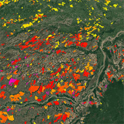
Monitoring Trends in Burn Severity (MTBS) Burn Severity Images
The burn severity mosaics consist of thematic raster images of MTBS burn severity classes for all currently completed MTBS fires for the continental United States, Alaska, Hawaii and Puerto Rico. Mosaicked burn severity images are compiled annually for each year by US State and the … eros fire forest gtac landcover landsat-derived -
NLCD 2019: USGS National Land Cover Database, 2019 release
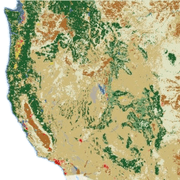
NLCD (the National Land Cover Database) is a 30-m Landsat-based land cover database spanning 8 epochs (2001, 2004, 2006, 2008, 2011, 2013, 2016, and 2019). A ninth epoch for 2021 is also available here. The images rely on the imperviousness data layer for the urban … blm landcover landuse-landcover mrlc nlcd usgs -
NLCD 2021: USGS National Land Cover Database, 2021 release
The U.S. Geological Survey (USGS), in partnership with several federal agencies, has now developed and released seven National Land Cover Database (NLCD) products: NLCD 1992, 2001, 2006, 2011, 2016, 2019, and 2021. Beginning with the 2016 release, land cover products were created for two-to-three-year intervals … blm landcover landuse-landcover mrlc nlcd usgs -
Oxford MAP: Malaria Atlas Project Fractional International Geosphere-Biosphere Programme Landcover
The underlying dataset for this landcover product is the IGBP layer found within the MODIS annual landcover product (MCD12Q1). This data was converted from its categorical format, which has a ≈500 meter resolution, to a fractional product indicating the integer percentage (0-100) of the output … landcover landuse-landcover map -
SBTN Natural Lands Map v1
The SBTN Natural Lands Map v1 is a 2020 baseline map of natural and non-natural land covers intended for use by companies setting science-based targets for nature, specifically the SBTN Land target #1: no conversion of natural ecosystems. "Natural" and "non-natural" definitions were adapted from … ecosystems landcover landuse-landcover wri -
SBTN Natural Lands Map v1.1
The SBTN Natural Lands Map v1.1 is a 2020 baseline map of natural and non-natural land covers intended for use by companies setting science-based targets for nature, specifically the SBTN Land target #1: no conversion of natural ecosystems. "Natural" and "non-natural" definitions were adapted from … ecosystems landcover landuse-landcover wri -
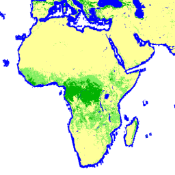
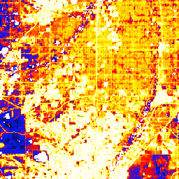
TNC Global Human Modification v3 (Change-Consistent 300m)
The Global Human Modification v3 dataset measures cumulative human pressures on global terrestrial ecosystems (excluding Antarctica). It tracks data from 1990 to 2022 and is intended to help quantify human impact for conservation planning, policy-making, and research. This dataset is the "Change-Consistent" Series ("c" series) … fragmentation human-modification landcover landscape-gradient population stressors -
TNC Global Human Modification v3 (Static Snapshot 90m)
The Global Human Modification v3 dataset measures cumulative human pressures on global terrestrial ecosystems (excluding Antarctica). It tracks data from 1990 to 2022 and is intended to help quantify human impact for conservation planning, policy-making, and research. This is the 2022 static snapshot ("s" series) … fragmentation human-modification landcover landscape-gradient population stressors -
USDA NASS Cropland Data Layers
The Cropland Data Layer (CDL) is a crop-specific land cover data layer created annually for the continental United States using moderate resolution satellite imagery and extensive agricultural ground truth. The CDL is created by the USDA, National Agricultural Statistics Service (NASS), Research and Development Division, … agriculture crop landcover usda -
USFS Landscape Change Monitoring System v2025-11 (CONUS and OCONUS)
This product is part of the Landscape Change Monitoring System (LCMS) data suite. It shows LCMS-modeled change, land cover, and/or land use classes for each year and covers the Conterminous United States (CONUS) as well as areas outside the CONUS (OCONUS) including Alaska (AK), Puerto … change-detection forest gtac gtac-data-publish landcover landuse -
USFS TreeMap v2016 (Conterminous United States)
This product is part of the TreeMap data suite. It provides detailed spatial information on forest characteristics including number of live and dead trees, biomass, and carbon across the entire forested extent of the continental United States in 2016. TreeMap v2016 contains one image, a … biomass carbon climate-change conus forest forest-biomass -
USFS TreeMap v2020
This product is part of the TreeMap data suite. It provides detailed spatial information on forest characteristics including number of live and dead trees, biomass, and carbon across the entire forested extent of the United States in 2020. TreeMap v2020 contains 22-band 30 x 30m … aboveground biomass carbon climate-change conus forest -
USFS TreeMap v2022

This product is part of the TreeMap data suite. It provides detailed spatial information on forest characteristics including number of live and dead trees, biomass, and carbon across the entire forested extent of the United States in 2022. TreeMap v2022 contains 22-band 30 x 30m … aboveground biomass carbon climate-change conus forest -
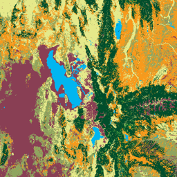
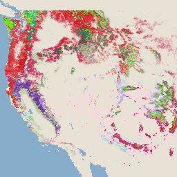
USGS GAP Alaska 2001
The GAP/LANDFIRE National Terrestrial Ecosystems data represents a detailed vegetation and land cover classification for the Conterminous U.S., Alaska, Hawaii, and Puerto Rico.GAP/LF 2011 Ecosystems for the Conterminous U.S. is an update of the National Gap Analysis Program Land Cover Data - Version 2.2. Alaska … ecosystems gap landcover landfire usgs vegetation -
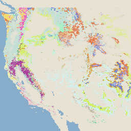
USGS GAP CONUS 2011
The GAP/LANDFIRE National Terrestrial Ecosystems data represents a detailed vegetation and land cover classification for the Conterminous U.S., Alaska, Hawaii, and Puerto Rico.GAP/LF 2011 Ecosystems for the Conterminous U.S. is an update of the National Gap Analysis Program Land Cover Data - Version 2.2. Alaska … ecosystems gap landcover landfire usgs vegetation -
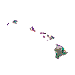
USGS GAP Hawaii 2001
The GAP/LANDFIRE National Terrestrial Ecosystems data represents a detailed vegetation and land cover classification for the Conterminous U.S., Alaska, Hawaii, and Puerto Rico.GAP/LF 2011 Ecosystems for the Conterminous U.S. is an update of the National Gap Analysis Program Land Cover Data - Version 2.2. Alaska … ecosystems gap landcover landfire usgs vegetation -
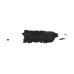
USGS GAP Puerto Rico 2001
The GAP/LANDFIRE National Terrestrial Ecosystems data represents a detailed vegetation and land cover classification for the Conterminous U.S., Alaska, Hawaii, and Puerto Rico.GAP/LF 2011 Ecosystems for the Conterminous U.S. is an update of the National Gap Analysis Program Land Cover Data - Version 2.2. Alaska … ecosystems gap landcover landfire usgs vegetation -
World Settlement Footprint 2015
The World Settlement Footprint (WSF) 2015 is a 10m resolution binary mask outlining the extent of human settlements globally derived by means of 2014-2015 multitemporal Landsat-8 and Sentinel-1 imagery (of which ~217,000 and ~107,000 scenes have been processed, respectively). The temporal dynamics of human settlements … landcover landsat-derived population sentinel1-derived settlement urban