Page Summary
-
Copernicus datasets cover diverse areas including atmosphere monitoring, land monitoring, digital elevation models, ocean monitoring, climate reanalysis, built environment, and satellite imagery.
-
Atmospheric composition, land cover, ocean conditions, and built-up areas are monitored through various global and regional datasets.
-
Sentinel satellite data, including Sentinel-1, Sentinel-2, Sentinel-3, and Sentinel-5P, are fundamental to many Copernicus products.
-
Sentinel-5P provides both Near Real-Time (NRTI) and Offline (OFFL) datasets for atmospheric trace gases and aerosol properties.
-
Specific datasets like ERA5 and ERA5-Land provide reanalysis of climate and land variables, while GHSL datasets focus on built environment characteristics.
-
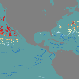
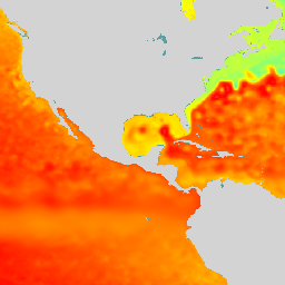
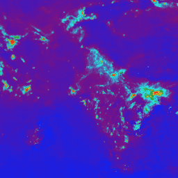
Copernicus Atmosphere Monitoring Service (CAMS) Global Near-Real-Time
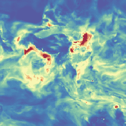
The Copernicus Atmosphere Monitoring Service provides the capacity to continuously monitor the composition of the Earth's atmosphere at global and regional scales. The main global near-real-time production system is a data assimilation and forecasting suite providing two 5-day forecasts per day for aerosols and chemical … aerosol atmosphere climate copernicus ecmwf forecast -
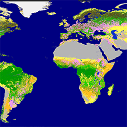
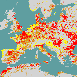
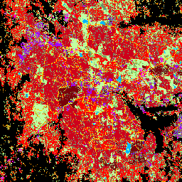
Copernicus CORINE Land Cover
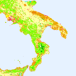
The CORINE (coordination of information on the environment) Land Cover (CLC) inventory was initiated in 1985 to standardize data collection on land in Europe to support environmental policy development. The project is coordinated by the European Environment Agency (EEA) in the frame of the EU … copernicus eea esa eu landcover landuse-landcover -
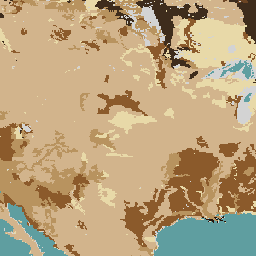
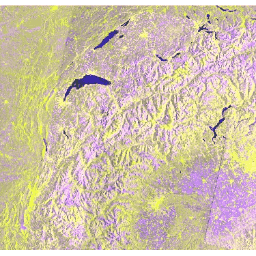
Copernicus DEM GLO-30 (2024_1): Global 30m Digital Elevation Model
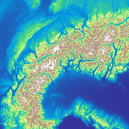
The Copernicus DEM is a Digital Surface Model (DSM) which represents the surface of the Earth including buildings, infrastructure and vegetation. This DEM is derived from an edited DSM named WorldDEM™, i.e., flattening of water bodies and consistent flow of rivers has been included. Editing … copernicus dem elevation elevation-topography geophysical -
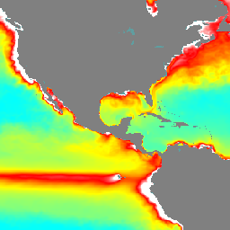
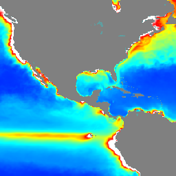
Copernicus Global In-situ Observations of Ocean Currents - Argo
The In Situ TAC is a distributed centre organized around 7 oceanographic regions: the global ocean and the 6 EUROGOOS regional alliances. It involves 14 partners from 11 countries in Europe. It doesn't deploy any observing system and relies on data, exclusively funded by other … copernicus currents insitu oceans -
Copernicus Global In-situ Observations of Ocean Currents - Drifter
The In Situ TAC is a distributed centre organized around 7 oceanographic regions: the global ocean and the 6 EUROGOOS regional alliances. It involves 14 partners from 11 countries in Europe. It doesn't deploy any observing system and relies on data, exclusively funded by other … copernicus currents insitu oceans -
Copernicus Global In-situ Observations of Ocean Currents - Radar Radial
The In Situ TAC is a distributed centre organized around 7 oceanographic regions: the global ocean and the 6 EUROGOOS regional alliances. It involves 14 partners from 11 countries in Europe. It doesn't deploy any observing system and relies on data, exclusively funded by other … copernicus currents insitu oceans radar -
Copernicus Global In-situ Observations of Ocean Currents - Radar Total
The In Situ TAC is a distributed centre organized around 7 oceanographic regions: the global ocean and the 6 EUROGOOS regional alliances. It involves 14 partners from 11 countries in Europe. It doesn't deploy any observing system and relies on data, exclusively funded by other … copernicus currents insitu oceans radar -
Copernicus Global Land Cover Layers: CGLS-LC100 Collection 3
The Copernicus Global Land Service (CGLS) is earmarked as a component of the Land service to operate a multi-purpose service component that provides a series of bio-geophysical products on the status and evolution of land surface at global scale. The Dynamic Land Cover map at … copernicus eea esa eu landcover landuse-landcover -
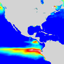
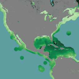
Copernicus Global Ocean Bio-Geo-Chemical Forecast - BIO
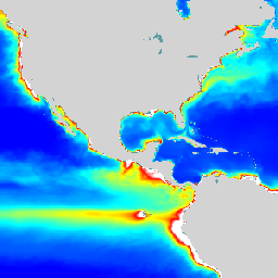
The Operational Mercator Ocean biogeochemical global ocean analysis and forecast system at 1/4 degree is providing 10 days of 3D global ocean forecasts updated weekly. The time series is aggregated in time, in order to reach a two full year's time series sliding window. This … copernicus daily forecast oceans -
Copernicus Global Ocean Bio-Geo-Chemical Forecast - CAR
The Operational Mercator Ocean biogeochemical global ocean analysis and forecast system at 1/4 degree is providing 10 days of 3D global ocean forecasts updated weekly. The time series is aggregated in time, in order to reach a two full year's time series sliding window. This … copernicus daily forecast oceans -
Copernicus Global Ocean Bio-Geo-Chemical Forecast - CO2
The Operational Mercator Ocean biogeochemical global ocean analysis and forecast system at 1/4 degree is providing 10 days of 3D global ocean forecasts updated weekly. The time series is aggregated in time, in order to reach a two full year's time series sliding window. This … copernicus daily forecast oceans -
Copernicus Global Ocean Bio-Geo-Chemical Forecast - NUT
The Operational Mercator Ocean biogeochemical global ocean analysis and forecast system at 1/4 degree is providing 10 days of 3D global ocean forecasts updated weekly. The time series is aggregated in time, in order to reach a two full year's time series sliding window. This … copernicus daily forecast oceans -
Copernicus Global Ocean Bio-Geo-Chemical Forecast - OPTICS
The Operational Mercator Ocean biogeochemical global ocean analysis and forecast system at 1/4 degree is providing 10 days of 3D global ocean forecasts updated weekly. The time series is aggregated in time, in order to reach a two full year's time series sliding window. This … copernicus daily forecast oceans -
Copernicus Global Ocean Bio-Geo-Chemical Forecast - PFT
The Operational Mercator Ocean biogeochemical global ocean analysis and forecast system at 1/4 degree is providing 10 days of 3D global ocean forecasts updated weekly. The time series is aggregated in time, in order to reach a two full year's time series sliding window. This … copernicus daily forecast oceans -
Copernicus Global Ocean Bio-Geo-Chemical Forecast - PLANKTON

The Operational Mercator Ocean biogeochemical global ocean analysis and forecast system at 1/4 degree is providing 10 days of 3D global ocean forecasts updated weekly. The time series is aggregated in time, in order to reach a two full year's time series sliding window. This … copernicus daily forecast oceans -
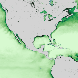
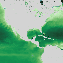
Copernicus Satellite Ocean Color Daily Data

This dataset provides global daily estimates of ocean surface chlorophyll-a concentration and remote sensing reflectance derived from multiple satellite sensors. Remote-sensing reflectance (or Rrs) is defined as the ratio of water-leaving radiance to downwelling irradiance and serves as the main input to algorithms used to … chlorophyll-a copernicus daily oceans -
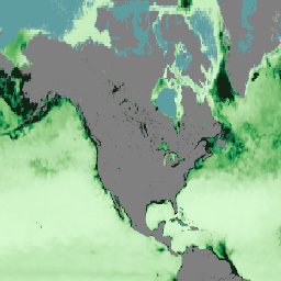
ERA5 Daily Aggregates - Latest Climate Reanalysis Produced by ECMWF / Copernicus Climate Change Service
ERA5 is the fifth generation ECMWF atmospheric reanalysis of the global climate. Reanalysis combines model data with observations from across the world into a globally complete and consistent dataset. ERA5 replaces its predecessor, the ERA-Interim reanalysis. ERA5 DAILY provides aggregated values for each day for … climate copernicus dewpoint ecmwf era5 precipitation -
ERA5 Hourly - ECMWF Climate Reanalysis
ERA5 is the fifth generation ECMWF atmospheric reanalysis of the global climate. It is produced by the Copernicus Climate Change Service (C3S) at ECMWF. Reanalysis combines model data with observations from across the world into a globally complete and consistent dataset using the laws of … atmosphere climate copernicus ecmwf era5 hourly -
ERA5 Hourly Pressure Levels - ECMWF Climate Reanalysis
ERA5 is the fifth generation ECMWF atmospheric reanalysis of the global climate. Reanalysis combines model data with observations from across the world into a globally complete and consistent dataset. ERA5 replaces its predecessor, the ERA-Interim reanalysis. This dataset contains 3D parameters at 37 pressure levels. atmosphere climate copernicus ecmwf era5 hourly -
ERA5 Monthly Aggregates - Latest Climate Reanalysis Produced by ECMWF / Copernicus Climate Change Service

ERA5 is the fifth generation ECMWF atmospheric reanalysis of the global climate. Reanalysis combines model data with observations from across the world into a globally complete and consistent dataset. ERA5 replaces its predecessor, the ERA-Interim reanalysis. ERA5 MONTHLY provides aggregated values for each month for … climate copernicus dewpoint ecmwf era5 precipitation -
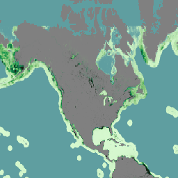
ERA5-Land Daily Aggregated - ECMWF Climate Reanalysis
ERA5-Land is a reanalysis dataset providing a consistent view of the evolution of land variables over several decades at an enhanced resolution compared to ERA5. ERA5-Land has been produced by replaying the land component of the ECMWF ERA5 climate reanalysis. Reanalysis combines model data with … cds climate copernicus ecmwf era5-land evaporation -
ERA5-Land Hourly - ECMWF Climate Reanalysis

ERA5-Land is a reanalysis dataset providing a consistent view of the evolution of land variables over several decades at an enhanced resolution compared to ERA5. ERA5-Land has been produced by replaying the land component of the ECMWF ERA5 climate reanalysis. Reanalysis combines model data with … cds climate copernicus ecmwf era5-land evaporation -
ERA5-Land Monthly Aggregated - ECMWF Climate Reanalysis
ERA5-Land is a reanalysis dataset providing a consistent view of the evolution of land variables over several decades at an enhanced resolution compared to ERA5. ERA5-Land has been produced by replaying the land component of the ECMWF ERA5 climate reanalysis. Reanalysis combines model data with … cds climate copernicus ecmwf era5-land evaporation -
ERA5-Land Monthly Averaged by Hour of Day - ECMWF Climate Reanalysis
ERA5-Land is a reanalysis dataset providing a consistent view of the evolution of land variables over several decades at an enhanced resolution compared to ERA5. ERA5-Land has been produced by replaying the land component of the ECMWF ERA5 climate reanalysis. Reanalysis combines model data with … cds climate copernicus ecmwf era5-land evaporation -
ERA5-Land Static - ECMWF Climate Reanalysis
ERA5-Land is a reanalysis dataset providing a consistent view of the evolution of land variables over several decades at an enhanced resolution compared to ERA5. ERA5-Land has been produced by replaying the land component of the ECMWF ERA5 climate reanalysis. Reanalysis combines model data with … cds climate copernicus ecmwf era5-land evaporation -
ESA WorldCereal 10 m v100
The European Space Agency (ESA) WorldCereal 10 m 2021 product suite consists of global-scale annual and seasonal crop maps and their related confidence. They were generated as part of the ESA-WorldCereal project. More information on the content of these products and the methodology used to … agriculture copernicus crop esa global landcover -
ESA WorldCereal Active Cropland 10 m v100
The European Space Agency (ESA) WorldCereal Active Cropland 10 m 2021 product suite contains global-scale seasonal active cropland markers. They were generated as part of the ESA-WorldCereal project. The active cropland products indicate whether or not a pixel identified as temporary crops has been actively … agriculture copernicus crop esa global landcover -
FireCCI51: MODIS Fire_cci Burned Area Pixel Product, Version 5.1
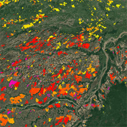
The MODIS Fire_cci Burned Area pixel product version 5.1 (FireCCI51) is a monthly global ~250m spatial resolution dataset containing information on burned area as well as ancillary data. It is based on surface reflectance in the Near Infrared (NIR) band from the MODIS instrument onboard … burn cci climate-change copernicus esa fire -
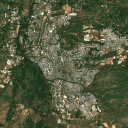
GHSL: Global building height 2018 (P2023A)
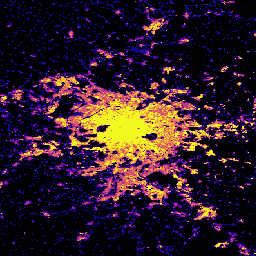
This spatial raster dataset depicts the global distribution of building heights at a resolution of 100 m, referred to the year 2018. The input data used to predict building heights are the ALOS Global Digital Surface Model (30 m), the NASA Shuttle Radar Topographic Mission … alos building built built-environment builtup copernicus -
GHSL: Global building volume 1975-2030 (P2023A)
This raster dataset depicts the global distribution of building volume, expressed in cubic metres per 100 m grid cell. The dataset measures the total building volume and the building volume allocated to grid cells of predominant non-residential (NRES) use. Estimates are based on the built-up … alos building built-environment copernicus dem ghsl -
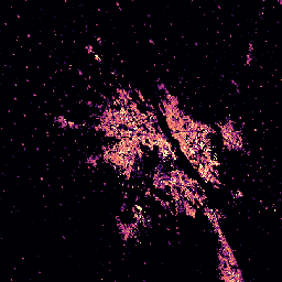
GHSL: Global built-up surface 10m (P2023A)
This raster dataset depicts the distribution of built-up surfaces, expressed in square metres per 10 m grid cell, for 2018 as observed from the S2 image data. The datasets measure: a) the total built-up surface, and b) the built-up surface allocated to grid cells of … built built-environment builtup copernicus ghsl jrc -
GHSL: Global built-up surface 1975-2030 (P2023A)
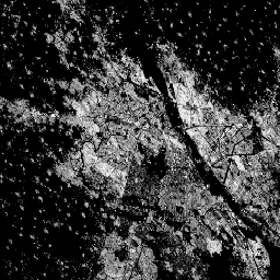
This raster dataset depicts the distribution of built-up surfaces, expressed in square metres per 100 m grid cell. The dataset measures: a) the total built-up surface, and b) the built-up surface allocated to grid cells of predominant non-residential (NRES) use. Data are spatially-temporally interpolated or … built built-environment builtup copernicus ghsl jrc -
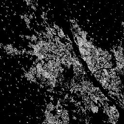
GHSL: Global settlement characteristics (10 m) 2018 (P2023A)
This spatial raster dataset delineates human settlements at 10 m resolution, and describes their inner characteristics in terms of the functional and height-related components of the built environment. More information about the GHSL data products can be found in the GHSL Data Package 2023 report … building built builtup copernicus ghsl height -
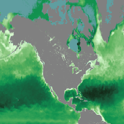
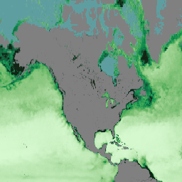
Global Ocean Colour: Bio-Geo-Chemical, L4, from Satellite Observations, Optics, Multi-Sensor 4KM
The Global Ocean Colour (Copernicus-GlobColour) dataset is a Bio-Geo-Chemical (BGC) product developed by ACRI-ST. Derived from multiple satellite sources like SeaWiFS, MODIS, and OLCI. It provides a comprehensive range of oceanographic variables, including: Chlorophyll (CHL), Phytoplankton Functional types and sizes (PFT), Primary Production (PP), Suspended … copernicus oceans -
Global Ocean Colour: Bio-Geo-Chemical, L4, from Satellite Observations, Plankton, Multi-Sensor, 4KM
The Global Ocean Colour (Copernicus-GlobColour) dataset is a Bio-Geo-Chemical (BGC) product developed by ACRI-ST. Derived from multiple satellite sources like SeaWiFS, MODIS, and OLCI. It provides a comprehensive range of oceanographic variables, including: Chlorophyll (CHL), Phytoplankton Functional types and sizes (PFT), Primary Production (PP), Suspended … copernicus oceans -
Global Ocean Colour: Bio-Geo-Chemical, L4, from Satellite Observations, Plankton, OLCI, 300M
The Global Ocean Colour (Copernicus-GlobColour) dataset is a Bio-Geo-Chemical (BGC) product developed by ACRI-ST. Derived from multiple satellite sources like SeaWiFS, MODIS, and OLCI. It provides a comprehensive range of oceanographic variables, including: Chlorophyll (CHL), Phytoplankton Functional types and sizes (PFT), Primary Production (PP), Suspended … copernicus oceans -
Global Ocean Colour: Bio-Geo-Chemical, L4, from Satellite Observations, Primary Production, Multi-Sensor 4KM

The Global Ocean Colour (Copernicus-GlobColour) dataset is a Bio-Geo-Chemical (BGC) product developed by ACRI-ST. Derived from multiple satellite sources like SeaWiFS, MODIS, and OLCI. It provides a comprehensive range of oceanographic variables, including: Chlorophyll (CHL), Phytoplankton Functional types and sizes (PFT), Primary Production (PP), Suspended … copernicus oceans -
Global Ocean Colour: Bio-Geo-Chemical, L4, from Satellite Observations, Reflectance, Multi-Sensor 4KM
The Global Ocean Colour (Copernicus-GlobColour) dataset is a Bio-Geo-Chemical (BGC) product developed by ACRI-ST. Derived from multiple satellite sources like SeaWiFS, MODIS, and OLCI. It provides a comprehensive range of oceanographic variables, including: Chlorophyll (CHL), Phytoplankton Functional types and sizes (PFT), Primary Production (PP), Suspended … copernicus oceans -
Global Ocean Colour: Bio-Geo-Chemical, L4, from Satellite Observations, Reflectance, OLCI 300M
The Global Ocean Colour (Copernicus-GlobColour) dataset is a Bio-Geo-Chemical (BGC) product developed by ACRI-ST. Derived from multiple satellite sources like SeaWiFS, MODIS, and OLCI. It provides a comprehensive range of oceanographic variables, including: Chlorophyll (CHL), Phytoplankton Functional types and sizes (PFT), Primary Production (PP), Suspended … copernicus oceans -
Global Ocean Colour: Bio-Geo-Chemical, L4, from Satellite Observations, Transparency, Multi-Sensor, 4KM
The Global Ocean Colour (Copernicus-GlobColour) dataset is a Bio-Geo-Chemical (BGC) product developed by ACRI-ST. Derived from multiple satellite sources like SeaWiFS, MODIS, and OLCI. It provides a comprehensive range of oceanographic variables, including: Chlorophyll (CHL), Phytoplankton Functional types and sizes (PFT), Primary Production (PP), Suspended … copernicus oceans -
Global Ocean Colour: Bio-Geo-Chemical, L4, from Satellite Observations, Transparency, OLCI, 4KM
The Global Ocean Colour (Copernicus-GlobColour) dataset is a Bio-Geo-Chemical (BGC) product developed by ACRI-ST. Derived from multiple satellite sources like SeaWiFS, MODIS, and OLCI. It provides a comprehensive range of oceanographic variables, including: Chlorophyll (CHL), Phytoplankton Functional types and sizes (PFT), Primary Production (PP), Suspended … copernicus oceans -
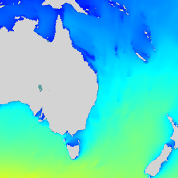
Global Ocean Physics Analysis and Forecast Daily
Copernicus Marine Physics 2D Daily Mean Fields (cmems_mod_glo_phy_anfc_0.083deg_P1D-m) deliver global daily-averaged ocean surface and bottom variables at 8km resolution. The Operational Mercator global ocean analysis and forecast system is providing 10 days of 2D global ocean forecasts updated daily. The time series is aggregated in … copernicus daily forecast oceans -
Global Ocean Waves Analysis and Forecast
The operational global ocean analysis and forecast system of Meteo-France with a resolution of 1/12 degree is providing daily analyses and 10 days forecasts for the global ocean sea surface waves. This product includes 3-hourly instantaneous fields of integrated wave parameters from the total spectrum … copernicus forecast hourly oceans -
Global Ocean Waves Static Bathymetry
Static bathymetry for the Global Ocean Waves Analysis and Forecast system. This dataset provides the sea floor depth in meters. The global wave system of Meteo-France is based on the wave model MFWAM which is a third generation wave model. MFWAM uses the computing code … bathymetry copernicus oceans -
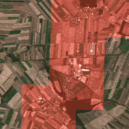
Harmonized Sentinel-2 MSI: MultiSpectral Instrument, Level-1C (TOA)
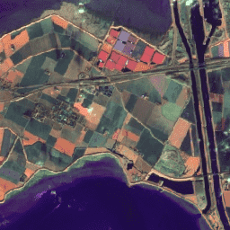
After 2022-01-25, Sentinel-2 scenes with PROCESSING_BASELINE '04.00' or above have their DN (value) range shifted by 1000. The HARMONIZED collection shifts data in newer scenes to be in the same range as in older scenes. Sentinel-2 is a wide-swath, high-resolution, multi-spectral imaging mission supporting Copernicus … copernicus esa eu msi radiance satellite-imagery -
Harmonized Sentinel-2 MSI: MultiSpectral Instrument, Level-2A (SR)
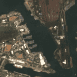
After 2022-01-25, Sentinel-2 scenes with PROCESSING_BASELINE '04.00' or above have their DN (value) range shifted by 1000. The HARMONIZED collection shifts data in newer scenes to be in the same range as in older scenes. Sentinel-2 is a wide-swath, high-resolution, multi-spectral imaging mission supporting Copernicus … copernicus esa eu msi reflectance satellite-imagery -
LUCAS Copernicus (Polygons with attributes, 2018) V1
The Land Use/Cover Area frame Survey (LUCAS) in the European Union (EU) was set up to provide statistical information. It represents a triennial in-situ landcover and land-use data-collection exercise that extends over the whole of the EU's territory. LUCAS collects information on land cover and … copernicus eu jrc landcover landuse landuse-landcover -
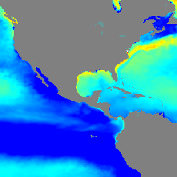
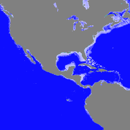
Multi Observation Global Ocean Sea Surface Salinity and Sea Surface Density : Daily, Multi-Year Reprocessed

Multi Observation Global Ocean Sea Surface Salinity and Sea Surface Density is an oceanographic product that provides daily, global, and gap-free Level-4 (L4) analyses of Sea Surface Salinity (SSS) and Sea Surface Density (SSD) at a high resolution of 1/8 degree. This product is generated … copernicus oceans -
Multi Observation Global Ocean Sea Surface Salinity and Sea Surface Density : Daily, Near Real Time

Multi Observation Global Ocean Sea Surface Salinity and Sea Surface Density is an oceanographic product that provides daily, global, and gap-free Level-4 (L4) analyses of Sea Surface Salinity (SSS) and Sea Surface Density (SSD) at a high resolution of 1/8 degree. This product is generated … copernicus oceans -
Sentinel-1 SAR GRD: C-band Synthetic Aperture Radar Ground Range Detected, log scaling
The Sentinel-1 mission provides data from a dual-polarization C-band Synthetic Aperture Radar (SAR) instrument at 5.405GHz (C band). This collection includes the S1 Ground Range Detected (GRD) scenes, processed using the Sentinel-1 Toolbox to generate a calibrated, ortho-corrected product. The collection is updated daily. New … backscatter copernicus esa eu polarization radar -
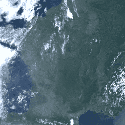
Sentinel-2: Cloud Probability
The S2 cloud probability is created with the sentinel2-cloud-detector library (using LightGBM). All bands are upsampled using bilinear interpolation to 10m resolution before the gradient boost base algorithm is applied. The resulting 0..1 floating point probability is scaled to 0..100 and stored as an UINT8. … cloud copernicus esa eu msi radiance -
Sentinel-3 OLCI EFR: Ocean and Land Color Instrument Earth Observation Full Resolution
The Ocean and Land Color Instrument (OLCI) Earth Observation Full Resolution (EFR) dataset contains top of atmosphere radiances at 21 spectral bands with center wavelengths ranging between 0.4µm and 1.02µm at spatial resolution of 300m with worldwide coverage every ~2 days. OLCI is one of … copernicus esa eu radiance satellite-imagery sentinel -
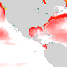
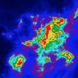
Sentinel-5P NRTI AER AI: Near Real-Time UV Aerosol Index

NRTI/L3_AER_AI This dataset provides near real-time high-resolution imagery of the UV Aerosol Index (UVAI), also called the Absorbing Aerosol Index (AAI). The AAI is based on wavelength-dependent changes in Rayleigh scattering in the UV spectral range for a pair of wavelengths. The difference between observed … aai aerosol air-quality atmosphere copernicus esa -
Sentinel-5P NRTI AER LH: Near Real-Time UV Aerosol Layer Height
NRTI/L3_AER_LH This dataset provides offline high-resolution imagery of the UV Aerosol Index (UVAI), also called the Absorbing Layer Height (ALH). The ALH is very sensitive to cloud contamination. However, aerosols and clouds can be difficult to distinguish, and ALH is computed for all FRESCO effective … aerosol air-quality alh atmosphere copernicus esa -
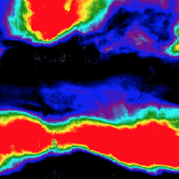
Sentinel-5P NRTI CLOUD: Near Real-Time Cloud Properties

NRTI/L3_CLOUD This dataset provides near real-time high-resolution imagery of cloud parameters. The TROPOMI/S5P cloud properties retrieval is based on the OCRA and ROCINN algorithms currently being used in the operational GOME and GOME-2 products. OCRA retrieves the cloud fraction using measurements in the UV/VIS spectral … atmosphere cloud copernicus dlr esa eu -
Sentinel-5P NRTI CO: Near Real-Time Carbon Monoxide
NRTI/L3_CO This dataset provides near real-time high-resolution imagery of CO concentrations. Carbon monoxide (CO) is an important atmospheric trace gas for understanding tropospheric chemistry. In certain urban areas, it is a major atmospheric pollutant. Main sources of CO are combustion of fossil fuels, biomass burning, … air-quality atmosphere carbon-monoxide copernicus esa eu -
Sentinel-5P NRTI HCHO: Near Real-Time Formaldehyde
NRTI/L3_HCHO This dataset provides near real-time high-resolution imagery of atmospheric formaldehyde (HCHO) concentrations. Formaldehyde is an intermediate gas in almost all oxidation chains of non-methane volatile organic compounds (NMVOC), leading eventually to CO2. Non-Methane Volatile Organic Compounds (NMVOCs) are, together with NOx, CO and CH4, … air-quality atmosphere bira copernicus dlr esa -
Sentinel-5P NRTI NO2: Near Real-Time Nitrogen Dioxide
NRTI/L3_NO2 This dataset provides near real-time high-resolution imagery of NO2 concentrations. Nitrogen oxides (NO2 and NO) are important trace gases in the Earth's atmosphere, present in both the troposphere and the stratosphere. They enter the atmosphere as a result of anthropogenic activities (notably fossil fuel … air-quality atmosphere copernicus esa eu knmi -
Sentinel-5P NRTI O3: Near Real-Time Ozone
NRTI/L3_O3 This dataset provides near-real-time high-resolution imagery of total column ozone concentrations. See also COPERNICUS/S5P/OFFL/L3_O3_TCL for the tropospheric column data. In the stratosphere, the ozone layer shields the biosphere from dangerous solar ultraviolet radiation. In the troposphere, it acts as an efficient cleansing agent, but … air-quality atmosphere copernicus esa eu o3 -
Sentinel-5P NRTI SO2: Near Real-Time Sulfur Dioxide
NRTI/L3_SO2 This dataset provides near real-time high-resolution imagery of atmospheric sulfur dioxide (SO2) concentrations. Sulfur dioxide (SO2) enters the Earth's atmosphere through both natural and anthropogenic processes. It plays a role in chemistry on a local and global scale and its impact ranges from short-term … air-quality atmosphere bira copernicus dlr esa -
Sentinel-5P OFFL AER AI: Offline UV Aerosol Index
OFFL/L3_AER_AI This dataset provides offline high-resolution imagery of the UV Aerosol Index (UVAI), also called the Absorbing Aerosol Index (AAI). The AAI is based on wavelength-dependent changes in Rayleigh scattering in the UV spectral range for a pair of wavelengths. The difference between observed and … aai aerosol air-quality atmosphere copernicus esa -
Sentinel-5P OFFL AER LH: Offline UV Aerosol Layer Height
OFFL/L3_AER_LH This dataset provides offline high-resolution imagery of the UV Aerosol Index (UVAI), also called the Absorbing Layer Height (ALH). The ALH is very sensitive to cloud contamination. However, aerosols and clouds can be difficult to distinguish, and ALH is computed for all FRESCO effective … aerosol air-quality alh atmosphere copernicus esa -
Sentinel-5P OFFL CH4: Offline Methane
OFFL/L3_CH4 This dataset provides offline high-resolution imagery of methane concentrations. Methane (CH4) is, after carbon dioxide (CO2), the most important contributor to the anthropogenically enhanced greenhouse effect. Roughly three-quarters of methane emissions are anthropogenic and as such, it is important to continue the record of … atmosphere climate copernicus esa eu knmi -
Sentinel-5P OFFL CLOUD: Offline Cloud Properties
OFFL/L3_CLOUD This dataset provides offline high-resolution imagery of cloud parameters. The TROPOMI/S5P cloud properties retrieval is based on the OCRA and ROCINN algorithms currently being used in the operational GOME and GOME-2 products. OCRA retrieves the cloud fraction using measurements in the UV/VIS spectral regions … atmosphere cloud copernicus dlr esa eu -
Sentinel-5P OFFL CO: Offline Carbon Monoxide
OFFL/L3_CO This dataset provides offline high-resolution imagery of CO concentrations. Carbon monoxide (CO) is an important atmospheric trace gas for understanding tropospheric chemistry. In certain urban areas, it is a major atmospheric pollutant. Main sources of CO are combustion of fossil fuels, biomass burning, and … air-quality atmosphere carbon-monoxide copernicus esa eu -
Sentinel-5P OFFL HCHO: Offline Formaldehyde

OFFL/L3_HCHO This dataset provides offline high-resolution imagery of atmospheric formaldehyde (HCHO) concentrations. Formaldehyde is an intermediate gas in almost all oxidation chains of non-methane volatile organic compounds (NMVOC), leading eventually to CO2. Non-Methane Volatile Organic Compounds (NMVOCs) are, together with NOx, CO and CH4, among … air-quality atmosphere bira copernicus dlr esa -
Sentinel-5P OFFL NO2: Offline Nitrogen Dioxide
OFFL/L3_NO2 This dataset provides offline high-resolution imagery of NO2 concentrations. Nitrogen oxides (NO2 and NO) are important trace gases in the Earth's atmosphere, present in both the troposphere and the stratosphere. They enter the atmosphere as a result of anthropogenic activities (notably fossil fuel combustion … air-quality atmosphere copernicus esa eu knmi -
Sentinel-5P OFFL O3 TCL: Offline Tropospheric Ozone

OFFL/L3_O3_TCL This dataset provides offline tropospheric high-resolution imagery of ozone concentrations between 20N and 20S. See also COPERNICUS/S5P/OFFL/L3_O3 and COPERNICUS/S5P/NRTI/L3_O3 for the total column data. In the stratosphere, the ozone layer shields the biosphere from dangerous solar ultraviolet radiation. In the troposphere, it acts as … air-quality atmosphere copernicus esa eu o3 -
Sentinel-5P OFFL O3: Offline Ozone
OFFL/L3_O3 This dataset provides offline high-resolution imagery of total column ozone concentrations. See also COPERNICUS/S5P/OFFL/L3_O3_TCL for the tropospheric column data. In the stratosphere, the ozone layer shields the biosphere from dangerous solar ultraviolet radiation. In the troposphere, it acts as an efficient cleansing agent, but … air-quality atmosphere copernicus esa eu o3 -
Sentinel-5P OFFL SO2: Offline Sulfur Dioxide
OFFL/L3_SO2 This dataset provides offline high-resolution imagery of atmospheric sulfur dioxide (SO2) concentrations. Sulfur dioxide (SO2) enters the Earth's atmosphere through both natural and anthropogenic processes. It plays a role in chemistry on a local and global scale and its impact ranges from short-term pollution … air-quality atmosphere bira copernicus dlr esa -
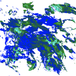
TUBerlin/BigEarthNet/v1
BigEarthNet is a new large-scale Sentinel-2 benchmark archive, consisting of 590,326 Sentinel-2 image patches. To construct BigEarthNet, 125 Sentinel-2 tiles were acquired between June 2017 and May 2018 over the 10 countries (Austria, Belgium, Finland, Ireland, Kosovo, Lithuania, Luxembourg, Portugal, Serbia, Switzerland) of Europe. All … copernicus landuse-landcover sentinel