Page Summary
-
The global Human Modification dataset (gHM) provides a cumulative measure of human modification of terrestrial lands globally at 1 square-kilometer resolution.
-
The MODIS Fire_cci Burned Area pixel product version 5.1 (FireCCI51) is a monthly global ~250m spatial resolution dataset containing information on burned area.
-
CSP gHM: Global Human Modification
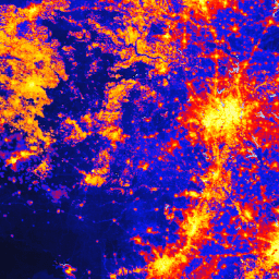
The global Human Modification dataset (gHM) provides a cumulative measure of human modification of terrestrial lands globally at 1 square-kilometer resolution. The gHM values range from 0.0-1.0 and are calculated by estimating the proportion of a given location (pixel) that is modified, the estimated intensity … csp fragmentation human-modification landcover landscape-gradient population -
FireCCI51: MODIS Fire_cci Burned Area Pixel Product, Version 5.1
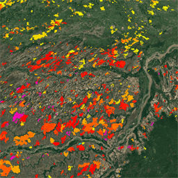
The MODIS Fire_cci Burned Area pixel product version 5.1 (FireCCI51) is a monthly global ~250m spatial resolution dataset containing information on burned area as well as ancillary data. It is based on surface reflectance in the Near Infrared (NIR) band from the MODIS instrument onboard … burn cci climate-change copernicus esa fire -
TNC Global Human Modification v3 (Change-Consistent 300m)
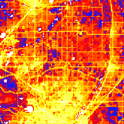
The Global Human Modification v3 dataset measures cumulative human pressures on global terrestrial ecosystems (excluding Antarctica). It tracks data from 1990 to 2022 and is intended to help quantify human impact for conservation planning, policy-making, and research. This dataset is the "Change-Consistent" Series ("c" series) … fragmentation human-modification landcover landscape-gradient population stressors -
TNC Global Human Modification v3 (Static Snapshot 90m)
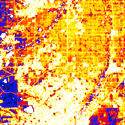
The Global Human Modification v3 dataset measures cumulative human pressures on global terrestrial ecosystems (excluding Antarctica). It tracks data from 1990 to 2022 and is intended to help quantify human impact for conservation planning, policy-making, and research. This is the 2022 static snapshot ("s" series) … fragmentation human-modification landcover landscape-gradient population stressors