Page Summary
-
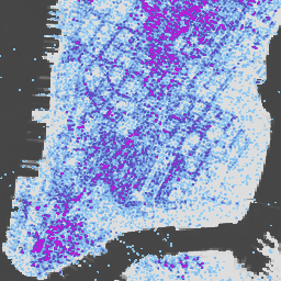
Global building height data for 2018 is available at 100m resolution.
-
Global building volume data from 1975-2030 is depicted in cubic metres per 100m grid cell.
-
Global built-up surface data is available at both 10m resolution (2018) and 100m resolution (1975-2030).
-
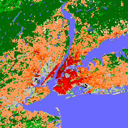
Data on global settlement characteristics for 2018 is available at 10m resolution, detailing functional and height-related components of the built environment.
-
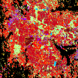
Global maps of Local Climate Zones provide a 100m resolution classification of urban landscapes.
-
GHSL: Global building height 2018 (P2023A)
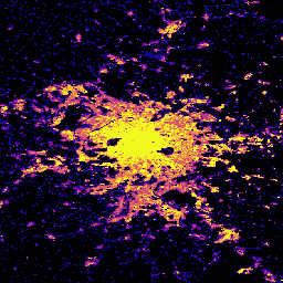
This spatial raster dataset depicts the global distribution of building heights at a resolution of 100 m, referred to the year 2018. The input data used to predict building heights are the ALOS Global Digital Surface Model (30 m), the NASA Shuttle Radar Topographic Mission … alos building built built-environment builtup copernicus -
GHSL: Global building volume 1975-2030 (P2023A)
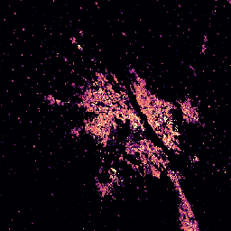
This raster dataset depicts the global distribution of building volume, expressed in cubic metres per 100 m grid cell. The dataset measures the total building volume and the building volume allocated to grid cells of predominant non-residential (NRES) use. Estimates are based on the built-up … alos building built-environment copernicus dem ghsl -
GHSL: Global built-up surface 10m (P2023A)
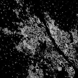
This raster dataset depicts the distribution of built-up surfaces, expressed in square metres per 10 m grid cell, for 2018 as observed from the S2 image data. The datasets measure: a) the total built-up surface, and b) the built-up surface allocated to grid cells of … built built-environment builtup copernicus ghsl jrc -
GHSL: Global built-up surface 1975-2030 (P2023A)
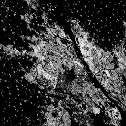
This raster dataset depicts the distribution of built-up surfaces, expressed in square metres per 100 m grid cell. The dataset measures: a) the total built-up surface, and b) the built-up surface allocated to grid cells of predominant non-residential (NRES) use. Data are spatially-temporally interpolated or … built built-environment builtup copernicus ghsl jrc -
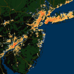
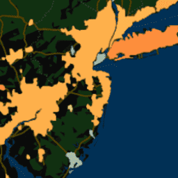
GHSL: Global settlement characteristics (10 m) 2018 (P2023A)
This spatial raster dataset delineates human settlements at 10 m resolution, and describes their inner characteristics in terms of the functional and height-related components of the built environment. More information about the GHSL data products can be found in the GHSL Data Package 2023 report … building built builtup copernicus ghsl height -
Global map of Local Climate Zones, latest version
Since their introduction in 2012, Local Climate Zones (LCZs) emerged as a new standard for characterizing urban landscapes, providing a holistic classification approach that takes into account micro-scale land-cover and associated physical properties. This global map of Local Climate Zones, at 100m pixel size and … climate landcover landuse-landcover urban -
Overture Maps - Places: Place
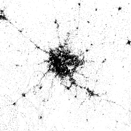
The Overture Maps Places theme contains more than 64 million point representations of real-world entities: businesses, schools, hospitals, religious organizations, landmarks, mountain peaks, and much more. Each place record includes location coordinates, names, categories, contact information (websites, social media, emails, phones), brand information, addresses, and … global infrastructure-boundaries map population publisher-dataset urban -
TIGER: 2020 Tabulation (Census) Block
The United States Census Bureau regularly releases a geodatabase named TIGER. This dataset contains the 2020 census blocks, roughly equivalent to a city block. There are just over eight million polygon features covering the United States, the District of Columbia, Puerto Rico, and the Island … census city infrastructure-boundaries neighborhood table tiger -
TIGER: US Census Block Groups (BG) 2010

The United States Census Bureau regularly releases a geodatabase named TIGER. This dataset contains the 2010 census block groups, which is a cluster of blocks within the same census tract that have the same first digit of their four-digit census block number. There are just … census city infrastructure-boundaries neighborhood table tiger -
TIGER: US Census Block Groups (BG) 2020
The United States Census Bureau regularly releases a geodatabase named TIGER. This dataset contains the 2020 census block groups, which is a cluster of blocks within the same census tract that have the same first digit of their four-digit census block number. There are just … census city infrastructure-boundaries neighborhood table tiger -
TIGER: US Census Blocks
The United States Census Bureau regularly releases a geodatabase named TIGER. This dataset contains the 2010 census blocks, roughly equivalent to a city block. There are just over 11 million polygon features covering the United States, the District of Columbia, Puerto Rico, and the Island … census city infrastructure-boundaries neighborhood table tiger -
TIGER: US Census Tracts
The United States Census Bureau regularly releases a geodatabase named TIGER. This dataset contains the 2020 census tracts. Tract areas vary tremendously, but in urban areas are roughly equivalent to a neighborhood. There are just over 85000 polygon features covering the United States, the District … census city infrastructure-boundaries neighborhood table tiger -
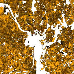
Tsinghua FROM-GLC Year of Change to Impervious Surface
This dataset contains annual change information of global impervious surface area from 1985 to 2018 at a 30m resolution. Change from pervious to impervious was determined using a combined approach of supervised classification and temporal consistency checking. Impervious pixels are defined as above 50% impervious. … built population tsinghua urban -
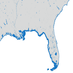
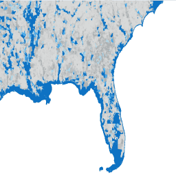
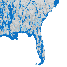
World Settlement Footprint 2015
The World Settlement Footprint (WSF) 2015 is a 10m resolution binary mask outlining the extent of human settlements globally derived by means of 2014-2015 multitemporal Landsat-8 and Sentinel-1 imagery (of which ~217,000 and ~107,000 scenes have been processed, respectively). The temporal dynamics of human settlements … landcover landsat-derived population sentinel1-derived settlement urban -
YCEO Surface Urban Heat Islands: Pixel-Level Annual Daytime and Nighttime Intensity

This dataset contains annual, summertime, and wintertime surface urban heat island (SUHI) intensities for day and night for over 10,000 urban clusters throughout the world. The dataset was created using the MODIS 8-day TERRA and AQUA land surface temperature (LST) products, the Landscan urban extent … climate uhi urban yale -
YCEO Surface Urban Heat Islands: Pixel-Level Composites of Yearly Summertime Daytime and Nighttime Intensity

This dataset contains annual, summertime, and wintertime surface urban heat island (SUHI) intensities for day and night for over 10,000 urban clusters throughout the world. The dataset was created using the MODIS 8-day TERRA and AQUA land surface temperature (LST) products, the Landscan urban extent … climate uhi urban yale -
YCEO Surface Urban Heat Islands: Pixel-Level Yearly Composites of Wintertime Daytime and Nighttime Intensity
This dataset contains annual, summertime, and wintertime surface urban heat island (SUHI) intensities for day and night for over 10,000 urban clusters throughout the world. The dataset was created using the MODIS 8-day TERRA and AQUA land surface temperature (LST) products, the Landscan urban extent … climate uhi urban yale -
YCEO Surface Urban Heat Islands: Spatially-Averaged Daytime and Nighttime Intensity for Annual, Summer, and Winter

This dataset contains annual, summertime, and wintertime surface urban heat island (SUHI) intensities for day and night for over 10,000 urban clusters throughout the world. The dataset was created using the MODIS 8-day TERRA and AQUA land surface temperature (LST) products, the Landscan urban extent … climate uhi urban yale -
YCEO Surface Urban Heat Islands: Spatially-Averaged Monthly Composites of Daytime and Nighttime Intensity

This dataset contains annual, summertime, and wintertime surface urban heat island (SUHI) intensities for day and night for over 10,000 urban clusters throughout the world. The dataset was created using the MODIS 8-day TERRA and AQUA land surface temperature (LST) products, the Landscan urban extent … climate uhi urban yale -
YCEO Surface Urban Heat Islands: Spatially-Averaged Yearly Composites of Annual Daytime and Nighttime Intensity
This dataset contains annual, summertime, and wintertime surface urban heat island (SUHI) intensities for day and night for over 10,000 urban clusters throughout the world. The dataset was created using the MODIS 8-day TERRA and AQUA land surface temperature (LST) products, the Landscan urban extent … climate uhi urban yale