Page Summary
-
Multiple datasets provide information on ecosystems and protected areas, including BLM AIM terrestrial data, IUCN Global Ecosystem Typology, and World Database on Protected Areas (WDPA).
-
Several datasets offer vegetation and land cover classifications, such as OpenLandMap Potential Distribution of Biomes and USGS GAP National Terrestrial Ecosystems data for various US regions.
-
Ecoregion datasets from RESOLVE and US EPA (Level III and IV) provide spatial frameworks for studying and managing ecosystems.
-
SBTN Natural Lands Map versions provide baseline maps of natural and non-natural land covers for setting science-based targets for nature.
-
BLM AIM TerrADat TerrestrialAIM Point v1
Since 2011, the Bureau of Land Management (BLM) has collected field information to inform land health through its Assessment Inventory and Monitoring (AIM) strategy. To date, more than 6,000 terrestrial AIM field plots have been collected over BLM lands. The BLM AIM data archive is … blm ecosystems hydrology range soil table -
ESA CCI Above-Ground Biomass for 2007, 2010, 2015-2022 (v6.0)
This dataset updated to v6.0 provides estimates of forest above-ground biomass for the years 2007, 2010, 2015, 2016, 2017, 2018, 2019, 2020, 2021, and 2022. These estimates are derived from a combination of Earth observation data, depending on the year, obtained from the Copernicus Sentinel-1 … biomass cci ecosystems esa forest -
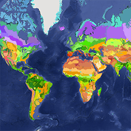
IUCN Global Ecosystem Typology Level 3: 1.0
The Global Ecosystem Typology is a taxonomy of ecosystems based on their unique characteristics. It is a global classification system that provides a consistent framework for describing and classifying ecological ecosystems. The Global Ecosystem Typology has six levels. The top three levels (realms, functional biomes, … ecosystem ecosystems global table -
OpenLandMap Potential Distribution of Biomes
Potential Natural Vegetation biomes global predictions of classes (based on predictions using the BIOMES 6000 dataset's 'current biomes' category.) Potential Natural Vegetation (PNV) is the vegetation cover in equilibrium with climate that would exist at a given location non-impacted by human activities. PNV is useful … ecosystems envirometrix opengeohub openlandmap potential -
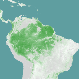
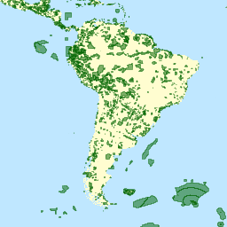
RESOLVE Ecoregions 2017
The RESOLVE Ecoregions dataset, updated in 2017, offers a depiction of the 846 terrestrial ecoregions that represent our living planet. View the stylized map at https://ecoregions2017.appspot.com/ or in Earth Engine. Ecoregions, in the simplest definition, are ecosystems of regional extent. Specifically, ecoregions represent distinct assemblages … biodiversity conservation ecoregions ecosystems global table -
SBTN Natural Lands Map v1
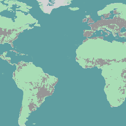
The SBTN Natural Lands Map v1 is a 2020 baseline map of natural and non-natural land covers intended for use by companies setting science-based targets for nature, specifically the SBTN Land target #1: no conversion of natural ecosystems. "Natural" and "non-natural" definitions were adapted from … ecosystems landcover landuse-landcover wri -
SBTN Natural Lands Map v1.1
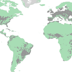
The SBTN Natural Lands Map v1.1 is a 2020 baseline map of natural and non-natural land covers intended for use by companies setting science-based targets for nature, specifically the SBTN Land target #1: no conversion of natural ecosystems. "Natural" and "non-natural" definitions were adapted from … ecosystems landcover landuse-landcover wri -
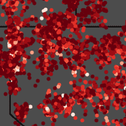
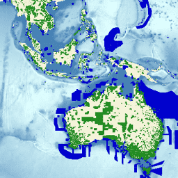
Species Distribution, Australia Mammals
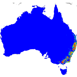
These species distribution model outputs, developed by Google in collaboration with QCIF and EcoCommons, represent estimates of species’ relative occurrence likelihoods (i.e., higher values indicate a higher likelihood that the species would be detected at a location, for a given survey methodology and given survey … alphaearth-derived biodiversity conservation ecosystems nature-trace publisher-dataset -
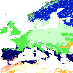
US EPA Ecoregions (Level III)
The U.S. Environmental Protection Agency (USEPA) provides the Ecoregions dataset to serve as a spatial framework for the research, assessment, management, and monitoring of ecosystems and ecosystem components. Ecoregions denote areas of general similarity in ecosystems and in the type, quality, and quantity of environmental … ecoregions ecosystems epa table -
US EPA Ecoregions (Level IV)

The U.S. Environmental Protection Agency (USEPA) provides the Ecoregions dataset to serve as a spatial framework for the research, assessment, management, and monitoring of ecosystems and ecosystem components. Ecoregions denote areas of general similarity in ecosystems and in the type, quality, and quantity of environmental … ecoregions ecosystems epa table -
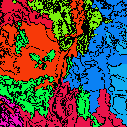
USGS GAP Alaska 2001
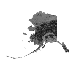
The GAP/LANDFIRE National Terrestrial Ecosystems data represents a detailed vegetation and land cover classification for the Conterminous U.S., Alaska, Hawaii, and Puerto Rico.GAP/LF 2011 Ecosystems for the Conterminous U.S. is an update of the National Gap Analysis Program Land Cover Data - Version 2.2. Alaska … ecosystems gap landcover landfire usgs vegetation -
USGS GAP CONUS 2011
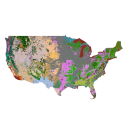
The GAP/LANDFIRE National Terrestrial Ecosystems data represents a detailed vegetation and land cover classification for the Conterminous U.S., Alaska, Hawaii, and Puerto Rico.GAP/LF 2011 Ecosystems for the Conterminous U.S. is an update of the National Gap Analysis Program Land Cover Data - Version 2.2. Alaska … ecosystems gap landcover landfire usgs vegetation -
USGS GAP Hawaii 2001
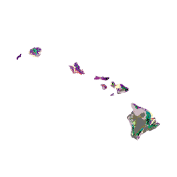
The GAP/LANDFIRE National Terrestrial Ecosystems data represents a detailed vegetation and land cover classification for the Conterminous U.S., Alaska, Hawaii, and Puerto Rico.GAP/LF 2011 Ecosystems for the Conterminous U.S. is an update of the National Gap Analysis Program Land Cover Data - Version 2.2. Alaska … ecosystems gap landcover landfire usgs vegetation -
USGS GAP Puerto Rico 2001
The GAP/LANDFIRE National Terrestrial Ecosystems data represents a detailed vegetation and land cover classification for the Conterminous U.S., Alaska, Hawaii, and Puerto Rico.GAP/LF 2011 Ecosystems for the Conterminous U.S. is an update of the National Gap Analysis Program Land Cover Data - Version 2.2. Alaska … ecosystems gap landcover landfire usgs vegetation -
WDKBA: World Database of Key Biodiversity Areas (KBAs) - March 2026
If you are interested in accessing the KBA dataset please complete the KBA data request form which will allow access directly in GEE once approved. Key Biodiversity Areas (KBAs) are 'sites contributing significantly to the global persistence of biodiversity’, in terrestrial, freshwater and marine ecosystems. … biodiversity boundaries ecosystems global iucn management -
WDOECM: Other Effective Area-based Conservation Measures (points)

A geographically defined area other than a Protected Area, which is governed and managed in ways that achieve positive and sustained long-term outcomes for the in situ conservation of biodiversity, with associated ecosystem functions and services and where applicable, cultural, spiritual, socio-economic, and other locally … boundaries ecosystems iucn mpa oceans protected -
WDOECM: Other Effective Area-based Conservation Measures (polygons)
A geographically defined area other than a Protected Area, which is governed and managed in ways that achieve positive and sustained long-term outcomes for the in situ conservation of biodiversity, with associated ecosystem functions and services and where applicable, cultural, spiritual, socio-economic, and other locally … boundaries ecosystems iucn mpa oceans protected -
WDPA: World Database on Protected Areas (points)
The World Database on Protected Areas (WDPA) is the most up-to-date and complete source of information on protected areas, updated monthly with submissions from governments, non-governmental organizations, landowners, and communities. It is managed by the United Nations Environment Programme's World Conservation Monitoring Centre (UNEP-WCMC) with … boundaries ecosystems iucn mpa oceans protected -
WDPA: World Database on Protected Areas (polygons)
The World Database on Protected Areas (WDPA) is the most up-to-date and complete source of information on protected areas, updated monthly with submissions from governments, non-governmental organizations, landowners, and communities. It is managed by the United Nations Environment Programme's World Conservation Monitoring Centre (UNEP-WCMC) with … boundaries ecosystems iucn mpa oceans protected -
iNaturalist Multispecies Open Range Maps
The iNaturalist Multispecies Range Dataset provides modeled geographic ranges for thousands of species. Dataset contains species polygons, with attributes such as taxon_id, name, scientific_name, and geomodel_version. Ranges are estimated from iNaturalist community observations and updated on a monthly basis. These datasets enable large-scale biodiversity analyses, … biodiversity ecosystems range species