- Catalog Owner
- BirdLife International
- Dataset Availability
- 2016-01-01T00:00:00Z–2026-03-01T00:00:00Z
- Dataset Producer
- KBA Partnership
- Dataset Processor
- BirdLife International
- Contact
- BirdLife International
- Tags
Description
If you are interested in accessing the KBA dataset please complete the KBA data request form which will allow access directly in GEE once approved.
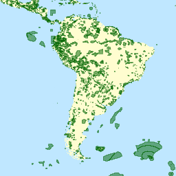
Key Biodiversity Areas (KBAs) are 'sites contributing significantly to the global persistence of biodiversity’, in terrestrial, freshwater and marine ecosystems. Sites can be identified as KBAs if they meet at least one of the KBA criteria set out in the KBA Standard (IUCN, 2016) for threatened or geographically restricted species or ecosystems, ecological integrity, biological processes, or irreplaceability. Both tabular and spatial data for KBAs are managed in the World Database of Key Biodiversity Areas (WDKBA).
The identification of KBAs draws upon the efforts of huge networks of local experts and relies on locally collected data. The process to reassess existing or identify new KBAs, is highly inclusive, consultative and nationally driven. Anyone with appropriate data may propose a site as a KBA, although consultation with relevant stakeholders at the local and national level is required when identifying the site and needs to be documented in the proposal. KBAs can be identified by a KBA National Coordination Group (KBA NCG) if this has been established in a country or by an individual or small group of proposers. Further information about KBAs can be found on the KBA website.
Data Sources. Sites of importance for biodiversity that had been identified using other pre-existing criteria formed the basis of the KBA dataset prior to the launch of the KBA Standard in 2016. These were principally the Important Bird and Biodiversity Areas (IBAs) identified by BirdLife International, plus Alliance for Zero Extinction (AZE) sites and KBAs covering multiple taxonomic groups in freshwater, marine and terrestrial systems under previously published criteria. Since 2016, many of these sites have been reassessed against the Global Standard. Currently, the global KBA network consists of >16,500 sites and these are classified as Global (those meeting Global KBA criteria), Regional (those not meeting Global KBA criteria but continuing to meet other pre-existing criteria) or Global/ Regional to be determined (those legacy sites with insufficient information to demonstrate whether they meet Global KBA criteria). Further details about the current KBA dataset are published on the KBA website.
Asset Naming Conventions. An updated version of the WDKBA is currently released every six months. The most recent version is permanently available as projects/ee-kbas-in-gee/assets/current. Previous versions, starting from March 2025, are available in the format projects/ee-kbas-in-gee/assets/YYYYMM.
Table Schema
Table Schema
| Name | Type | Description |
|---|---|---|
| AzeStatus | STRING | Whether or not the KBA is an Alliance for Zero Extinction (AZE) site (confirmed or ""). |
| Country | STRING | Name of country/territory containing the KBA. |
| IbaStatus | STRING | The Important Bird and Biodiversity Area (IBA) status of the KBA, taking one of the following values: candidate, confirmed, de-listed, does not qualify, superseded or "". |
| IntName | STRING | Name of KBA to be used internationally, typically in English. |
| ISO3 | STRING | ISO3 code of country/territory containing the KBA. |
| KbaClass | STRING | The classification of KBAs as one of the following:
|
| KbaStatus | STRING | Current state of the KBA's assessment, this field equals confirmed for all published sites |
| LastUpdate | STRING | Year in which the underlying KBA data was last updated. |
| LegacyKba | STRING | Whether the KBA was identified using KBA criteria from before the publication of the KBA standard. |
| NatName | STRING | Name of KBA used nationally, typically in the language of its country. |
| Region | STRING | Name of region containing the KBA. |
| SitAreaKM2 | DOUBLE | Calculated site area in KM2. |
| SitLat | DOUBLE | Latitude coordinate of centroid. |
| SitLong | DOUBLE | Longitude coordinate of centroid. |
| SitRecID | DOUBLE | Unique identifier for a KBA. |
| Source | STRING | Origin of the spatial data. |
Terms of Use
Terms of Use
Please visit the full terms and conditions page of the World Database of KBAs. Select highlights below:
No Commercial Use. You may not use, nor facilitate or assist others to use, either (a) KBA Data or (b) any Derivative Works (as further defined in clause 5) for Commercial Use without the prior written permission of BirdLife International on behalf of the KBA Secretariat, which grants permission on behalf of the owners of the relevant intellectual property rights. "Commercial Use" means a) any use by, on behalf of, or to inform or assist the activities of, a commercial entity (an entity that operates 'for profit') or b) use by any individual or non-profit entity for the purposes of revenue generation.
Disclaimer. The designation of geographical entities on The KBA Website do not imply the expression of, or represent, any opinion by the KBA Partners concerning the legal status of any country, territory or area, or concerning the delimitation of its frontiers or boundaries.
Attribution. The recipient of the data will provide full acknowledgement and citation (which includes reference to the version of the KBA Data used) in any materials or publications derived in part or in whole from the data.
Citations
BirdLife International (year). Digital boundaries of Key Biodiversity Areas from the World Database of Key Biodiversity Areas. Developed by the KBA Partnership: BirdLife International, International Union for the Conservation of Nature, American Bird Conservancy, Amphibian Survival Alliance, Conservation International, Critical Ecosystem Partnership Fund, Global Environment Facility, Re:Wild, NatureServe, Rainforest Trust, Royal Society for the Protection of Birds, Wildlife Conservation Society and World Wildlife Fund. [insert month/year of version used]. Available at http://www.keybiodiversityareas.org/kba-data/request.
Explore with Earth Engine
Code Editor (JavaScript)
var kbas = ee.FeatureCollection('projects/ee-kbas-in-gee/assets/current');

var KbasStyled = kbas.style({
  color: '#FFD700',
  fillColor: '#FFD70066',
  width: 1
});

Map.setCenter(0, 0,4);
Map.addLayer(KbasStyled, {}, 'Key Biodiversity Areas');