Page Summary
-
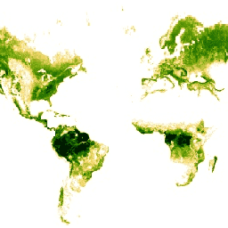
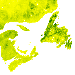
Multiple datasets provide global forest cover information with varying resolutions and years of data collection.
-
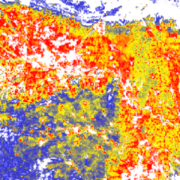
Several datasets focus on forest characteristics like biomass, carbon density, and canopy height.
-
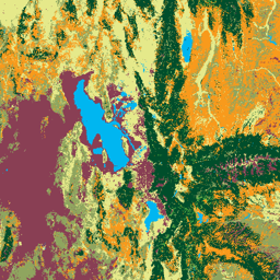
Specific regional datasets are available for areas like Cote d'Ivoire, Europe, Canada, and the United States.
-
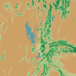
Some datasets are specifically designed to monitor and analyze changes in forest cover and drivers of forest loss.
-
Data derived from various sources, including Landsat, LiDAR, and SAR imagery, contribute to these forest datasets.
-
Cote d'Ivoire BNETD 2020 Land Cover Map
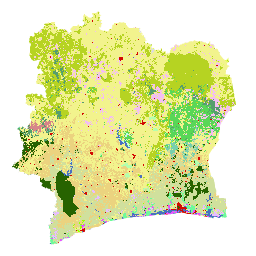
The Cote d'Ivoire BNETD 2020 Land Cover Map was produced by the Ivorian Government through a national institution, the Center for Geographic Information and Digital from the National Study Office Techniques and Development (BNETD-CIGN), with technical and financial support from the European Union. The methodology … classification deforestation forest landcover landuse-landcover -
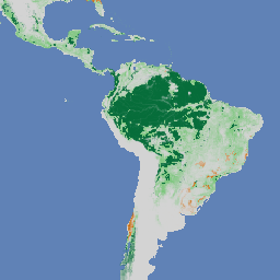
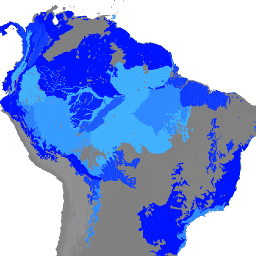
EC JRC global map of forest cover 2020, V3
The global map of forest cover provides a spatially explicit representation of forest presence and absence for the year 2020 at 10m spatial resolution. The year 2020 corresponds to the cut-off date of the Regulation from the European Union "on the making available on the … eudr forest forest-biomass jrc -
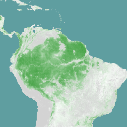
EC JRC global map of forest types 2020, V1
The global map of forest types provides a spatially explicit representation of primary forest, naturally regenerating forest and planted forest (including plantation forest) for the year 2020 at 10m spatial resolution. The base layer for mapping these forest types is the extent of forest cover … eudr forest forest-biomass jrc landcover primary-forest -
ESA CCI Above-Ground Biomass for 2007, 2010, 2015-2022 (v6.0)
This dataset updated to v6.0 provides estimates of forest above-ground biomass for the years 2007, 2010, 2015, 2016, 2017, 2018, 2019, 2020, 2021, and 2022. These estimates are derived from a combination of Earth observation data, depending on the year, obtained from the Copernicus Sentinel-1 … biomass cci ecosystems esa forest -
European Primary Forest Dataset - Points

European primary forest data harmonizes 48 different, mostly field-based datasets of primary forests, and contains 18,411 individual patches (41.1 Mha) spread across 33 countries. It includes includes mainly old-growth, late-successional forests, but also some early seral stages and young forests that originated after natural disturbances … europe forest forest-biomass table -
European Primary Forest Dataset - Polygons

European primary forest data harmonizes 48 different, mostly field-based datasets of primary forests, and contains 18,411 individual patches (41.1 Mha) spread across 33 countries. It includes includes mainly old-growth, late-successional forests, but also some early seral stages and young forests that originated after natural disturbances … europe forest forest-biomass table -
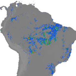
FORMA Alert Thresholds
NOTE from WRI: WRI decided to stop updating FORMA alerts. The goal was to simplify the Global Forest Watch user experience and reduce redundancy. We found that Terra-i and GLAD were more frequently used. Moreover, using GLAD as a standard, found that Terra-i outperformed FORMA … daily deforestation fire forest forma gfw -
FORMA Alerts
NOTE from WRI: WRI decided to stop updating FORMA alerts. The goal was to simplify the Global Forest Watch user experience and reduce redundancy. We found that Terra-i and GLAD were more frequently used. Moreover, using GLAD as a standard, found that Terra-i outperformed FORMA … daily deforestation fire forest forma gfw -
FORMA Raw Output FIRMS
NOTE from WRI: WRI decided to stop updating FORMA alerts. The goal was to simplify the Global Forest Watch user experience and reduce redundancy. We found that Terra-i and GLAD were more frequently used. Moreover, using GLAD as a standard, found that Terra-i outperformed FORMA … daily deforestation fire forest forma gfw -
FORMA Raw Output NDVI
NOTE from WRI: WRI decided to stop updating FORMA alerts. The goal was to simplify the Global Forest Watch user experience and reduce redundancy. We found that Terra-i and GLAD were more frequently used. Moreover, using GLAD as a standard, found that Terra-i outperformed FORMA … daily deforestation forest forest-biomass forma gfw -
FORMA Vegetation T-Statistics
NOTE from WRI: WRI decided to stop updating FORMA alerts. The goal was to simplify the Global Forest Watch user experience and reduce redundancy. We found that Terra-i and GLAD were more frequently used. Moreover, using GLAD as a standard, found that Terra-i outperformed FORMA … daily deforestation forest forest-biomass forma gfw -
Farmscapes 2020
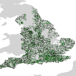
The Farmscapes 2020 dataset provides high-resolution (25cm) probability maps for three key semi-natural features within England's agricultural landscapes: hedgerows, woodland, and stone walls. This dataset was developed in collaboration with the Leverhulme Centre for Nature Recovery at Oxford to serve as a baseline for applications … biodiversity climate conservation ecological-connectivity forest landuse-landcover -
Farmscapes 2020 Vectorised
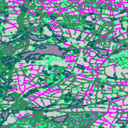
This is the vectorised version of the Farmscapes 2020 raster dataset. It provides polygon geometries representing fine-scale semi-natural landscape features (specifically hedgerows, woodland, and stone walls) across England's agricultural landscapes. This dataset was developed in collaboration with the Oxford Leverhulme Centre for Nature Recovery to … biodiversity climate conservation ecological-connectivity forest landuse-landcover -
Forest Typology (ForTy) 2020 v1.0

The Forest Typology (ForTy) v1 dataset consists of a global per-class probability map at 10 m resolution covering all land areas between 65°S and 84°N latitude for the year 2020. The six-class typology is aligned with FAO and EU Deforestation Regulation (EUDR) definitions: Class 1 … alphaearth-derived biodiversity climate conservation deforestation eudr -
Forest proximate people (FPP) 1.0
The "Forest Proximate People" (FPP) dataset is one of the data layers contributing to the development of indicator #13, "number of forest-dependent people in extreme poverty," of the Collaborative Partnership on Forests (CPF) Global Core Set of forest-related indicators (GCS). The FPP dataset provides an … agriculture fao forest global plant-productivity population -
GEDI L4D Imputed Waveforms, Version 2
The GEDI Level 4D (L4D) product provides a 30-m spatial elaboration of the mission's sample of footprint-level L2A V002, L2B V002, and L4A Version 2.1 products globally between latitudes -51.6 and 51.6 degrees. A k-nearest neighbors (k-NN) algorithm was used with Landsat time series data … biomass canopy elevation forest forest-biomass gedi -
Global 2020 Forest Classification for IPCC Aboveground Biomass Tier 1 Estimates, V1
This dataset provides classes of global forests delineated by status/condition in 2020 at approximately 30m resolution. The data support generating Tier 1 estimates for Aboveground dry woody Biomass Density (AGBD) in natural forests in the 2019 Refinement to the 2006 IPCC Guidelines for National Greenhouse … aboveground biomass carbon classification forest forest-biomass -
Global 3-class PALSAR-2/PALSAR Forest/Non-Forest Map
A newer version of this dataset with 4 classes for 2017-2020 can be found in JAXA/ALOS/PALSAR/YEARLY/FNF4 The global forest/non-forest map (FNF) is generated by classifying the SAR image (backscattering coefficient) in the global 25m resolution PALSAR-2/PALSAR SAR mosaic so that strong and low backscatter pixels … alos alos2 classification eroc forest forest-biomass -
Global 4-class PALSAR-2/PALSAR Forest/Non-Forest Map
The global forest/non-forest map (FNF) is generated by classifying the SAR image (backscattering coefficient) in the global 25m resolution PALSAR-2/PALSAR SAR mosaic so that strong and low backscatter pixels are assigned as "forest" and "non-forest", respectively. Here, "forest" is defined as the natural forest with … alos alos2 classification eroc forest forest-biomass -
Global Aboveground and Belowground Biomass Carbon Density Maps
This dataset provides temporally consistent and harmonized global maps of aboveground and belowground biomass carbon density for the year 2010 at a 300-m spatial resolution. The aboveground biomass map integrates land-cover specific, remotely sensed maps of woody, grassland, cropland, and tundra biomass. Input maps were … aboveground biomass carbon density forest forest-biomass -
Global Forest Canopy Height, 2005
This dataset represents global tree heights based on a fusion of spaceborne-lidar data (2005) from the Geoscience Laser Altimeter System (GLAS) and ancillary geospatial data. See Simard et al. (2011) for details. canopy forest forest-biomass geophysical jpl nasa -
Global Forest Cover Change (GFCC) Tree Cover Multi-Year Global 30m
The Landsat Vegetation Continuous Fields (VCF) tree cover layers contain estimates of the percentage of horizontal ground in each 30-m pixel covered by woody vegetation greater than 5 meters in height. The dataset is available for four epochs centered on the years 2000, 2005, 2010 … forest forest-biomass glcf landsat-derived nasa umd -
Gridded GEDI Vegetation Structure Metrics and Biomass Density with COUNTS metrics, 12KM pixel size
This dataset consists of near-global, analysis-ready, multi-resolution gridded vegetation structure metrics derived from NASA Global Ecosystem Dynamics Investigation (GEDI) Level 2 and 4A products associated with 25-m diameter lidar footprints. This dataset provides a comprehensive representation of near-global vegetation structure that is inclusive of the … biomass canopy forest forest-biomass gedi larse -
Gridded GEDI Vegetation Structure Metrics and Biomass Density with COUNTS metrics, 1KM pixel size

This dataset consists of near-global, analysis-ready, multi-resolution gridded vegetation structure metrics derived from NASA Global Ecosystem Dynamics Investigation (GEDI) Level 2 and 4A products associated with 25-m diameter lidar footprints. This dataset provides a comprehensive representation of near-global vegetation structure that is inclusive of the … biomass canopy forest forest-biomass gedi larse -
Gridded GEDI Vegetation Structure Metrics and Biomass Density with COUNTS metrics, 6KM pixel size
This dataset consists of near-global, analysis-ready, multi-resolution gridded vegetation structure metrics derived from NASA Global Ecosystem Dynamics Investigation (GEDI) Level 2 and 4A products associated with 25-m diameter lidar footprints. This dataset provides a comprehensive representation of near-global vegetation structure that is inclusive of the … biomass canopy forest forest-biomass gedi larse -
Gridded GEDI Vegetation Structure Metrics and Biomass Density, 12KM pixel size

This dataset consists of near-global, analysis-ready, multi-resolution gridded vegetation structure metrics derived from NASA Global Ecosystem Dynamics Investigation (GEDI) Level 2 and 4A products associated with 25-m diameter lidar footprints. This dataset provides a comprehensive representation of near-global vegetation structure that is inclusive of the … biomass canopy forest forest-biomass gedi larse -
Gridded GEDI Vegetation Structure Metrics and Biomass Density, 1KM pixel size
This dataset consists of near-global, analysis-ready, multi-resolution gridded vegetation structure metrics derived from NASA Global Ecosystem Dynamics Investigation (GEDI) Level 2 and 4A products associated with 25-m diameter lidar footprints. This dataset provides a comprehensive representation of near-global vegetation structure that is inclusive of the … biomass canopy forest forest-biomass gedi larse -
Gridded GEDI Vegetation Structure Metrics and Biomass Density, 6KM pixel size

This dataset consists of near-global, analysis-ready, multi-resolution gridded vegetation structure metrics derived from NASA Global Ecosystem Dynamics Investigation (GEDI) Level 2 and 4A products associated with 25-m diameter lidar footprints. This dataset provides a comprehensive representation of near-global vegetation structure that is inclusive of the … biomass canopy forest forest-biomass gedi larse -
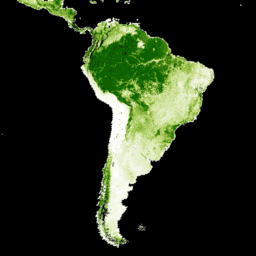
Hansen Global Forest Change v1.13 (2000-2025)
Results from time-series analysis of Landsat images in characterizing global forest extent and change. The 'first' and 'last' bands are reference multispectral imagery from the first and last available years for Landsat spectral bands corresponding to red, NIR, SWIR1, and SWIR2. Reference composite imagery represents … forest forest-biomass geophysical landsat-derived umd -
Landsat-derived forest age for Canada 2019
Canadian primary forest dataset is a satellite-based forest age map for 2019 across Canada's forested ecozones at a 30-m spatial resolution. Remotely-sensed data from Landsat (disturbances, surface reflectance composites, forest structure) and MODIS (Gross Primary Production) are utilized to determine age. Forest age can be … canada forest forest-biomass -
Monitoring Trends in Burn Severity (MTBS) Burn Severity Images
The burn severity mosaics consist of thematic raster images of MTBS burn severity classes for all currently completed MTBS fires for the continental United States, Alaska, Hawaii and Puerto Rico. Mosaicked burn severity images are compiled annually for each year by US State and the … eros fire forest gtac landcover landsat-derived -
NEON Canopy Height Model (CHM)

Height of the top of canopy above bare earth (Canopy Height Model; CHM). The CHM is derived from the NEON LiDAR point cloud and is generated by creating a continuous surface of canopy height estimates across the entire spatial domain of the LiDAR survey. The … airborne canopy forest forest-biomass highres lidar -
NEON Canopy Nitrogen Content (CNC)
Modelled canopy nitrogen concentration calibrated with NEON plant foliar chemistry observations and predicted with L1 surface directional reflectance, derived from the NEON Imaging Spectrometer (NIS). Bands include 1) canopy nitrogen percent, 2) canopy nitrogen model uncertainty, 3) classification result for needle vs. non-needle model and … airborne canopy forest highres hyperspectral neon -
NEON Digital Elevation Model (DEM)
Digital models of the surface (DSM) and terrain (DTM) derived from NEON LiDAR data. DSM: Surface features (topographic information with vegetation and man-made structures present). DTM: Bare earth elevation (topographic information with vegetation and man-made structures removed). Images are given in meters above mean sea … airborne dem elevation-topography forest highres lidar -
NEON RGB Camera Imagery

High resolution Red-Green-Blue (RGB) orthorectified camera images mosaicked and output onto a fixed, uniform spatial grid using nearest-neighbor resampling; spatial resolution is 0.1 m. The digital camera is part of a suite of instruments on the NEON Airborne Observation Platform (AOP) that also includes a … airborne forest highres neon neon-prod-earthengine orthophoto -
NEON Surface Bidirectional Reflectance
The NEON AOP Surface Bidirectional Reflectance is a hyperspectral VSWIR (visible to shortwave infrared) data product, containing 426 bands spanning wavelengths from ~380 nm to 2510 nm. Reflectance is scaled by a factor of 10000. Wavelengths between 1340-1445 nm and 1790-1955 nm are set to … airborne forest highres hyperspectral neon neon-prod-earthengine -
NEON Surface Directional Reflectance

The NEON AOP Surface Directional Reflectance is a hyperspectral VSWIR (visible to shortwave infrared) data product, containing 426 bands spanning wavelengths from ~380 nm to 2510 nm. Reflectance is scaled by a factor of 10000. Wavelengths between 1340-1445 nm and 1790-1955 nm are set to … airborne forest hyperspectral neon neon-prod-earthengine publisher-dataset -
NICFI Satellite Data Program Basemaps for Tropical Forest Monitoring - Africa
This image collection provides access to high-resolution satellite monitoring of the tropics for the primary purpose of reducing and reversing the loss of tropical forests, contributing to combating climate change, conserving biodiversity, contributing to forest regrowth, restoration and enhancement, and facilitating sustainable development, all of … basemaps forest nicfi planet planet-nicfi publisher-dataset -
NICFI Satellite Data Program Basemaps for Tropical Forest Monitoring - Americas
This image collection provides access to high-resolution satellite monitoring of the tropics for the primary purpose of reducing and reversing the loss of tropical forests, contributing to combating climate change, conserving biodiversity, contributing to forest regrowth, restoration and enhancement, and facilitating sustainable development, all of … basemaps forest nicfi planet planet-nicfi publisher-dataset -
NICFI Satellite Data Program Basemaps for Tropical Forest Monitoring - Asia
This image collection provides access to high-resolution satellite monitoring of the tropics for the primary purpose of reducing and reversing the loss of tropical forests, contributing to combating climate change, conserving biodiversity, contributing to forest regrowth, restoration and enhancement, and facilitating sustainable development, all of … basemaps forest nicfi planet planet-nicfi publisher-dataset -
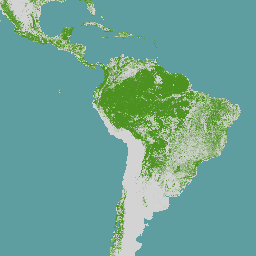
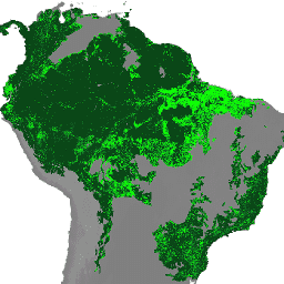
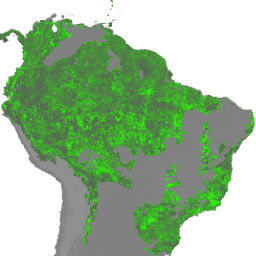
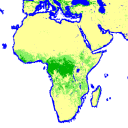
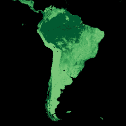
Natural Forests of the World 2020

Natural Forests of the World 2020, provides a global map of natural forest probability for the year 2020 at a 10-meter resolution. It was developed to support initiatives like the European Union's Deforestation Regulation (EUDR) and other efforts for forest conservation and monitoring. The map … biodiversity climate conservation deforestation eudr forest -
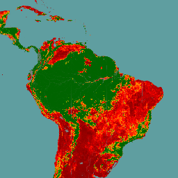
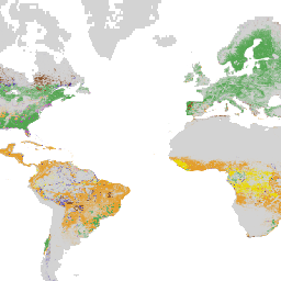
Primary Humid Tropical Forests
Primary humid tropical forests provide numerous global ecosystem services, but are under continuing threat of clearing from economic drivers. To facilitate national land use planning and balancing the goals of economic development and maintenance of ecosystem services, a primary humid tropical forest map was created … forest forest-biomass global landsat-derived umd -
SCANFI: the Spatialized CAnadian National Forest Inventory data product1.2
This data publication contains a set of 30m resolution raster files representing 2020 Canadian wall-to-wall maps of broad land cover type, forest canopy height, degree of crown closure and aboveground tree biomass, along with species composition of several major tree species. The Spatialized CAnadian National … canada forest forest-biomass publisher-dataset tree-cover -
Tree proximate people (TPP) 1.0
The "Tree Proximate People" (TPP) is one of the datasets contributing to the development of indicator #13, number of forest-dependent people in extreme poverty, of the Collaborative Partnership on Forests (CPF) Global Core Set of forest-related indicators (GCS). The TPP dataset provides 4 different estimates … agriculture fao forest global plant-productivity population -
USFS Landscape Change Monitoring System v2025-11 (CONUS and OCONUS)
This product is part of the Landscape Change Monitoring System (LCMS) data suite. It shows LCMS-modeled change, land cover, and/or land use classes for each year and covers the Conterminous United States (CONUS) as well as areas outside the CONUS (OCONUS) including Alaska (AK), Puerto … change-detection forest gtac gtac-data-publish landcover landuse -
USFS Tree Canopy Cover v2025-6 (CONUS and OCONUS)
The Tree Canopy Cover (TCC) data suite, produced by the United States Department of Agriculture, Forest Service (USFS), are annual remote sensing-based map outputs spanning from 1985-2025. These data support the National Land Cover Database (NLCD) project, which is managed by the US Geological Survey … forest gtac gtac-data-publish landuse-landcover publisher-dataset redcastle-resources -
USFS TreeMap v2016 (Conterminous United States)
This product is part of the TreeMap data suite. It provides detailed spatial information on forest characteristics including number of live and dead trees, biomass, and carbon across the entire forested extent of the continental United States in 2016. TreeMap v2016 contains one image, a … biomass carbon climate-change conus forest forest-biomass -
USFS TreeMap v2020
This product is part of the TreeMap data suite. It provides detailed spatial information on forest characteristics including number of live and dead trees, biomass, and carbon across the entire forested extent of the United States in 2020. TreeMap v2020 contains 22-band 30 x 30m … aboveground biomass carbon climate-change conus forest -
USFS TreeMap v2022

This product is part of the TreeMap data suite. It provides detailed spatial information on forest characteristics including number of live and dead trees, biomass, and carbon across the entire forested extent of the United States in 2022. TreeMap v2022 contains 22-band 30 x 30m … aboveground biomass carbon climate-change conus forest -
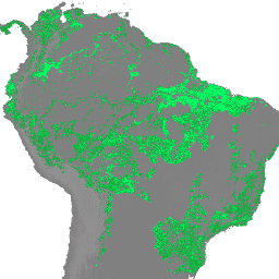
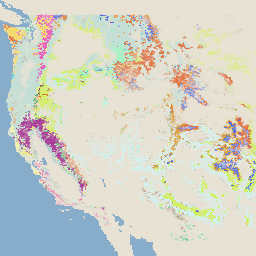
WRI/Google DeepMind Global Drivers of Forest Loss 2001-2022 v1.0

This dataset maps the dominant driver of tree cover loss from 2001-2022 globally at 1 km resolution. Produced by the World Resources Institute (WRI) and Google DeepMind, the data were developed using a global neural network model (ResNet) trained on a set of samples collected … agriculture deforestation forest forest-biomass google landandcarbon -
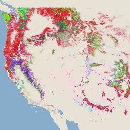
WRI/Google DeepMind Global Drivers of Forest Loss 2001-2023 v1.1

This dataset maps the dominant driver of tree cover loss from 2001-2023 globally at 1 km resolution. Produced by the World Resources Institute (WRI) and Google DeepMind, the data were developed using a global neural network model (ResNet) trained on a set of samples collected … agriculture deforestation forest forest-biomass google landandcarbon -
WRI/Google DeepMind Global Drivers of Forest Loss 2001-2024 v1.2

This dataset maps the dominant driver of tree cover loss from 2001-2024 globally at 1 km resolution. Produced by the World Resources Institute (WRI) and Google DeepMind, the data were developed using a global neural network model (ResNet) trained on a set of samples collected … agriculture deforestation forest forest-biomass google landandcarbon -
WRI/Google DeepMind Global Drivers of Forest Loss 2001-2025 v1.3
This dataset maps the dominant driver of tree cover loss from 2001-2025 globally at 1 km resolution. Produced by the World Resources Institute (WRI) and Google DeepMind, the data were developed using a global neural network model (ResNet) trained on a set of samples collected … agriculture deforestation forest forest-biomass google landandcarbon