Page Summary
-
ALOS/AVNIR-2 ORI dataset contains orthorectified imagery from the AVNIR-2 sensor on the ALOS satellite.
-
NEON RGB Camera Imagery provides high resolution orthorectified camera images from the NEON Airborne Observation Platform.
-
ALOS/AVNIR-2 ORI
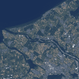
This dataset is contains orthorectified imagery from the Advanced Visible and Near Infrared Radiometer type 2 (AVNIR-2) sensor on-board the Advanced Land Observing Satellite (ALOS) "DAICHI". The AVNIR-2 ORI product was created from AVNIR-2 1B1 data after stereo matching with reference to ALOS's Panchromatic Remote-sensing … alos jaxa orthophoto satellite-imagery visible -
NEON RGB Camera Imagery

High resolution Red-Green-Blue (RGB) orthorectified camera images mosaicked and output onto a fixed, uniform spatial grid using nearest-neighbor resampling; spatial resolution is 0.1 m. The digital camera is part of a suite of instruments on the NEON Airborne Observation Platform (AOP) that also includes a … airborne forest highres neon neon-prod-earthengine orthophoto