Page Summary
-
Multiple satellite imagery and related datasets are available, covering various sensors, resolutions, and processing levels.
-
Datasets include imagery from Landsat, ASTER, ALOS, Sentinel, MODIS, GOES, VIIRS, EMIT, EO-1, PROBA-V, Planet SkySat, and NEON.
-
Available data types range from raw radiance and TOA reflectance to surface reflectance, BRDF/Albedo products, and atmospheric trace gas information.
-
Specific datasets cater to different applications like tropical forest monitoring, cloud assessment, and emergency observation.
-
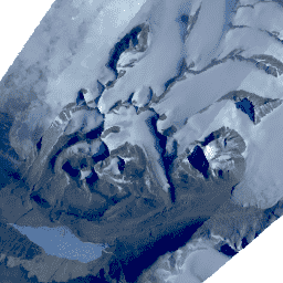
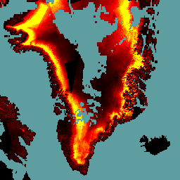
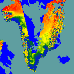
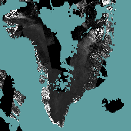
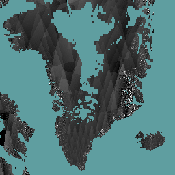
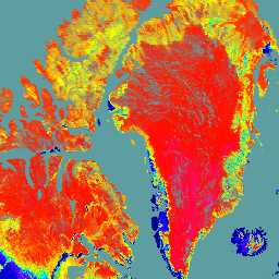
2000 Greenland Mosaic - Greenland Ice Mapping Project (GIMP)
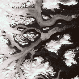
This dataset provides a complete 15 m resolution image mosaic of the Greenland ice sheet derived from Landsat 7 ETM+ and RADARSAT-1 SAR imagery from the years 1999 to 2002. The methods include a combination of image cloud masking, pan sharpening, image sampling and resizing, … arctic gimp greenland imagery nasa polar -
AG100: ASTER Global Emissivity Dataset 100-meter V003
The Advanced Spaceborne Thermal Emission and Reflection Radiometer Global Emissivity Database (ASTER-GED) was developed by the National Aeronautics and Space Administration's (NASA) Jet Propulsion Laboratory (JPL), California Institute of Technology. This product includes the mean emissivity and standard deviation for all 5 ASTER Thermal Infrared … aster elevation emissivity geophysical infrared jpl -
ALOS-2 PALSAR-2 StripMap Level 2.1
Starting from the night of January 1st, 2024, based on the request from Japanese ministries and related organization, JAXA implemented ALOS-2 PALSAR-2 emergency observation. Since JAXA expects these emergency observation data to be extremely useful for disaster management, JAXA decided to open these data on … alos2 eroc jaxa palsar2 radar sar -
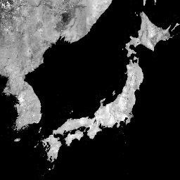
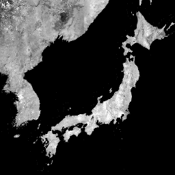
ALOS/AVNIR-2 ORI
This dataset is contains orthorectified imagery from the Advanced Visible and Near Infrared Radiometer type 2 (AVNIR-2) sensor on-board the Advanced Land Observing Satellite (ALOS) "DAICHI". The AVNIR-2 ORI product was created from AVNIR-2 1B1 data after stereo matching with reference to ALOS's Panchromatic Remote-sensing … alos jaxa orthophoto satellite-imagery visible -
ASTER L1T Radiance
Note: There is a gap in data collection between November 28, 2024 and January 16, 2025 due to technical issues with the ASTER instrument. See the USGS announcement for more information. The Advanced Spaceborne Thermal Emission and Reflection Radiometer (ASTER) is a multispectral imager that … aster imagery nasa nir radiance satellite-imagery -
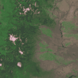
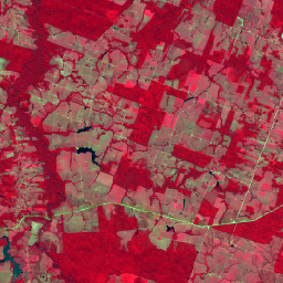
Brazil Forest Imagery Dataset 2008: Analytic Basemap
This dataset provides up to a 10-meter resolution multispectral (green, red, and near-infrared) basemap of Brazil, primarily captured in 2008, to support implementation of the Brazil Forest Code. The mosaic is synthesized from SPOT 2, 4, and 5 satellite data. It serves as a higher-resolution … brazil forest-code google imagery multispectral satellite-imagery -
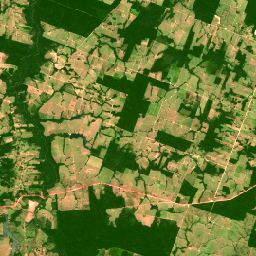
Brazil Forest Imagery Dataset 2008: Visual Basemap
This dataset provides a visual imagery basemap of Brazil with up to 5-meter resolution, primarily captured in 2008, to support implementation of the Brazil Forest Code. The mosaic is synthesized from SPOT 2, 4, and 5 satellite data. It serves as a high-resolution alternative to … brazil deforestation forest-code google rgb satellite-imagery -
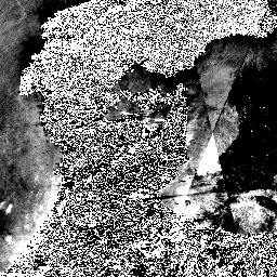
Cloud Score+ S2_HARMONIZED V1
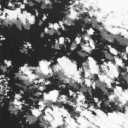
Cloud Score+ is a quality assessment (QA) processor for medium-to-high resolution optical satellite imagery. The Cloud Score+ S2_HARMONIZED dataset is being operationally produced from the harmonized Sentinel-2 L1C collection, and Cloud Score+ outputs can be used to identify relatively clear pixels and effectively remove clouds … cloud google satellite-imagery sentinel2-derived -
EMIT L1B At-Sensor Calibrated Radiance and Geolocation Data 60 m

The EMIT Project is part of the Earth Venture-Instrument (EV-I) Program directed by the Program Director of the NASA Earth Science Division (ESD). EMIT is comprised of a VSWIR Infrared Dyson imaging spectrometer adapted for installation on the International Space Station (ISS). EMIT measures radiance … daily emit nasa radiance satellite-imagery -
EMIT L2A Estimated Surface Reflectance and Uncertainty and Masks 60 m

The EMIT Project is part of the Earth Venture-Instrument (EV-I) Program directed by the Program Director of the NASA Earth Science Division (ESD). EMIT is comprised of a VSWIR Infrared Dyson imaging spectrometer adapted for installation on the International Space Station (ISS). EMIT measures radiance … daily emit nasa reflectance satellite-imagery -
EO-1 Hyperion Hyperspectral Imager
Hyperion is a high resolution hyperspectral imager producing 220 unique spectral channels ranging from 0.357 to 2.576 micrometers with a 10-nm bandwidth. The instrument operates in a pushbroom fashion, with a spatial resolution of 30 meters for all bands and a standard scene width of … hyperspectral satellite-imagery usgs -
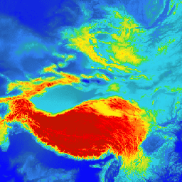
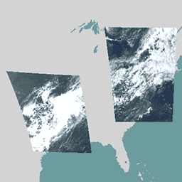
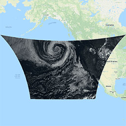
GOES-16 MCMIPC Series ABI Level 2 Cloud and Moisture Imagery CONUS
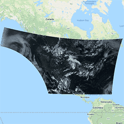
The Cloud and Moisture Imagery products are all at 2km resolution. Bands 1-6 are reflective. The dimensionless "reflectance factor" quantity is normalized by the solar zenith angle. These bands support the characterization of clouds, vegetation, snow/ice, and aerosols. Bands 7-16 are emissive. The brightness temperature … abi atmosphere goes goes-16 goes-east goes-r -
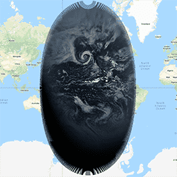
GOES-16 MCMIPF Series ABI Level 2 Cloud and Moisture Imagery Full Disk
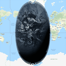
The Cloud and Moisture Imagery products are all at 2km resolution. Bands 1-6 are reflective. The dimensionless "reflectance factor" quantity is normalized by the solar zenith angle. These bands support the characterization of clouds, vegetation, snow/ice, and aerosols. Bands 7-16 are emissive. The brightness temperature … abi atmosphere goes goes-16 goes-east goes-r -
GOES-16 MCMIPM Series ABI Level 2 Cloud and Moisture Imagery Mesoscale
The Cloud and Moisture Imagery products are all at 2km resolution. Bands 1-6 are reflective. The dimensionless "reflectance factor" quantity is normalized by the solar zenith angle. These bands support the characterization of clouds, vegetation, snow/ice, and aerosols. Bands 7-16 are emissive. The brightness temperature … abi atmosphere goes goes-16 goes-east goes-r -
GOES-17 MCMIPC Series ABI Level 2 Cloud and Moisture Imagery CONUS

The Cloud and Moisture Imagery products are all at 2km resolution. Bands 1-6 are reflective. The dimensionless "reflectance factor" quantity is normalized by the solar zenith angle. These bands support the characterization of clouds, vegetation, snow/ice, and aerosols. Bands 7-16 are emissive. The brightness temperature … abi atmosphere goes goes-17 goes-s mcmip -
GOES-17 MCMIPF Series ABI Level 2 Cloud and Moisture Imagery Full Disk

The Cloud and Moisture Imagery products are all at 2km resolution. Bands 1-6 are reflective. The dimensionless "reflectance factor" quantity is normalized by the solar zenith angle. These bands support the characterization of clouds, vegetation, snow/ice, and aerosols. Bands 7-16 are emissive. The brightness temperature … abi atmosphere goes goes-17 goes-s mcmip -
GOES-17 MCMIPM Series ABI Level 2 Cloud and Moisture Imagery Mesoscale

The Cloud and Moisture Imagery products are all at 2km resolution. Bands 1-6 are reflective. The dimensionless "reflectance factor" quantity is normalized by the solar zenith angle. These bands support the characterization of clouds, vegetation, snow/ice, and aerosols. Bands 7-16 are emissive. The brightness temperature … abi atmosphere goes goes-17 goes-s mcmip -
GOES-18 MCMIPC Series ABI Level 2 Cloud and Moisture Imagery CONUS
The Cloud and Moisture Imagery products are all at 2km resolution. Bands 1-6 are reflective. The dimensionless "reflectance factor" quantity is normalized by the solar zenith angle. These bands support the characterization of clouds, vegetation, snow/ice, and aerosols. Bands 7-16 are emissive. The brightness temperature … abi atmosphere goes goes-18 goes-t goes-west -
GOES-18 MCMIPF Series ABI Level 2 Cloud and Moisture Imagery Full Disk
The Cloud and Moisture Imagery products are all at 2km resolution. Bands 1-6 are reflective. The dimensionless "reflectance factor" quantity is normalized by the solar zenith angle. These bands support the characterization of clouds, vegetation, snow/ice, and aerosols. Bands 7-16 are emissive. The brightness temperature … abi atmosphere goes goes-18 goes-t goes-west -
GOES-18 MCMIPM Series ABI Level 2 Cloud and Moisture Imagery Mesoscale
The Cloud and Moisture Imagery products are all at 2km resolution. Bands 1-6 are reflective. The dimensionless "reflectance factor" quantity is normalized by the solar zenith angle. These bands support the characterization of clouds, vegetation, snow/ice, and aerosols. Bands 7-16 are emissive. The brightness temperature … abi atmosphere goes goes-18 goes-t goes-west -
GOES-19 MCMIPC Series ABI Level 2 Cloud and Moisture Imagery CONUS
The Cloud and Moisture Imagery products are all at 2km resolution. Bands 1-6 are reflective. The dimensionless "reflectance factor" quantity is normalized by the solar zenith angle. These bands support the characterization of clouds, vegetation, snow/ice, and aerosols. Bands 7-16 are emissive. The brightness temperature … abi atmosphere goes goes-19 goes-east goes-u -
GOES-19 MCMIPF Series ABI Level 2 Cloud and Moisture Imagery Full Disk

The Cloud and Moisture Imagery products are all at 2km resolution. Bands 1-6 are reflective. The dimensionless "reflectance factor" quantity is normalized by the solar zenith angle. These bands support the characterization of clouds, vegetation, snow/ice, and aerosols. Bands 7-16 are emissive. The brightness temperature … abi atmosphere goes goes-19 goes-east goes-u -
GOES-19 MCMIPM Series ABI Level 2 Cloud and Moisture Imagery Mesoscale

The Cloud and Moisture Imagery products are all at 2km resolution. Bands 1-6 are reflective. The dimensionless "reflectance factor" quantity is normalized by the solar zenith angle. These bands support the characterization of clouds, vegetation, snow/ice, and aerosols. Bands 7-16 are emissive. The brightness temperature … abi atmosphere goes goes-19 goes-east goes-u -
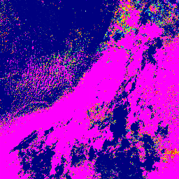
Global PALSAR-2/PALSAR Yearly Mosaic, version 1
A newer version of this dataset with data for 2015-2021 can be found in JAXA/ALOS/PALSAR/YEARLY/SAR_EPOCH The global 25m PALSAR/PALSAR-2 mosaic is a seamless global SAR image created by mosaicking strips of SAR imagery from PALSAR/PALSAR-2. For each year and location, the strip data were selected … alos alos2 eroc jaxa palsar palsar2 -
Global PALSAR-2/PALSAR Yearly Mosaic, version 2.5.0
The global 25m PALSAR/PALSAR-2 mosaic is a seamless global SAR image created by mosaicking strips of SAR imagery from PALSAR/PALSAR-2. For each year and location, the strip data were selected through visual inspection of the browse mosaics available over the period, with those showing minimum … alos alos2 eroc jaxa palsar palsar2 -
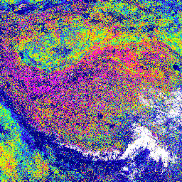
Global Seasonal Sentinel-1 Interferometric Coherence and Backscatter V2019 Backscatter
This data set is the first-of-its-kind spatial representation of multi-seasonal, global C-band Synthetic Aperture Radar (SAR) interferometric repeat-pass coherence and backscatter signatures. Coverage comprises land masses and ice sheets from 82 degrees Northern to 79 degrees Southern latitudes. The data set is derived from multi-temporal … backscatter earth-big-data jpl nasa polarization radar -
Global Seasonal Sentinel-1 Interferometric Coherence and Backscatter V2019 Coherence
This data set is the first-of-its-kind spatial representation of multi-seasonal, global C-band Synthetic Aperture Radar (SAR) interferometric repeat-pass coherence and backscatter signatures. Coverage comprises land masses and ice sheets from 82 degrees Northern to 79 degrees Southern latitudes. The data set is derived from multi-temporal … earth-big-data jpl nasa polarization radar sar -
Global Seasonal Sentinel-1 Interferometric Coherence and Backscatter V2019 Decay Model Parameters
This data set is the first-of-its-kind spatial representation of multi-seasonal, global C-band Synthetic Aperture Radar (SAR) interferometric repeat-pass coherence and backscatter signatures. Coverage comprises land masses and ice sheets from 82 degrees Northern to 79 degrees Southern latitudes. The data set is derived from multi-temporal … earth-big-data jpl nasa polarization radar sar -
Global Seasonal Sentinel-1 Interferometric Coherence and Backscatter V2019 Incidence Layover Shadow
This data set is the first-of-its-kind spatial representation of multi-seasonal, global C-band Synthetic Aperture Radar (SAR) interferometric repeat-pass coherence and backscatter signatures. Coverage comprises land masses and ice sheets from 82 degrees Northern to 79 degrees Southern latitudes. The data set is derived from multi-temporal … earth-big-data jpl nasa polarization radar sar -
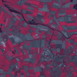
HLSL30: HLS-2 Landsat Operational Land Imager Surface Reflectance and TOA Brightness Daily Global 30m
The Harmonized Landsat Sentinel-2 (HLS) project provides consistent surface reflectance (SR) and top of atmosphere (TOA) brightness data from a virtual constellation of satellite sensors. The Operational Land Imager (OLI) is housed aboard the joint NASA/USGS Landsat 8 and Landsat 9 satellites, while the Multi-Spectral … landsat nasa satellite-imagery sentinel usgs -
HLSS30: HLS Sentinel-2 Multi-spectral Instrument Surface Reflectance Daily Global 30m

The Harmonized Landsat Sentinel-2 (HLS) project provides consistent surface reflectance data from the Operational Land Imager (OLI) aboard the joint NASA/USGS Landsat 8 satellite and the Multi-Spectral Instrument (MSI) aboard Europe's Copernicus Sentinel-2A satellites. The combined measurement enables global observations of the land every 2-3 … landsat nasa satellite-imagery sentinel usgs -
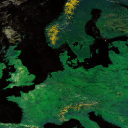
Harmonized Sentinel-2 MSI: MultiSpectral Instrument, Level-1C (TOA)
After 2022-01-25, Sentinel-2 scenes with PROCESSING_BASELINE '04.00' or above have their DN (value) range shifted by 1000. The HARMONIZED collection shifts data in newer scenes to be in the same range as in older scenes. Sentinel-2 is a wide-swath, high-resolution, multi-spectral imaging mission supporting Copernicus … copernicus esa eu msi radiance satellite-imagery -
Harmonized Sentinel-2 MSI: MultiSpectral Instrument, Level-2A (SR)
After 2022-01-25, Sentinel-2 scenes with PROCESSING_BASELINE '04.00' or above have their DN (value) range shifted by 1000. The HARMONIZED collection shifts data in newer scenes to be in the same range as in older scenes. Sentinel-2 is a wide-swath, high-resolution, multi-spectral imaging mission supporting Copernicus … copernicus esa eu msi reflectance satellite-imagery -
Landsat Collection 2 Tier 1 Level 2 32-Day Composite
These Landsat Collection 2 Tier 1 Level 2 composites are made from Tier 1 Level 2 orthorectified scenes, and include the SR bands: blue, green, red, nir, swir1, swir2, and thermal. These composites are created from all the scenes in each 32-day period beginning from … landsat landsat-composite satellite-imagery sr usgs -
Landsat Collection 2 Tier 1 Level 2 8-Day Composite
These Landsat Collection 2 Tier 1 Level 2 composites are made from Tier 1 Level 2 orthorectified scenes, and include the SR bands: blue, green, red, nir, swir1, swir2, and thermal. These composites are created from all the scenes in each 8-day period beginning from … landsat landsat-composite satellite-imagery sr usgs -
Landsat Collection 2 Tier 1 Level 2 Annual Composite
These Landsat Collection 2 Tier 1 Level 2 composites are made from Tier 1 Level 2 orthorectified scenes, and include the SR bands: blue, green, red, nir, swir1, swir2, and thermal. These composites are created from all the scenes in each annual period beginning from … landsat landsat-composite satellite-imagery sr usgs -
Landsat Global Land Survey 1975
The Global Land Survey (GLS) 1975 is a global collection of imagery from the Landsat Multispectral Scanner (MSS). Most scenes were acquired by Landsat 1-3 in 1972-1983. A few gaps in the Landsat 1-3 data have been filled with scenes acquired by Landsat 4-5 during … global gls landsat radiance satellite-imagery usgs -
Landsat Global Land Survey 2005, Landsat 5 scenes

The GLS2005 data set is a collection of 9500 orthorectified leaf-on medium-resolution satellite images collected between 2004 and 2007 and covering the Earth's land masses. GLS2005 uses mainly Landsat 5 and gap-filled Landsat 7 data with EO-1 ALI and Terra ASTER data filling in any … etm gls l5 landsat radiance satellite-imagery -
Landsat Global Land Survey 2005, Landsat 5+7 scenes

The GLS2005 data set is a collection of 9500 orthorectified leaf-on medium-resolution satellite images collected between 2004 and 2007 and covering the Earth's land masses. GLS2005 uses mainly Landsat 5 and gap-filled Landsat 7 data with EO-1 ALI and Terra ASTER data filling in any … gls landsat radiance satellite-imagery usgs -
Landsat Global Land Survey 2005, Landsat 7 scenes
The GLS2005 data set is a collection of 9500 orthorectified leaf-on medium-resolution satellite images collected between 2004 and 2007 and covering the Earth's land masses. GLS2005 uses mainly Landsat 5 and gap-filled Landsat 7 data with EO-1 ALI and Terra ASTER data filling in any … etm gls l7 landsat radiance satellite-imagery -
Landsat Image Mosaic of Antarctica (LIMA) - Processed Landsat Scenes (16 bit)
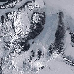
The Landsat Image Mosaic of Antarctica (LIMA) is a seamless and virtually cloudless mosaic created from processed Landsat 7 ETM+ scenes. Processed Landsat Scenes (16 bit) are Level 1Gt NLAPS scenes converted to 16 bit, processed with sun-angle correction, and converted to reflectance values (Bindschadler … antarctica ice landsat-derived lima mosaic satellite-imagery -
Landsat Image Mosaic of Antarctica (LIMA) - Processed Landsat Scenes (16 bit) Metadata
The Landsat Image Mosaic of Antarctica (LIMA) is a seamless and virtually cloudless mosaic created from processed Landsat 7 ETM+ scenes. Processed Landsat Scenes (16 bit) are Level 1Gt NLAPS scenes converted to 16 bit, processed with sun-angle correction, and converted to reflectance values (Bindschadler … antarctica ice landsat-derived lima mosaic satellite-imagery -
Landsat Image Mosaic of Antarctica (LIMA) 16-Bit Pan-Sharpened Mosaic

The Landsat Image Mosaic of Antarctica (LIMA) is a seamless and virtually cloudless mosaic created from processed Landsat 7 ETM+ scenes. This LIMA dataset is the 16-bit Intermediate LIMA. The mosaic consists of pan-sharpened normalized surface reflectance scenes (Landsat ETM+ bands 1, 2, 3, and … antarctica ice landsat-derived lima mosaic satellite-imagery -
MCD19A1.061: Land Surface BRF Daily L2G Global 500m and 1km
The MCD19A1 Version 6.1 data product is a Moderate Resolution Imaging Spectroradiometer (MODIS) Terra and Aqua combined Land Surface Bidirectional Reflectance Factor (BRF) gridded Level 2 product produced daily at 500 meter and 1 kilometer resolution. For more information see the MAIAC user guide. aerosol aod aqua daily global maiac -
MCD43A1.061 MODIS BRDF-Albedo Model Parameters Daily 500m
The MCD43A1 V6.1 Bidirectional Reflectance Distribution Function and Albedo (BRDF/Albedo) Model Parameters dataset is a 500 meter daily 16-day product. The Julian date represents the 9th day of the 16-day retrieval period, and consequently the observations are weighted to estimate the BRDF/Albedo for that day. … albedo brdf daily global modis nasa -
MCD43A2.061 MODIS BRDF-Albedo Quality Daily 500m
The MCD43A2 V6.1 Bidirectional Reflectance Distribution Function and Albedo (BRDF/Albedo) Quality dataset is a 500 meter daily 16-day product. It contains all the quality information for the corresponding 16-day MCD43A3 Albedo and the MCD43A4 Nadir-BRDF (NBAR) products. The MCD43A2 contains individual band quality and observation … albedo brdf daily global modis nasa -
MCD43A3.061 MODIS Albedo Daily 500m
The MCD43A3 V6.1 Albedo Model dataset is a daily 16-day product. It provides both directional hemispherical reflectance (black sky albedo) and bihemispherical reflectance (white sky albedo) for each of the MODIS surface reflectance bands (band 1 through band 7) as well as 3 broad spectrum … albedo black-sky daily global modis nasa -
MCD43A4.061 MODIS Nadir BRDF-Adjusted Reflectance Daily 500m
The MCD43A4 V6.1 Nadir Bidirectional Reflectance Distribution Function Adjusted Reflectance (NBAR) product provides 500 meter reflectance data of the MODIS "land" bands 1-7. These are adjusted using a bidirectional reflectance distribution function to model the values as if they were collected from a nadir view. … albedo brdf daily global modis nasa -
MCD43C3.061 BRDF/Albedo Daily L3 0.05 Deg CMG
The MCD43C3 Version 6.1 Bidirectional Reflectance Distribution Function and Albedo (BRDF/Albedo) Albedo dataset is produced daily using 16 days of Terra and Aqua MODIS data in a 0.05 degree (5,600 meters at the equator) Climate Modeling Grid (CMG). Data are temporally weighted to the ninth … albedo black-sky brdf daily global modis -
MOD09A1.061 Terra Surface Reflectance 8-Day Global 500m

The MOD09A1 V6.1 product provides an estimate of the surface spectral reflectance of Terra MODIS bands 1-7 at 500m resolution and corrected for atmospheric conditions such as gasses, aerosols, and Rayleigh scattering. Along with the seven reflectance bands is a quality layer and four observation … 8-day global modis nasa satellite-imagery sr -
MOD09CMG.061 Terra Surface Reflectance Daily L3 Global 0.05 Deg CMG
The MOD09CMG Version 6.1 product provides an estimate of the surface spectral reflectance of Terra Moderate Resolution Imaging Spectroradiometer (MODIS) Bands 1 through 7, resampled to 5600 meter pixel resolution and corrected for atmospheric conditions such as gasses, aerosols, and Rayleigh scattering. The MOD09CMG data … brightness-temperature ozone satellite-imagery surface-reflectance terra -
MOD09GA.061 Terra Surface Reflectance Daily Global 1km and 500m

The MODIS Surface Reflectance products provide an estimate of the surface spectral reflectance as it would be measured at ground level in the absence of atmospheric scattering or absorption. Low-level data are corrected for atmospheric gases and aerosols. MOD09GA version 6.1 provides bands 1-7 in … daily global modis nasa satellite-imagery sr -
MOD09GQ.061 Terra Surface Reflectance Daily Global 250m

The MODIS Surface Reflectance products provide an estimate of the surface spectral reflectance as it would be measured at ground level in the absence of atmospheric scattering or absorption. Low-level data are corrected for atmospheric gases and aerosols. MOD09GQ version 6.1 provides bands 1 and … daily global modis nasa satellite-imagery sr -
MOD09Q1.061 Terra Surface Reflectance 8-Day Global 250m

The MOD09Q1 product provides an estimate of the surface spectral reflectance of bands 1 and 2 at 250m resolution and corrected for atmospheric conditions such as gasses, aerosols, and Rayleigh scattering. Along with the two reflectance bands, a quality layer is also included. For each … 8-day global mod09q1 modis nasa satellite-imagery -
MODOCGA.006 Terra Ocean Reflectance Daily Global 1km

The MODOCGA V6 ocean reflectance product consists of 1 kilometer reflectance data from Terra MODIS bands 8-16. The product is referred to as ocean reflectance, because bands 8-16 are used primarily to produce ocean products, but this is not an ocean product as the tiles … daily global modis nasa oceans reflectance -
MYD09A1.061 Aqua Surface Reflectance 8-Day Global 500m
The MYD09A1 V6.1 product provides an estimate of the surface spectral reflectance of Aqua MODIS bands 1-7 at 500m resolution and corrected for atmospheric conditions such as gasses, aerosols, and Rayleigh scattering. Along with the seven reflectance bands is a quality layer and four observation … 8-day aqua global modis nasa satellite-imagery -
MYD09CMG.061 Aqua Surface Reflectance Daily L3 Global 0.05 Deg CMG
The MYD09CMG Version 6.1 product provides an estimate of the surface spectral reflectance of Aqua Moderate Resolution Imaging Spectroradiometer (MODIS) Bands 1 through 7, resampled to 5600 meter pixel resolution and corrected for atmospheric conditions such as gasses, aerosols, and Rayleigh scattering. The MYD09CMG data … aqua brightness-temperature ozone satellite-imagery surface-reflectance -
MYD09GA.061 Aqua Surface Reflectance Daily Global 1km and 500m
The MODIS Surface Reflectance products provide an estimate of the surface spectral reflectance as it would be measured at ground level in the absence of atmospheric scattering or absorption. Low-level data are corrected for atmospheric gases and aerosols. MYD09GA version 6.1 provides bands 1-7 in … aqua daily global modis nasa satellite-imagery -
MYD09GQ.061 Aqua Surface Reflectance Daily Global 250m
The MODIS Surface Reflectance products provide an estimate of the surface spectral reflectance as it would be measured at ground level in the absence of atmospheric scattering or absorption. Low-level data are corrected for atmospheric gases and aerosols. MYD09GQ version 6.1 provides bands 1 and … aqua daily global modis nasa satellite-imagery -
MYD09Q1.061 Aqua Surface Reflectance 8-Day Global 250m
The MYD09Q1 product provides an estimate of the surface spectral reflectance of bands 1 and 2 at 250m resolution and corrected for atmospheric conditions such as gasses, aerosols, and Rayleigh scattering. Along with the two reflectance bands, a quality layer is also included. For each … 8-day aqua global modis nasa satellite-imagery -
MYDOCGA.006 Aqua Ocean Reflectance Daily Global 1km
The MYDOCGA V6 ocean reflectance product consists of 1 kilometer reflectance data from Aqua MODIS bands 8-16. The product is referred to as ocean reflectance, because bands 8-16 are used primarily to produce ocean products, but this is not an ocean product as the tiles … aqua daily global modis nasa oceans -
NEON Surface Bidirectional Reflectance
The NEON AOP Surface Bidirectional Reflectance is a hyperspectral VSWIR (visible to shortwave infrared) data product, containing 426 bands spanning wavelengths from ~380 nm to 2510 nm. Reflectance is scaled by a factor of 10000. Wavelengths between 1340-1445 nm and 1790-1955 nm are set to … airborne forest highres hyperspectral neon neon-prod-earthengine -
NEON Surface Directional Reflectance

The NEON AOP Surface Directional Reflectance is a hyperspectral VSWIR (visible to shortwave infrared) data product, containing 426 bands spanning wavelengths from ~380 nm to 2510 nm. Reflectance is scaled by a factor of 10000. Wavelengths between 1340-1445 nm and 1790-1955 nm are set to … airborne forest hyperspectral neon neon-prod-earthengine publisher-dataset -
NICFI Satellite Data Program Basemaps for Tropical Forest Monitoring - Africa
This image collection provides access to high-resolution satellite monitoring of the tropics for the primary purpose of reducing and reversing the loss of tropical forests, contributing to combating climate change, conserving biodiversity, contributing to forest regrowth, restoration and enhancement, and facilitating sustainable development, all of … basemaps forest nicfi planet planet-nicfi publisher-dataset -
NICFI Satellite Data Program Basemaps for Tropical Forest Monitoring - Americas
This image collection provides access to high-resolution satellite monitoring of the tropics for the primary purpose of reducing and reversing the loss of tropical forests, contributing to combating climate change, conserving biodiversity, contributing to forest regrowth, restoration and enhancement, and facilitating sustainable development, all of … basemaps forest nicfi planet planet-nicfi publisher-dataset -
NICFI Satellite Data Program Basemaps for Tropical Forest Monitoring - Asia
This image collection provides access to high-resolution satellite monitoring of the tropics for the primary purpose of reducing and reversing the loss of tropical forests, contributing to combating climate change, conserving biodiversity, contributing to forest regrowth, restoration and enhancement, and facilitating sustainable development, all of … basemaps forest nicfi planet planet-nicfi publisher-dataset -
NOAA CDR AVHRR: Surface Reflectance, Version 5
The NOAA Climate Data Record (CDR) of AVHRR Surface Reflectance contains gridded daily surface reflectance and brightness temperatures derived from the Advanced Very High Resolution Radiometer (AVHRR) sensors onboard seven NOAA polar orbiting satellites. The data are gridded at a resolution of 0.05° and computed … avhrr cdr daily land noaa reflectance -
OPERA Radiometric Terrain-Corrected SAR Backscatter from Sentinel-1 Static Layers V1.0
This product contains static radar geometry layers associated with the OPERA Radiometric Terrain Corrected SAR Backscatter from Sentinel-1 dataset. Due to the S1 mission’s narrow orbital tube, radar-geometry layers such as incidence angle, local incidence angle, number of looks, and RTC Area Normalization Factor (ANF) … jpl nasa opera sar satellite-imagery sentinel1-derived -
OPERA Radiometric Terrain-Corrected SAR Backscatter from Sentinel-1 V1.0
This product consists of radar backscatter normalized with respect to the topography. It maps signals related to the physical properties of ground scattering objects, such as surface roughness and soil moisture and/or vegetation. The OPERA RTC-S1 product is derived from Copernicus Sentinel-1 Interferometric Wide (IW) … backscatter jpl nasa opera polarization radar -
PALSAR-2 ScanSAR Level 2.2
The 25 m PALSAR-2 ScanSAR is normalized backscatter data of PALSAR-2 broad area observation mode with observation width of 350 km. The SAR imagery was ortho-rectificatied and slope corrected using the ALOS World 3D - 30 m (AW3D30) Digital Surface Model. Polarization data are stored … alos2 eroc jaxa palsar2 radar sar -
PROBA-V C1 Top Of Canopy Daily Synthesis 100m
Proba-V is a satellite mission tasked to map land cover and vegetation growth. It was designed to provide continuity for the VGT optical instrument from the SPOT-4 and SPOT-5 missions. The sensor collects data in three VNIR (visible and near-infrared) bands and one SWIR (short-wave … esa multispectral nir proba probav satellite-imagery -
PROBA-V C1 Top Of Canopy Daily Synthesis 333m

Proba-V is a satellite mission tasked to map land cover and vegetation growth. It was designed to provide continuity for the VGT optical instrument from the SPOT-4 and SPOT-5 missions. The sensor collects data in three VNIR (visible and near-infrared) bands and one SWIR (short-wave … esa multispectral nir proba probav satellite-imagery -
Planet SkySat Public Ortho Imagery, Multispectral
This data from Planet labs Inc. SkySat satellites was collected for the experimental "Skybox for Good Beta" program in 2015, as well as for various crisis response events and a few other projects. The data is available in both a 5-band Multispectral/Pan collection, and a … highres multispectral pansharpened planet satellite-imagery skysat -
Planet SkySat Public Ortho Imagery, RGB
This data from Planet labs Inc. SkySat satellites was collected for the experimental "Skybox for Good Beta" program in 2015, as well as for various crisis response events and a few other projects. The data is available in both a 5-band Multispectral/Pan collection, and a … highres pansharpened planet rgb satellite-imagery skysat -
SPOT Multispectral Imagery 10-20m, Brazil
This collection provides 2008-era raw multispectral imagery from the SPOT 2, 4, and 5 satellites over the country of Brazil. These missions, operated by CNES, were designed to provide high-resolution, wide-area optical imagery for managing Earth's resources. SPOT 2 and 4 utilized HRV and HRVIR … brazil forest-code google multispectral satellite-imagery spot -
SPOT Multispectral Pseudo Natural Color Imagery 10-20m, Brazil
This collection contains 2008-era "pseudo natural color" RGB images derived from the native multispectral bands of SPOT 2, 4, and 5 for Brazil. Because the HRV and HRG sensors did not include a native blue band, this product synthesizes an RGB representation to approximate a … brazil forest-code google rgb satellite-imagery spot -
SPOT Panchromatic Imagery 5-10m, Brazil
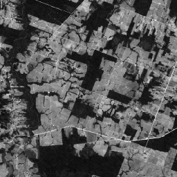
This collection contains the raw panchromatic (PAN) bands from the SPOT 2, 4, and 5 satellites for Brazil circa 2008. The panchromatic sensor provides the highest native spatial resolution of the missions, capturing light across a broad visible spectrum (0.51-0.73 µm for SPOT 2, 0.61-0.68 … brazil forest-code google imagery satellite-imagery spot -
SPOT Pansharpened Pseudo Natural Color Imagery 5-10m, Brazil
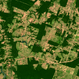
This collection provides high-resolution pansharpened pseudo-natural color SPOT imagery satellites 2, 4, and 5 for Brazil circa 2008. Where a corresponding high-resolution panchromatic image was available, it was fused with multispectral data to achieve enhanced spatial detail (up to 5m for SPOT 5 or 10m … brazil forest-code google rgb satellite-imagery spot -
Satellite Embedding V1
The Google Satellite Embedding dataset is a global, analysis-ready collection of learned geospatial embeddings. Each 10-meter pixel in this dataset is a 64-dimensional representation, or "embedding vector," that encodes temporal trajectories of surface conditions at and around that pixel as measured by various Earth observation … annual global google landsat-derived satellite-imagery sentinel1-derived -
Sentinel-1 SAR GRD: C-band Synthetic Aperture Radar Ground Range Detected, log scaling
The Sentinel-1 mission provides data from a dual-polarization C-band Synthetic Aperture Radar (SAR) instrument at 5.405GHz (C band). This collection includes the S1 Ground Range Detected (GRD) scenes, processed using the Sentinel-1 Toolbox to generate a calibrated, ortho-corrected product. The collection is updated daily. New … backscatter copernicus esa eu polarization radar -
Sentinel-2: Cloud Probability
The S2 cloud probability is created with the sentinel2-cloud-detector library (using LightGBM). All bands are upsampled using bilinear interpolation to 10m resolution before the gradient boost base algorithm is applied. The resulting 0..1 floating point probability is scaled to 0..100 and stored as an UINT8. … cloud copernicus esa eu msi radiance -
Sentinel-3 OLCI EFR: Ocean and Land Color Instrument Earth Observation Full Resolution
The Ocean and Land Color Instrument (OLCI) Earth Observation Full Resolution (EFR) dataset contains top of atmosphere radiances at 21 spectral bands with center wavelengths ranging between 0.4µm and 1.02µm at spatial resolution of 300m with worldwide coverage every ~2 days. OLCI is one of … copernicus esa eu radiance satellite-imagery sentinel -
USGS Landsat 1 MSS Collection 2 Tier 1 Raw Scenes

Landsat 1 MSS Collection 2 Tier 1 DN values, representing scaled, calibrated at-sensor radiance. Landsat scenes with the highest available data quality are placed into Tier 1 and are considered suitable for time-series processing analysis. Tier 1 includes Level-1 Precision Terrain (L1TP) processed data that … c2 global l1 landsat lm1 mss -
USGS Landsat 1 MSS Collection 2 Tier 2 Raw Scenes

Landsat 1 MSS Collection 2 Tier 2 DN values, representing scaled, calibrated at-sensor radiance. Scenes not meeting Tier 1 criteria during processing are assigned to Tier 2. This includes Systematic terrain (L1GT) and Systematic (L1GS) processed scenes, as well as any L1TP scenes that do … c2 global l1 landsat lm1 mss -
USGS Landsat 2 MSS Collection 2 Tier 1 Raw Scenes

Landsat 2 MSS Collection 2 Tier 1 DN values, representing scaled, calibrated at-sensor radiance. Landsat scenes with the highest available data quality are placed into Tier 1 and are considered suitable for time-series processing analysis. Tier 1 includes Level-1 Precision Terrain (L1TP) processed data that … c2 global l2 landsat lm2 mss -
USGS Landsat 2 MSS Collection 2 Tier 2 Raw Scenes

Landsat 2 MSS Collection 2 Tier 2 DN values, representing scaled, calibrated at-sensor radiance. Scenes not meeting Tier 1 criteria during processing are assigned to Tier 2. This includes Systematic terrain (L1GT) and Systematic (L1GS) processed scenes, as well as any L1TP scenes that do … c2 global l2 landsat lm2 mss -
USGS Landsat 3 MSS Collection 2 Tier 1 Raw Scenes

Landsat 3 MSS Collection 2 Tier 1 DN values, representing scaled, calibrated at-sensor radiance. Landsat scenes with the highest available data quality are placed into Tier 1 and are considered suitable for time-series processing analysis. Tier 1 includes Level-1 Precision Terrain (L1TP) processed data that … c2 global l3 landsat lm3 mss -
USGS Landsat 3 MSS Collection 2 Tier 2 Raw Scenes

Landsat 3 MSS Collection 2 Tier 2 DN values, representing scaled, calibrated at-sensor radiance. Scenes not meeting Tier 1 criteria during processing are assigned to Tier 2. This includes Systematic terrain (L1GT) and Systematic (L1GS) processed scenes, as well as any L1TP scenes that do … c2 global l3 landsat lm3 mss -
USGS Landsat 4 Level 2, Collection 2, Tier 1

This dataset contains atmospherically corrected surface reflectance and land surface temperature derived from the data produced by the Landsat TM sensor. These images contain 4 visible and near-infrared (VNIR) bands and 2 short-wave infrared (SWIR) bands processed to orthorectified surface reflectance, and one thermal infrared … cfmask cloud fmask global landsat lasrc -
USGS Landsat 4 Level 2, Collection 2, Tier 2

This dataset contains atmospherically corrected surface reflectance and land surface temperature derived from the data produced by the Landsat TM sensor. These images contain 4 visible and near-infrared (VNIR) bands and 2 short-wave infrared (SWIR) bands processed to orthorectified surface reflectance, and one thermal infrared … cfmask cloud fmask global landsat lasrc -
USGS Landsat 4 MSS Collection 2 Tier 1 Raw Scenes

Landsat 4 MSS Collection 2 Tier 1 DN values, representing scaled, calibrated at-sensor radiance. Landsat scenes with the highest available data quality are placed into Tier 1 and are considered suitable for time-series processing analysis. Tier 1 includes Level-1 Precision Terrain (L1TP) processed data that … c2 global l4 landsat lm4 mss -
USGS Landsat 4 MSS Collection 2 Tier 2 Raw Scenes

Landsat 4 MSS Collection 2 Tier 2 DN values, representing scaled, calibrated at-sensor radiance. Scenes not meeting Tier 1 criteria during processing are assigned to Tier 2. This includes Systematic terrain (L1GT) and Systematic (L1GS) processed scenes, as well as any L1TP scenes that do … c2 global l4 landsat lm4 mss -
USGS Landsat 4 TM Collection 2 Tier 1 Raw Scenes

Landsat 4 TM Collection 2 Tier 1 DN values, representing scaled, calibrated at-sensor radiance. Landsat scenes with the highest available data quality are placed into Tier 1 and are considered suitable for time-series processing analysis. Tier 1 includes Level-1 Precision Terrain (L1TP) processed data that … c2 global l4 landsat lt4 radiance -
USGS Landsat 4 TM Collection 2 Tier 1 TOA Reflectance

Landsat 4 TM Collection 2 Tier 1 calibrated top-of-atmosphere (TOA) reflectance. Calibration coefficients are extracted from the image metadata. See Chander et al. (2009) for details on the TOA computation. global landsat satellite-imagery toa usgs -
USGS Landsat 4 TM Collection 2 Tier 2 Raw Scenes

Landsat 4 TM Collection 2 Tier 2 DN values, representing scaled, calibrated at-sensor radiance. Scenes not meeting Tier 1 criteria during processing are assigned to Tier 2. This includes Systematic terrain (L1GT) and Systematic (L1GS) processed scenes, as well as any L1TP scenes that do … c2 global l4 landsat lt4 radiance -
USGS Landsat 4 TM Collection 2 Tier 2 TOA Reflectance
Landsat 4 TM Collection 2 Tier 2 calibrated top-of-atmosphere (TOA) reflectance. Calibration coefficients are extracted from the image metadata. See Chander et al. (2009) for details on the TOA computation. global landsat satellite-imagery toa usgs -
USGS Landsat 5 Level 2, Collection 2, Tier 1

This dataset contains atmospherically corrected surface reflectance and land surface temperature derived from the data produced by the Landsat TM sensor. These images contain 4 visible and near-infrared (VNIR) bands and 2 short-wave infrared (SWIR) bands processed to orthorectified surface reflectance, and one thermal infrared … cfmask cloud fmask global landsat lasrc -
USGS Landsat 5 Level 2, Collection 2, Tier 2

This dataset contains atmospherically corrected surface reflectance and land surface temperature derived from the data produced by the Landsat TM sensor. These images contain 4 visible and near-infrared (VNIR) bands and 2 short-wave infrared (SWIR) bands processed to orthorectified surface reflectance, and one thermal infrared … cfmask cloud fmask global landsat lasrc -
USGS Landsat 5 MSS Collection 2 Tier 1 Raw Scenes

Landsat 5 MSS Collection 2 Tier 1 DN values, representing scaled, calibrated at-sensor radiance. Landsat scenes with the highest available data quality are placed into Tier 1 and are considered suitable for time-series processing analysis. Tier 1 includes Level-1 Precision Terrain (L1TP) processed data that … c2 global l5 landsat lm5 mss -
USGS Landsat 5 MSS Collection 2 Tier 2 Raw Scenes

Landsat 5 MSS Collection 2 Tier 2 DN values, representing scaled, calibrated at-sensor radiance. Scenes not meeting Tier 1 criteria during processing are assigned to Tier 2. This includes Systematic terrain (L1GT) and Systematic (L1GS) processed scenes, as well as any L1TP scenes that do … c2 global l5 landsat lm5 mss -
USGS Landsat 5 TM Collection 2 Tier 1 Raw Scenes

Landsat 5 TM Collection 2 Tier 1 DN values, representing scaled, calibrated at-sensor radiance. Landsat scenes with the highest available data quality are placed into Tier 1 and are considered suitable for time-series processing analysis. Tier 1 includes Level-1 Precision Terrain (L1TP) processed data that … c2 global l5 landsat lt5 radiance -
USGS Landsat 5 TM Collection 2 Tier 1 TOA Reflectance

Landsat 5 TM Collection 2 Tier 1 calibrated top-of-atmosphere (TOA) reflectance. Calibration coefficients are extracted from the image metadata. See Chander et al. (2009) for details on the TOA computation. global landsat satellite-imagery toa usgs -
USGS Landsat 5 TM Collection 2 Tier 2 Raw Scenes

Landsat 5 TM Collection 2 Tier 2 DN values, representing scaled, calibrated at-sensor radiance. Scenes not meeting Tier 1 criteria during processing are assigned to Tier 2. This includes Systematic terrain (L1GT) and Systematic (L1GS) processed scenes, as well as any L1TP scenes that do … c2 global l5 landsat lt5 radiance -
USGS Landsat 5 TM Collection 2 Tier 2 TOA Reflectance

Landsat 5 TM Collection 2 Tier 2 calibrated top-of-atmosphere (TOA) reflectance. Calibration coefficients are extracted from the image metadata. See Chander et al. (2009) for details on the TOA computation. global landsat satellite-imagery toa usgs -
USGS Landsat 7 Collection 2 Tier 1 Raw Scenes

Landsat 7 Collection 2 Tier 1 DN values, representing scaled, calibrated at-sensor radiance. Landsat scenes with the highest available data quality are placed into Tier 1 and are considered suitable for time-series processing analysis. Tier 1 includes Level-1 Precision Terrain (L1TP) processed data that have … c2 etm global l7 landsat le7 -
USGS Landsat 7 Collection 2 Tier 1 TOA Reflectance

Landsat 7 Collection 2 Tier 1 calibrated top-of-atmosphere (TOA) reflectance. Calibration coefficients are extracted from the image metadata. See Chander et al. (2009) for details on the TOA computation. Note that Landsat 7's orbit has been drifting to an earlier acquisition time since 2017. c2 global landsat satellite-imagery toa usgs -
USGS Landsat 7 Collection 2 Tier 1 and Real-Time data Raw Scenes

Landsat 7 Collection 2 Tier 1 and Real-Time data DN values, representing scaled, calibrated at-sensor radiance. Landsat scenes with the highest available data quality are placed into Tier 1 and are considered suitable for time-series processing analysis. Tier 1 includes Level-1 Precision Terrain (L1TP) processed … c2 etm global l7 landsat le7 -
USGS Landsat 7 Collection 2 Tier 1 and Real-Time data TOA Reflectance

Landsat 7 Collection 2 Tier 1 and Real-Time data calibrated top-of-atmosphere (TOA) reflectance. Calibration coefficients are extracted from the image metadata. See Chander et al. (2009) for details on the TOA computation. Note that Landsat 7's orbit has been drifting to an earlier acquisition time … c2 global landsat satellite-imagery toa usgs -
USGS Landsat 7 Collection 2 Tier 2 Raw Scenes

Landsat 7 Collection 2 Tier 2 DN values, representing scaled, calibrated at-sensor radiance. Scenes not meeting Tier 1 criteria during processing are assigned to Tier 2. This includes Systematic terrain (L1GT) and Systematic (L1GS) processed scenes, as well as any L1TP scenes that do not … c2 etm global l7 landsat le7 -
USGS Landsat 7 Collection 2 Tier 2 TOA Reflectance

Landsat 7 Collection 2 Tier 2 calibrated top-of-atmosphere (TOA) reflectance. Calibration coefficients are extracted from the image metadata. See Chander et al. (2009) for details on the TOA computation. Note that Landsat 7's orbit has been drifting to an earlier acquisition time since 2017. c2 global landsat satellite-imagery toa usgs -
USGS Landsat 7 Level 2, Collection 2, Tier 1

This dataset contains atmospherically corrected surface reflectance and land surface temperature derived from the data produced by the Landsat 7 ETM+ sensor. These images contain 4 visible and near-infrared (VNIR) bands and 2 short-wave infrared (SWIR) bands processed to orthorectified surface reflectance, and one thermal … cfmask cloud etm fmask global landsat -
USGS Landsat 7 Level 2, Collection 2, Tier 2
This dataset contains atmospherically corrected surface reflectance and land surface temperature derived from the data produced by the Landsat 7 ETM+ sensor. These images contain 4 visible and near-infrared (VNIR) bands and 2 short-wave infrared (SWIR) bands processed to orthorectified surface reflectance, and one thermal … cfmask cloud etm fmask global landsat -
USGS Landsat 8 Collection 2 Tier 1 Raw Scenes
Landsat 8 Collection 2 Tier 1 DN values, representing scaled, calibrated at-sensor radiance. Landsat scenes with the highest available data quality are placed into Tier 1 and are considered suitable for time-series processing analysis. Tier 1 includes Level-1 Precision Terrain (L1TP) processed data that have … c2 global l8 landsat lc8 oli-tirs -
USGS Landsat 8 Collection 2 Tier 1 TOA Reflectance

Landsat 8 Collection 2 Tier 1 calibrated top-of-atmosphere (TOA) reflectance. Calibration coefficients are extracted from the image metadata. See Chander et al. (2009) for details on the TOA computation. Landsat scenes with the highest available data quality are placed into Tier 1 and are considered … c2 global landsat satellite-imagery toa usgs -
USGS Landsat 8 Collection 2 Tier 1 and Real-Time data Raw Scenes

Landsat 8 Collection 2 Tier 1 and Real-Time data DN values, representing scaled, calibrated at-sensor radiance. Landsat scenes with the highest available data quality are placed into Tier 1 and are considered suitable for time-series processing analysis. Tier 1 includes Level-1 Precision Terrain (L1TP) processed … c2 global l8 landsat lc8 nrt -
USGS Landsat 8 Collection 2 Tier 1 and Real-Time data TOA Reflectance

Landsat 8 Collection 2 Tier 1 and Real-Time data calibrated top-of-atmosphere (TOA) reflectance. Calibration coefficients are extracted from the image metadata. See Chander et al. (2009) for details on the TOA computation. Landsat scenes with the highest available data quality are placed into Tier 1 … c2 global l8 landsat lc8 satellite-imagery -
USGS Landsat 8 Collection 2 Tier 2 Raw Scenes

Landsat 8 Collection 2 Tier 2 DN values, representing scaled, calibrated at-sensor radiance. Scenes not meeting Tier 1 criteria during processing are assigned to Tier 2. This includes Systematic terrain (L1GT) and Systematic (L1GS) processed scenes, as well as any L1TP scenes that do not … c2 global l8 landsat lc8 oli-tirs -
USGS Landsat 8 Collection 2 Tier 2 TOA Reflectance

Landsat 8 Collection 2 Tier 2 calibrated top-of-atmosphere (TOA) reflectance. Calibration coefficients are extracted from the image metadata. See Chander et al. (2009) for details on the TOA computation. Scenes not meeting Tier 1 criteria during processing are assigned to Tier 2. This includes Systematic … c2 global landsat satellite-imagery toa usgs -
USGS Landsat 8 Level 2, Collection 2, Tier 1

This dataset contains atmospherically corrected surface reflectance and land surface temperature derived from the data produced by the Landsat 8 OLI/TIRS sensors. These images contain 5 visible and near-infrared (VNIR) bands and 2 short-wave infrared (SWIR) bands processed to orthorectified surface reflectance, and one thermal … cfmask cloud fmask global l8sr landsat -
USGS Landsat 8 Level 2, Collection 2, Tier 2

This dataset contains atmospherically corrected surface reflectance and land surface temperature derived from the data produced by the Landsat 8 OLI/TIRS sensors. These images contain 5 visible and near-infrared (VNIR) bands and 2 short-wave infrared (SWIR) bands processed to orthorectified surface reflectance, and one thermal … cfmask cloud fmask global l8sr landsat -
USGS Landsat 9 Collection 2 Tier 1 Raw Scenes

Landsat 9 Collection 2 Tier 1 DN values, representing scaled, calibrated at-sensor radiance. Landsat scenes with the highest available data quality are placed into Tier 1 and are considered suitable for time-series processing analysis. Tier 1 includes Level-1 Precision Terrain (L1TP) processed data that have … c2 global l9 landsat lc9 oli-tirs -
USGS Landsat 9 Collection 2 Tier 1 TOA Reflectance
Landsat 9 Collection 2 Tier 1 calibrated top-of-atmosphere (TOA) reflectance. Calibration coefficients are extracted from the image metadata. See Chander et al. (2009) for details on the TOA computation. Landsat scenes with the highest available data quality are placed into Tier 1 and are considered … c2 global landsat satellite-imagery toa usgs -
USGS Landsat 9 Collection 2 Tier 2 Raw Scenes

Landsat 9 Collection 2 Tier 2 DN values, representing scaled, calibrated at-sensor radiance. Scenes not meeting Tier 1 criteria during processing are assigned to Tier 2. This includes Systematic terrain (L1GT) and Systematic (L1GS) processed scenes, as well as any L1TP scenes that do not … c2 global l9 landsat lc9 oli-tirs -
USGS Landsat 9 Collection 2 Tier 2 TOA Reflectance

Landsat 9 Collection 2 Tier 2 calibrated top-of-atmosphere (TOA) reflectance. Calibration coefficients are extracted from the image metadata. See Chander et al. (2009) for details on the TOA computation. Scenes not meeting Tier 1 criteria during processing are assigned to Tier 2. This includes Systematic … c2 global l9 landsat lc9 satellite-imagery -
USGS Landsat 9 Level 2, Collection 2, Tier 1

This dataset contains atmospherically corrected surface reflectance and land surface temperature derived from the data produced by the Landsat 9 OLI/TIRS sensors. These images contain 5 visible and near-infrared (VNIR) bands and 2 short-wave infrared (SWIR) bands processed to orthorectified surface reflectance, and one thermal … cfmask cloud fmask global l9sr landsat -
USGS Landsat 9 Level 2, Collection 2, Tier 2

This dataset contains atmospherically corrected surface reflectance and land surface temperature derived from the data produced by the Landsat 9 OLI/TIRS sensors. These images contain 5 visible and near-infrared (VNIR) bands and 2 short-wave infrared (SWIR) bands processed to orthorectified surface reflectance, and one thermal … cfmask cloud fmask global l9sr landsat -
VNP09GA: VIIRS Surface Reflectance Daily 500m and 1km

The Visible Infrared Imaging Radiometer Suite (VIIRS) daily surface reflectance (VNP09GA) product provides an estimate of land surface reflectance from the Suomi National Polar-Orbiting Partnership (S-NPP) VIIRS sensor. Data are provided for three imagery bands (I1, I2, I3) at nominal 500 meter resolution (~463 meter) … daily nasa noaa npp reflectance satellite-imagery -
VNP09H1: VIIRS Surface Reflectance 8-Day L3 Global 500m
The 8-day Visible Infrared Imaging Radiometer Suite (VIIRS) Surface Reflectance (VNP09H1) Version 1 composite product provides an estimate of land surface reflectance from the Suomi National Polar-orbiting Partnership (Suomi NPP) VIIRS sensor for three imagery bands (I1, I2, I3) at nominal 500m resolution (~463m). The … daily nasa noaa npp reflectance satellite-imagery -
VNP43IA1: BRDF/Albedo Model Parameters Daily L3 Global 500m SIN Grid
The Suomi National Polar-Orbiting Partnership (Suomi NPP) NASA Visible Infrared Imaging Radiometer Suite (VIIRS) Bidirectional Reflectance Distribution Function (BRDF) and Albedo Model Parameters (VNP43IA1) Version 1 product provides kernel weights (parameters) at 500 resolution. The VNP43IA1 product is produced daily using 16 days of VIIRS … land nasa noaa satellite-imagery surface viirs -
VNP43IA2: BRDF/Albedo Quality Daily L3 Global 500m SIN Grid
The Suomi National Polar-Orbiting Partnership (Suomi NPP) NASA Visible Infrared Imaging Radiometer Suite (VIIRS) Bidirectional Reflectance Distribution Function (BRDF) and Albedo Quality (VNP43IA2) Version 1 product provides BRDF and Albedo quality at 500m resolution. The VNP43IA2 product is produced daily using 16 days of VIIRS … land nasa noaa satellite-imagery surface viirs -
VNP43IA3: BRDF/Albedo Daily L3 Global 500m SIN Grid
The NASA/NOAA Suomi National Polar-orbiting Partnership (Suomi NPP) Visible Infrared Imaging Radiometer Suite (VIIRS) Bidirectional Reflectance Distribution Function (BRDF) and Albedo (BRDF/Albedo) Version 2 product provides albedo estimates at 500 meter resolution. The VNP43IA3 product is produced daily using 16 days of VIIRS data and … albedo brdf land nasa noaa satellite-imagery -
VNP43IA4: BRDF/Albedo Quality Daily L3 Global 500m SIN Grid

The NASA/NOAA Suomi National Polar-orbiting Partnership (Suomi NPP) Visible Infrared Imaging Radiometer Suite (VIIRS) Nadir Bidirectional Reflectance Distribution Function (BRDF) Adjusted Reflectance (NBAR) Version 2 product provides NBAR estimates at 500 meter resolution. The VNP43IA4 product is produced daily using 16 days of VIIRS data … brdf land nasa noaa satellite-imagery surface