Page Summary
-
The Global Land Survey (GLS) 1975 is a global collection of imagery from the Landsat Multispectral Scanner (MSS), available from 1972 to 1983.
-
These data contain 4 spectral bands: Green, Red, an NIR band, and a SWIR band, with a pixel size of 60 meters.
-
Landsat datasets are in the public domain and can be used without copyright restriction, with acknowledgement to the USGS as the data source.
-
The dataset is available for exploration and analysis through the Google Earth Engine platform.
- Dataset Availability
- 1972-07-25T00:00:00Z–1983-02-20T00:00:00Z
- Dataset Producer
- USGS
- Tags
Description
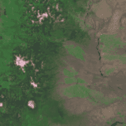
The Global Land Survey (GLS) 1975 is a global collection of imagery from the Landsat Multispectral Scanner (MSS). Most scenes were acquired by Landsat 1-3 in 1972-1983. A few gaps in the Landsat 1-3 data have been filled with scenes acquired by Landsat 4-5 during the years 1982-1987. These data contain 4 spectral bands: Green, Red, an NIR band, and a SWIR band. In the typical False-color presentation, the images appear red because the NIR band, displayed as red, highlights vegetation.
Bands
Bands
Pixel size: 60 meters (all bands)
| Name | Pixel Size | Wavelength | Description |
|---|---|---|---|
10 |
60 meters | 500-600 nm | Green |
20 |
60 meters | 600-700 nm | Red |
30 |
60 meters | 700-800 nm | Near infrared |
40 |
60 meters | 800-1100 nm | Short-wavelength infrared |
Terms of Use
Terms of Use
Landsat datasets are federally created data and therefore reside in the public domain and may be used, transferred, or reproduced without copyright restriction.
Acknowledgement or credit of the USGS as data source should be provided by including a line of text citation such as the example shown below.
(Product, Image, Photograph, or Dataset Name) courtesy of the U.S. Geological Survey
Example: Landsat-7 image courtesy of the U.S. Geological Survey
See the USGS Visual Identity System Guidance for further details on proper citation and acknowledgement of USGS products.
Citations
GLS 1975 image courtesy of the U.S. Geological Survey
Explore with Earth Engine
Code Editor (JavaScript)
var dataset = ee.ImageCollection('LANDSAT/GLS1975');
var falseColor = dataset.select(['30', '20', '10']);
var falseColorVis = {
  gamma: 1.6,
};
Map.setCenter(44.517, 25.998, 5);
Map.addLayer(falseColor, falseColorVis, 'False Color');