Page Summary
-
The 2000 Greenland Mosaic is a high-resolution image of the Greenland ice sheet from 1999-2002.
-
ArcticDEM provides high-resolution digital surface models of the Arctic, including vegetation and buildings.
-
The Greenland DEM from GIMP is a Digital Elevation Model combining different data sources.
-
The Greenland Ice & Ocean Mask offers detailed classification masks of ice and ocean for the Greenland ice sheet.
-
MEaSUREs provides mean monthly ice velocity maps for selected glacier areas in Greenland.
-
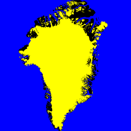
2000 Greenland Mosaic - Greenland Ice Mapping Project (GIMP)
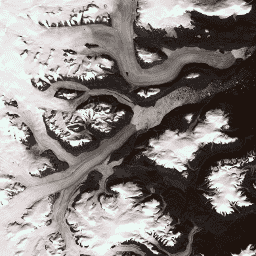
This dataset provides a complete 15 m resolution image mosaic of the Greenland ice sheet derived from Landsat 7 ETM+ and RADARSAT-1 SAR imagery from the years 1999 to 2002. The methods include a combination of image cloud masking, pan sharpening, image sampling and resizing, … arctic gimp greenland imagery nasa polar -
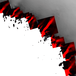
ArcticDEM Mosaic V4.1
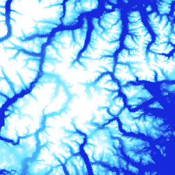
ArcticDEM is a National Geospatial-Intelligence Agency (NGA) and National Science Foundation (NSF) public-private initiative to automatically produce a high-resolution, high-quality digital surface model (DSM) of the Arctic using optical stereo imagery, high-performance computing, and open source photogrammetry software. It includes vegetation, tree canopy, buildings, and … arctic dem elevation-topography geophysical pgc umn -
ArcticDEM Strips
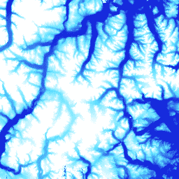
ArcticDEM is a National Geospatial-Intelligence Agency (NGA) and National Science Foundation (NSF) public-private initiative to automatically produce a high-resolution, high-quality digital surface model (DSM) of the Arctic using optical stereo imagery, high-performance computing, and open source photogrammetry software. It includes vegetation, tree canopy, buildings, and … arctic dem elevation-topography geophysical pgc umn -
Greenland DEM - Greenland Mapping Project (GIMP)
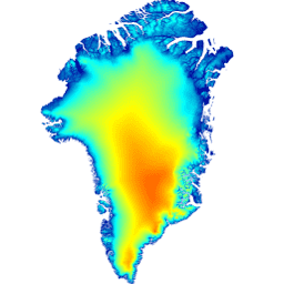
This Digital Elevation Model (DEM) is constructed from a combination of ASTER and SPOT-5 DEM's for the ice sheet periphery and margin (i.e. below the equilbrium line elevation) south of approximately 82.5°N and AVHRR photoclinometry in the ice sheet interior and far north (Scambos and … arctic elevation-topography gimp greenland nasa polar -
Greenland Ice & Ocean Mask - Greenland Mapping Project (GIMP)
This dataset provides complete land ice and ocean classification masks at 15 m for the Greenland ice sheet. Ice cover was mapped using a combination of orthorectified panchromatic (band 8) imagery from the Landsat 7 Enhanced Thematic Mapper Plus (ETM+), distributed by the USGS, and … arctic cryosphere gimp greenland ice nasa -
MEaSUREs Greenland Ice Velocity: Selected Glacier Site Velocity Maps from Optical Images Version 2
This dataset, part of the NASA Making Earth System Data Records for Use in Research Environments (MEaSUREs) program, consists of mean monthly velocity maps for selected glacier outlet areas. The maps are generated by tracking visible features between optical image pairs acquired by the Landsat … arctic cryosphere gimp greenland ice nasa