Page Summary
-
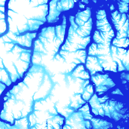
ArcticDEM and REMA are high-resolution Digital Surface Models (DSM) covering the Arctic and Antarctica, respectively.
-
ArcticDEM is produced using optical stereo imagery and open source photogrammetry software and includes vegetation, tree canopy, and buildings.
-
REMA is a time-stamped DSM of Antarctica available at 2-meter and 8-meter spatial resolutions.
-
Both ArcticDEM and REMA are available as mosaics and individual strips.
-
ArcticDEM Mosaic V4.1
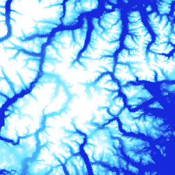
ArcticDEM is a National Geospatial-Intelligence Agency (NGA) and National Science Foundation (NSF) public-private initiative to automatically produce a high-resolution, high-quality digital surface model (DSM) of the Arctic using optical stereo imagery, high-performance computing, and open source photogrammetry software. It includes vegetation, tree canopy, buildings, and … arctic dem elevation-topography geophysical pgc umn -
ArcticDEM Strips
ArcticDEM is a National Geospatial-Intelligence Agency (NGA) and National Science Foundation (NSF) public-private initiative to automatically produce a high-resolution, high-quality digital surface model (DSM) of the Arctic using optical stereo imagery, high-performance computing, and open source photogrammetry software. It includes vegetation, tree canopy, buildings, and … arctic dem elevation-topography geophysical pgc umn -
REMA Mosaic

The Reference Elevation Model of Antarctica (REMA) is a high resolution, time-stamped Digital Surface Model (DSM) of Antarctica at 2-meter and 8-meter spatial resolutions. Mosaicked DEM files are compiled from multiple strips that have been co-registered, blended, and feathered to reduce edge-matching artifacts. dem elevation-topography geophysical pgc rema umn -
REMA Strips 2m

The Reference Elevation Model of Antarctica (REMA) is a high resolution, time-stamped Digital Surface Model (DSM) of Antarctica at 2-meter and 8-meter spatial resolutions. Strip DEM files correspond to the overlapping area of the input stereoscopic imagery pair strips as they are collected by DigitalGlobe's … dem elevation-topography geophysical pgc rema umn -
REMA Strips 8m

The Reference Elevation Model of Antarctica (REMA) is a high resolution, time-stamped Digital Surface Model (DSM) of Antarctica at 2-meter and 8-meter spatial resolutions. Strip DEM files correspond to the overlapping area of the input stereoscopic imagery pair strips as they are collected by DigitalGlobe's … dem elevation-topography geophysical pgc rema umn