Page Summary
-
The GLS2005 dataset consists of 9500 orthorectified satellite images collected between 2004 and 2007 covering Earth's land masses, primarily using Landsat 5 and 7 data.
-
USGS Landsat 7 Collection 2 Tier 1 and Tier 1 Real-Time datasets contain scaled, calibrated at-sensor radiance values considered suitable for time-series analysis.
-
USGS Landsat 7 Collection 2 Tier 2 dataset contains scaled, calibrated at-sensor radiance values for scenes that did not meet Tier 1 criteria.
-
USGS Landsat 7 Level 2, Collection 2, Tier 1 and Tier 2 datasets provide atmospherically corrected surface reflectance and land surface temperature derived from the Landsat 7 ETM+ sensor.
-
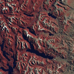
Landsat Global Land Survey 2005, Landsat 5 scenes

The GLS2005 data set is a collection of 9500 orthorectified leaf-on medium-resolution satellite images collected between 2004 and 2007 and covering the Earth's land masses. GLS2005 uses mainly Landsat 5 and gap-filled Landsat 7 data with EO-1 ALI and Terra ASTER data filling in any … etm gls l5 landsat radiance satellite-imagery -
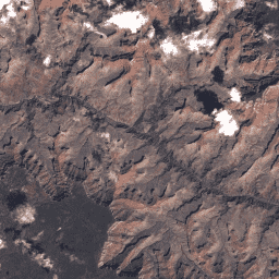
Landsat Global Land Survey 2005, Landsat 7 scenes
The GLS2005 data set is a collection of 9500 orthorectified leaf-on medium-resolution satellite images collected between 2004 and 2007 and covering the Earth's land masses. GLS2005 uses mainly Landsat 5 and gap-filled Landsat 7 data with EO-1 ALI and Terra ASTER data filling in any … etm gls l7 landsat radiance satellite-imagery -
USGS Landsat 7 Collection 2 Tier 1 Raw Scenes
Landsat 7 Collection 2 Tier 1 DN values, representing scaled, calibrated at-sensor radiance. Landsat scenes with the highest available data quality are placed into Tier 1 and are considered suitable for time-series processing analysis. Tier 1 includes Level-1 Precision Terrain (L1TP) processed data that have … c2 etm global l7 landsat le7 -
USGS Landsat 7 Collection 2 Tier 1 and Real-Time data Raw Scenes

Landsat 7 Collection 2 Tier 1 and Real-Time data DN values, representing scaled, calibrated at-sensor radiance. Landsat scenes with the highest available data quality are placed into Tier 1 and are considered suitable for time-series processing analysis. Tier 1 includes Level-1 Precision Terrain (L1TP) processed … c2 etm global l7 landsat le7 -
USGS Landsat 7 Collection 2 Tier 2 Raw Scenes

Landsat 7 Collection 2 Tier 2 DN values, representing scaled, calibrated at-sensor radiance. Scenes not meeting Tier 1 criteria during processing are assigned to Tier 2. This includes Systematic terrain (L1GT) and Systematic (L1GS) processed scenes, as well as any L1TP scenes that do not … c2 etm global l7 landsat le7 -
USGS Landsat 7 Level 2, Collection 2, Tier 1

This dataset contains atmospherically corrected surface reflectance and land surface temperature derived from the data produced by the Landsat 7 ETM+ sensor. These images contain 4 visible and near-infrared (VNIR) bands and 2 short-wave infrared (SWIR) bands processed to orthorectified surface reflectance, and one thermal … cfmask cloud etm fmask global landsat -
USGS Landsat 7 Level 2, Collection 2, Tier 2
This dataset contains atmospherically corrected surface reflectance and land surface temperature derived from the data produced by the Landsat 7 ETM+ sensor. These images contain 4 visible and near-infrared (VNIR) bands and 2 short-wave infrared (SWIR) bands processed to orthorectified surface reflectance, and one thermal … cfmask cloud etm fmask global landsat