Page Summary
-
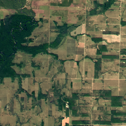
Orthophotos are aerial photos covering various countries, with distortions removed.
-
Datasets cover Estonia, Finland, Latvia, Netherlands, Switzerland, Slovakia, and Spain.
-
Some orthophotos are high-resolution, such as NEON RGB Camera Imagery at 0.1 m spatial resolution and SWISSIMAGE at 10 cm ground resolution.
-
Data is provided by national agencies and organizations like SMK in Finland and PNOA in Spain.
-
Specific collections exist, such as low-flying orthophotos for Estonia and a collection from Planet SkySat satellites.
-
Brazil Forest Imagery Dataset 2008: Visual Basemap
This dataset provides a visual imagery basemap of Brazil with up to 5-meter resolution, primarily captured in 2008, to support implementation of the Brazil Forest Code. The mosaic is synthesized from SPOT 2, 4, and 5 satellite data. It serves as a high-resolution alternative to … brazil deforestation forest-code google rgb satellite-imagery -
Estonia RGB low flying orthophotos

Orthophotos are an aerial photo dataset covering Estonia. An orthophoto is a processed aerial photo from which distortions caused by terrain relief, camera tilt relative to the ground at the moment of exposure and camera central projection are removed. A digital orthophoto has a certain … estonia low-flying orthophotos rgb -
Estonia RGB orthophotos
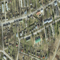
Orthophotos are an aerial photo dataset covering Estonia. An orthophoto is a processed aerial photo from which distortions caused by terrain relief, camera tilt relative to the ground at the moment of exposure and camera central projection are removed. A digital orthophoto has a certain … estonia orthophotos rgb -
Finland RGB NLS orthophotos 50 cm by SMK
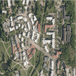
NLS Orthophotos are an aerial photo dataset covering the whole of Finland. This data is provided by SMK(The Energy Agency, formerly abbreviated SMK). An orthophoto is a combination of several individual aerial photos. The aerial photo data set in orthophoto format is available as the … finland orthophotos rgb smk -
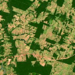
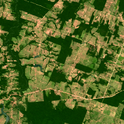
Latvia RGB orthophotos
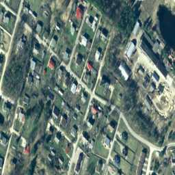
In Latvia, orthophoto maps are prepared in the Latvian coordinate system LKS-92 TM according to the TKS-93 map sheet division (scale 1:10000 map sheet corresponds to 5 x 5 kilometers in nature). Orthophoto maps are prepared for the whole territory of Latvia at the scale … latvia orthophotos rgb -
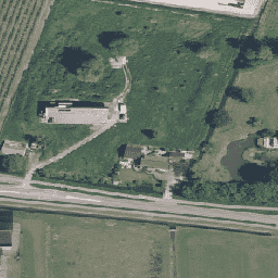
NEON RGB Camera Imagery

High resolution Red-Green-Blue (RGB) orthorectified camera images mosaicked and output onto a fixed, uniform spatial grid using nearest-neighbor resampling; spatial resolution is 0.1 m. The digital camera is part of a suite of instruments on the NEON Airborne Observation Platform (AOP) that also includes a … airborne forest highres neon neon-prod-earthengine orthophoto -
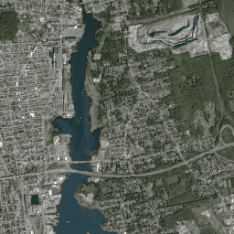
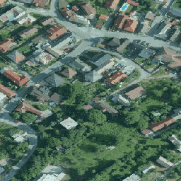
Netherlands orthophotos
Orthophotos of Netherlands is a set of color orthoimages. Two nationwide aerial photographs are collected per year: a leafless image at 7.5 cm resolution in the spring and one with leaves on trees at 25 cm resolution in the summer. For more information, please see … netherlands orthophotos rgb -
Planet SkySat Public Ortho Imagery, RGB
This data from Planet labs Inc. SkySat satellites was collected for the experimental "Skybox for Good Beta" program in 2015, as well as for various crisis response events and a few other projects. The data is available in both a 5-band Multispectral/Pan collection, and a … highres pansharpened planet rgb satellite-imagery skysat -
SPOT Multispectral Pseudo Natural Color Imagery 10-20m, Brazil
This collection contains 2008-era "pseudo natural color" RGB images derived from the native multispectral bands of SPOT 2, 4, and 5 for Brazil. Because the HRV and HRG sensors did not include a native blue band, this product synthesizes an RGB representation to approximate a … brazil forest-code google rgb satellite-imagery spot -
SPOT Pansharpened Pseudo Natural Color Imagery 5-10m, Brazil
This collection provides high-resolution pansharpened pseudo-natural color SPOT imagery satellites 2, 4, and 5 for Brazil circa 2008. Where a corresponding high-resolution panchromatic image was available, it was fused with multispectral data to achieve enhanced spatial detail (up to 5m for SPOT 5 or 10m … brazil forest-code google rgb satellite-imagery spot -
SWISSIMAGE 10 cm RGB imagery
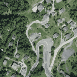
The SWISSIMAGE 10 cm orthophoto mosaic is an assembly of new color digital aerial images over the whole of Switzerland with a ground resolution of 10 cm in the plains and the main alpine valleys and 25 cm in the Alps. It is updated annually. … orthophotos rgb -
Slovakia orthophotos
Orthophotomosaic of the Slovak Republic is a set of color orthoimages without overlaps, gaps and visible brightness and color differences along the connecting lines. For more information, please see the Slovakia orthophotos documentation orthophotos rgb -
Spain RGB orthophotos 10 cm
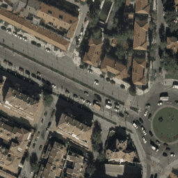
Mosaics of orthophotos from flights carried out between 2007 and 2018 by various public administration bodies at 10cm pixel resolution. This data is provided by National Plan for Aerial Orthophotography Spain (PNOA). For more information, please see the Spain orthophotos documentation orthophotos rgb