Page Summary
-
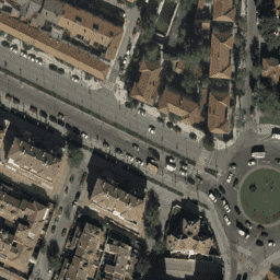
The dataset contains mosaics of orthophotos from flights in Spain between 2007 and 2018 at a 10cm pixel resolution, provided by the National Plan for Aerial Orthophotography Spain (PNOA).
-
The data is free for any legitimate purpose, with the only requirement being acknowledgment of the National Geographic Institute Spain as the origin and owner.
-
The dataset includes Red, Green, and Blue bands with pixel values ranging from 0 to 255.
- Dataset Availability
- 2007-01-01T00:00:00Z–2019-01-01T00:00:00Z
- Dataset Producer
- Spain orthophotos
- Tags
Description
Mosaics of orthophotos from flights carried out between 2007 and 2018 by various public administration bodies at 10cm pixel resolution. This data is provided by National Plan for Aerial Orthophotography Spain (PNOA).
For more information, please see the Spain orthophotos documentation
Bands
Bands
Pixel size: 0.1 meters (all bands)
| Name | Units | Min | Max | Pixel Size | Description |
|---|---|---|---|---|---|
R |
dn | 0 | 255 | 0.1 meters | Red |
G |
dn | 0 | 255 | 0.1 meters | Green |
B |
dn | 0 | 255 | 0.1 meters | Blue |
Terms of Use
Terms of Use
The data is free and free use for any legitimate purpose, the only strict obligation being that of acknowledging and mentioning the origin and ownership of the geographic information products and services licensed as National Geographic Institute.
For more details, see Terms of use
Citations
National Geographic Institute Spain
Explore with Earth Engine
Code Editor (JavaScript)
var dataset = ee.ImageCollection('Spain/PNOA/PNOA10');
Map.setCenter(-1.859852, 38.983734, 19);
Map.addLayer(dataset, {}, 'Spain RGB (10cm)');