Page Summary
-
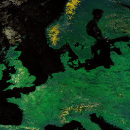
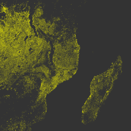
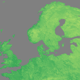
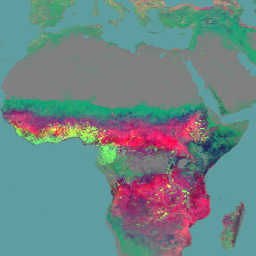
Several NOAA VIIRS datasets are available covering land surface characteristics like LAI, FAPAR, NDVI, reflectance, and phenology.
-
Nighttime light datasets from VIIRS are provided with different temporal resolutions (annual and monthly) and processing levels.
-
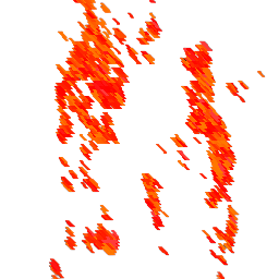
VIIRS data also includes products focused on active fire detection and burned area mapping at various resolutions.
-
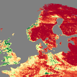
Land surface temperature and emissivity data is available from VIIRS for both daytime and nighttime observations.
-
Various VIIRS products related to Bidirectional Reflectance Distribution Function (BRDF) and Albedo are offered at 500m resolution.
-
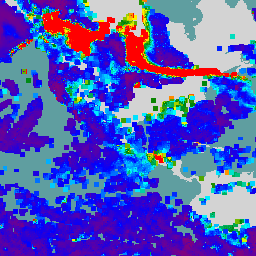
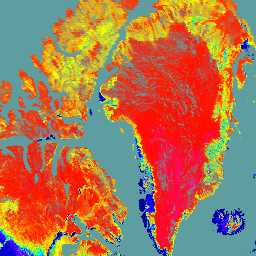
NOAA CDR VIIRS LAI FAPAR: Leaf Area Index and Fraction of Absorbed Photosynthetically Active Radiation, Version 1

This Climate Data Record (CDR) combines datasets for Leaf Area Index (LAI) and Fraction of Absorbed Photosynthetically Active Radiation (FAPAR), two biophysical variables that can be used to evaluate vegetation stress, forecast agricultural yields, and other modeling and resource management applications. LAI tracks the one-sided … cdr daily fapar lai land noaa -
NOAA CDR VIIRS NDVI: Normalized Difference Vegetation Index, Version 1

This dataset contains gridded daily Normalized Difference Vegetation Index (NDVI) derived from the NOAA Climate Data Record (CDR) of Visible Infrared Imaging Radiometer Suite (VIIRS) Surface Reflectance. The data record spans from 2014 onward using data from NOAA polar orbiting satellites. The data are projected … cdr daily land ndvi noaa vegetation-indices -
VIIRS Aerosol Optical Depth and Aerosol Particle Size EDRs V3
The VIIRS Aerosol Optical Depth (AOD) and Aerosol Particle Size (APS) Environmental Data Records (EDRs) product provides aerosol properties retrieved from the Visible Infrared Imaging Radiometer Suite (VIIRS) sensor. The primary product is the AOD at 550 nm, with additional retrievals at other sensor channels … aerosol aod atmosphere noaa viirs -
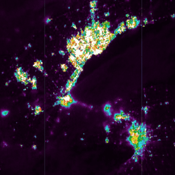
VIIRS Nighttime Day/Night Annual Band Composites V2.1
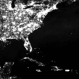
Annual global VIIRS nighttime lights dataset is a time series produced from monthly cloud-free average radiance grids spanning 2013 to 2021. Data for 2022 are available in the NOAA/VIIRS/DNB/ANNUAL_V22 dataset. An initial filtering step removed sunlit, moonlit and cloudy pixels, leading to rough composites that … annual dnb eog lights nighttime noaa -
VIIRS Nighttime Day/Night Annual Band Composites V2.2

Annual global VIIRS nighttime lights dataset is a time series produced from monthly cloud-free average radiance grids for 2022. Data for earlier years are available in the NOAA/VIIRS/DNB/ANNUAL_V21 dataset. An initial filtering step removed sunlit, moonlit and cloudy pixels, leading to rough composites that contains … annual dnb eog lights nighttime noaa -
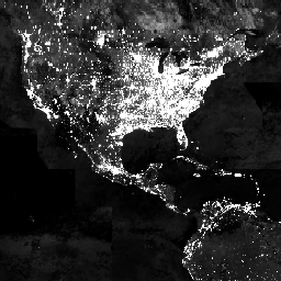
VIIRS Nighttime Day/Night Band Composites Version 1
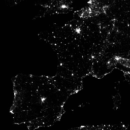
Monthly average radiance composite images using nighttime data from the Visible Infrared Imaging Radiometer Suite (VIIRS) Day/Night Band (DNB). As these data are composited monthly, there are many areas of the globe where it is impossible to get good quality data coverage for that month. … dnb eog lights monthly nighttime noaa -
VIIRS Stray Light Corrected Nighttime Day/Night Band Composites Version 1

Monthly average radiance composite images using nighttime data from the Visible Infrared Imaging Radiometer Suite (VIIRS) Day/Night Band (DNB). As these data are composited monthly, there are many areas of the globe where it is impossible to get good quality data coverage for that month. … dnb eog lights monthly nighttime noaa -
VJ114IMGTDL_NRT Daily Raster: VIIRS (NOAA-20) Band 375m Active Fire
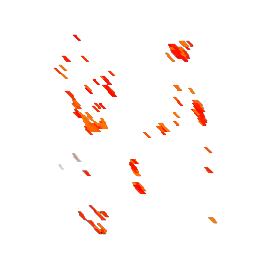
NOAA-20 (JPSS-1) Visible Infrared Imaging Radiometer Suite (VIIRS) Active Fire detection product is based on the instrument's 375m nominal resolution data. Compared to other coarser resolution (≥ 1km) satellite fire detection products, the improved 375 m data provide greater response over fires of relatively small … eosdis fire firms geophysical hotspot lance -
VNP09GA: VIIRS Surface Reflectance Daily 500m and 1km

The Visible Infrared Imaging Radiometer Suite (VIIRS) daily surface reflectance (VNP09GA) product provides an estimate of land surface reflectance from the Suomi National Polar-Orbiting Partnership (S-NPP) VIIRS sensor. Data are provided for three imagery bands (I1, I2, I3) at nominal 500 meter resolution (~463 meter) … daily nasa noaa npp reflectance satellite-imagery -
VNP09H1: VIIRS Surface Reflectance 8-Day L3 Global 500m
The 8-day Visible Infrared Imaging Radiometer Suite (VIIRS) Surface Reflectance (VNP09H1) Version 1 composite product provides an estimate of land surface reflectance from the Suomi National Polar-orbiting Partnership (Suomi NPP) VIIRS sensor for three imagery bands (I1, I2, I3) at nominal 500m resolution (~463m). The … daily nasa noaa npp reflectance satellite-imagery -
VNP13A1.002: VIIRS Vegetation Indices 16-Day 500m

The Suomi National Polar-Orbiting Partnership (S-NPP) NASA Visible Infrared Imaging Radiometer Suite (VIIRS) Vegetation Indices (VNP13A1) data product provides vegetation indices by a process of selecting the best available pixel over a 16-day acquisition period at 500 meter resolution. The VNP13 data products are designed … 16-day evi nasa ndvi noaa npp -
VNP14A1.002: Thermal Anomalies/Fire Daily L3 Global 1km SIN Grid
The daily Suomi National Polar-Orbiting Partnership NASA Visible Infrared Imaging Radiometer Suite (VIIRS) Thermal Anomalies/Fire (VNP14A1) Version 1 data product provides daily information about active fires and other thermal anomalies. The VNP14A1 data product is a global, 1km gridded composite of fire pixels detected from … fire land nasa noaa surface viirs -
VNP14IMGTDL_NRT Daily Raster: VIIRS (S-NPP) Band 375m Active Fire
Suomi NPP Visible Infrared Imaging Radiometer Suite (VIIRS) Active Fire detection product is based on the instrument's 375m nominal resolution data. Compared to other coarser resolution (≥ 1km) satellite fire detection products, the improved 375 m data provide greater response over fires of relatively small … eosdis fire firms geophysical hotspot lance -
VNP15A2H: LAI/FPAR 8-Day L4 Global 500m SIN Grid
The Visible Infrared Imaging Radiometer Suite (VIIRS) Leaf Area Index (LAI) and Fraction of Photosynthetically Active Radiation (FPAR) Version 1 data product provides information about the vegetative canopy layer at 500 meter resolution (VNP15A2H). The VIIRS sensor is located onboard the NOAA/NASA joint Suomi National … land nasa noaa surface vegetation-indices viirs -
VNP21A1D.002: Day Land Surface Temperature and Emissivity Daily 1km
The NASA Suomi National Polar-Orbiting Partnership (Suomi NPP) Visible Infrared Imaging Radiometer Suite (VIIRS) Land Surface Temperature and Emissivity (LST&E) Day Version 1 product (VNP21A1D) is compiled daily from daytime Level 2 Gridded (L2G) intermediate products. The L2G process maps the daily VNP21 swath granules … climate daily day land nasa noaa -
VNP21A1N.002: Night Land Surface Temperature and Emissivity Daily 1km

The NASA Suomi National Polar-Orbiting Partnership (Suomi NPP) Visible Infrared Imaging Radiometer Suite (VIIRS) Land Surface Temperature and Emissivity (LST&E) Night Version 1 product (VNP21A1N) is compiled daily from nighttime Level 2 Gridded (L2G) intermediate products. The L2G process maps the daily VNP21 swath granules … climate daily land nasa night noaa -
VNP22Q2.002: Land Surface Phenology Yearly L3 Global 500m SIN Grid
The Suomi National Polar-Orbiting Partnership (Suomi NPP) NASA Visible Infrared Imaging Radiometer Suite (VIIRS) Land Surface Phenology Yearly (VNP22Q2) Version 2 data product provides global land surface phenology (GLSP) metrics at yearly intervals. The VNP22Q2 data product is derived from time series of the two-band … land nasa ndvi noaa npp onset-greenness -
VNP43IA1: BRDF/Albedo Model Parameters Daily L3 Global 500m SIN Grid
The Suomi National Polar-Orbiting Partnership (Suomi NPP) NASA Visible Infrared Imaging Radiometer Suite (VIIRS) Bidirectional Reflectance Distribution Function (BRDF) and Albedo Model Parameters (VNP43IA1) Version 1 product provides kernel weights (parameters) at 500 resolution. The VNP43IA1 product is produced daily using 16 days of VIIRS … land nasa noaa satellite-imagery surface viirs -
VNP43IA2: BRDF/Albedo Quality Daily L3 Global 500m SIN Grid
The Suomi National Polar-Orbiting Partnership (Suomi NPP) NASA Visible Infrared Imaging Radiometer Suite (VIIRS) Bidirectional Reflectance Distribution Function (BRDF) and Albedo Quality (VNP43IA2) Version 1 product provides BRDF and Albedo quality at 500m resolution. The VNP43IA2 product is produced daily using 16 days of VIIRS … land nasa noaa satellite-imagery surface viirs -
VNP43IA3: BRDF/Albedo Daily L3 Global 500m SIN Grid
The NASA/NOAA Suomi National Polar-orbiting Partnership (Suomi NPP) Visible Infrared Imaging Radiometer Suite (VIIRS) Bidirectional Reflectance Distribution Function (BRDF) and Albedo (BRDF/Albedo) Version 2 product provides albedo estimates at 500 meter resolution. The VNP43IA3 product is produced daily using 16 days of VIIRS data and … albedo brdf land nasa noaa satellite-imagery -
VNP43IA4: BRDF/Albedo Quality Daily L3 Global 500m SIN Grid

The NASA/NOAA Suomi National Polar-orbiting Partnership (Suomi NPP) Visible Infrared Imaging Radiometer Suite (VIIRS) Nadir Bidirectional Reflectance Distribution Function (BRDF) Adjusted Reflectance (NBAR) Version 2 product provides NBAR estimates at 500 meter resolution. The VNP43IA4 product is produced daily using 16 days of VIIRS data … brdf land nasa noaa satellite-imagery surface -
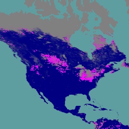
VNP46A1: VIIRS Daily Gridded Day Night Band 500m Linear Lat Lon Grid Night
The Suomi National Polar-orbiting Partnership (SNPP) Visible Infrared Imaging Radiometer Suite (VIIRS) supports a Day-Night Band (DNB) sensor that provides global daily measurements of nocturnal visible and near-infrared (NIR) light that are suitable for Earth system science and applications. The VIIRS DNB's ultra-sensitivity in lowlight … daily dnb nasa noaa population viirs -
VNP46A2: VIIRS Lunar Gap-Filled BRDF Nighttime Lights Daily L3 Global 500m
The Suomi National Polar-orbiting Partnership (SNPP) Visible Infrared Imaging Radiometer Suite (VIIRS) supports a Day-Night Band (DNB) sensor that provides global daily measurements of nocturnal visible and near-infrared(NIR) light that are suitable for Earth system science and applications. The VIIRS DNB's ultra-sensitivity in lowlight conditions … brdf daily nasa nighttime noaa population -
VNP64A1.002: Burned Area Monthly L4 Global 500m SIN Grid
The daily Suomi National Polar-Orbiting Partnership (Suomi NPP) NASA Visible Infrared Imaging Radiometer Suite (VIIRS) Burned Area (VNP64A1) Version 2 data product is a monthly, global gridded 500m product containing per-pixel burned area and quality information. The VNP64 burned area mapping approach employs 750m VIIRS … burn change-detection fire land nasa surface