
Tính năng định kiểu dựa trên dữ liệu cho tập dữ liệu cho phép bạn tải tập dữ liệu không gian địa lý của riêng mình lên, áp dụng kiểu tuỳ chỉnh cho các đặc điểm dữ liệu của tập dữ liệu đó và hiển thị các đặc điểm dữ liệu đó trên bản đồ. Với tính năng định kiểu dựa trên dữ liệu cho tập dữ liệu, bạn có thể tạo hình ảnh trực quan hoá dữ liệu dựa trên hình học điểm, hình nhiều đường và đa giác, đồng thời làm cho các đặc điểm dữ liệu phản hồi các sự kiện nhấp chuột. Tính năng định kiểu dựa trên dữ liệu cho tập dữ liệu chỉ được hỗ trợ trên bản đồ vectơ (cần có mã bản đồ).
Bắt đầu sử dụng tính năng định kiểu dựa trên dữ liệu cho tập dữ liệu
Thêm tập dữ liệu không gian địa lý tuỳ chỉnh
Thêm dữ liệu tuỳ chỉnh bằng Google Cloud Console hoặc Google Cloud Shell. Mỗi tập dữ liệu có một mã nhận dạng riêng. Bạn có thể liên kết mã này với một kiểu bản đồ. Các định dạng dữ liệu sau đây được hỗ trợ:
- GeoJSON
- Phân tách bằng dấu phẩy (CSV)
- KML
Để biết thông tin chi tiết về các yêu cầu và giới hạn của tập dữ liệu, hãy xem Tạo và quản lý tập dữ liệu
Giới thiệu về tập dữ liệu công khai
Để tạo kiểu cho một tập dữ liệu, bạn phải liên kết một kiểu bản đồ với một mã bản đồ. Việc này cũng liên kết tập dữ liệu với mã bản đồ. Trong một ứng dụng, nhà phát triển có thể tham chiếu đến mã bản đồ đó và mọi kiểu bản đồ cũng như dữ liệu không gian địa lý được liên kết với mã đó. Không có quyền kiểm soát quyền truy cập bổ sung nào được áp dụng cho dữ liệu không gian địa lý, khiến dữ liệu không gian địa lý có hiệu lực công khai cho bất kỳ ai có ứng dụng.
Tạo kiểu cho các đặc điểm dữ liệu
Sau khi tải dữ liệu tuỳ chỉnh lên và liên kết với một kiểu bản đồ và mã bản đồ, bạn có thể tạo kiểu cho các đặc điểm dữ liệu để tạo hiệu ứng trực quan và làm cho các đặc điểm phản hồi các sự kiện nhấp.
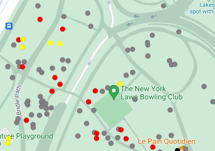
Tạo kiểu cho dữ liệu điểm để hiển thị các vị trí cụ thể trên bản đồ.
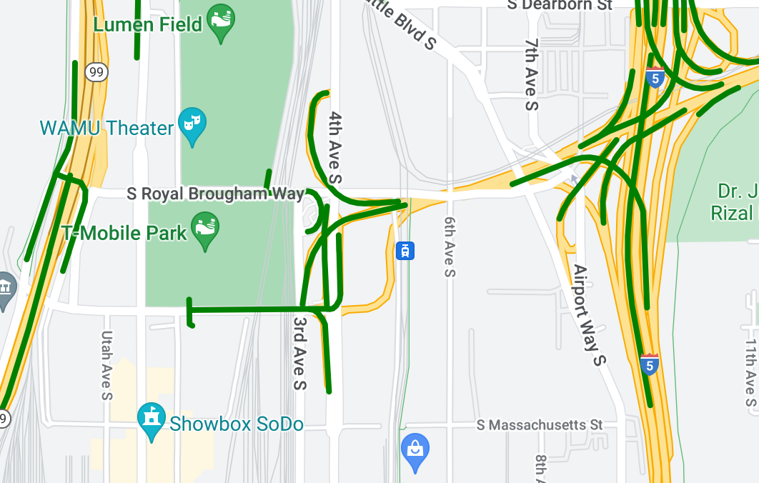
Định kiểu dữ liệu đường gấp khúc để làm nổi bật các đặc điểm địa lý.
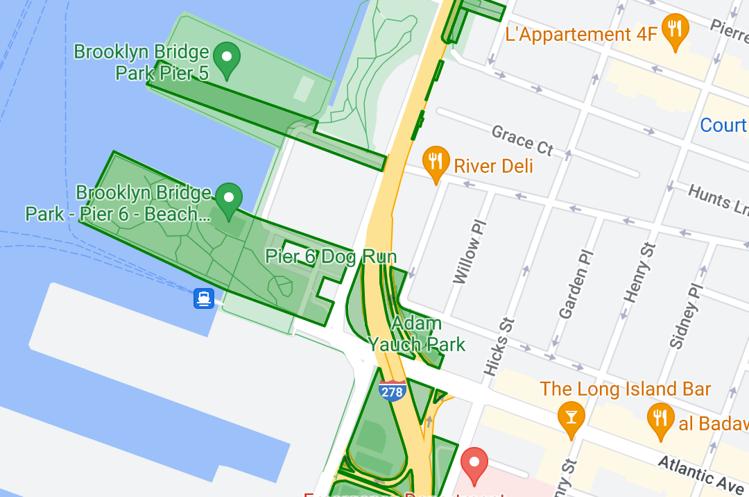
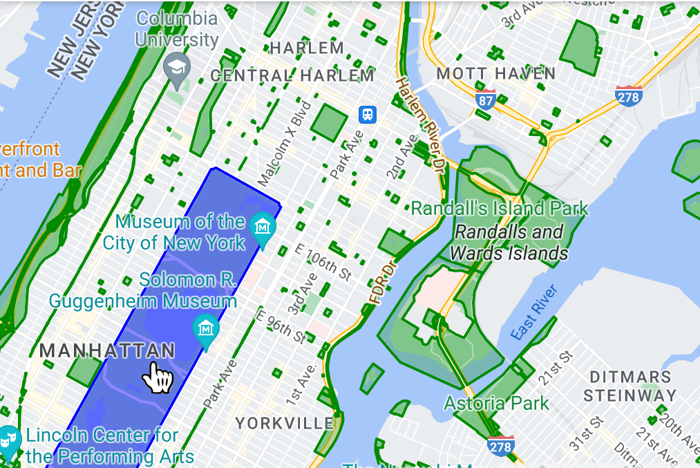
Tạo kiểu cho dữ liệu đa giác để làm nổi bật các khu vực địa lý.
Làm cho các đặc điểm dữ liệu phản hồi các sự kiện nhấp bằng cách thêm trình nghe sự kiện.
Hiệu suất khi kết xuất một số lượng lớn đặc điểm dữ liệu
Khi kết xuất một số lượng lớn đặc điểm dữ liệu, bạn có thể nhận thấy các vấn đề về hiệu suất trong ứng dụng của mình. Ví dụ: bạn có thể nhận thấy độ trễ về hiệu suất hoặc các vấn đề về độ ổn định với ứng dụng trong khi thu phóng hoặc xoay.