Change the style of buildings
Stay organized with collections
Save and categorize content based on your preferences.
Page Summary
Cloud-based maps styling requires the latest renderer for the Maps SDK for Android and is supported across Android, iOS, Maps JavaScript API, and Maps Static.
Buildings on vector maps automatically display in 3D at zoom level 17 and higher, but can be customized to a 2D "Footprints" style.
Users can adjust fill and stroke colors for "Footprints" style buildings, while 3D buildings only support fill color customization.
The building style can be changed in the Style Editor under the "Buildings" feature type within "Landscape, Human-made".
When you use a vector map in Android, iOS, or JavaScript,
buildings use the 3D style beginning at zoom level 17 and higher by
default. If you want to display only the 2D
outlines of buildings for a cleaner appearance, select the Footprints style.
Set the building style
Zoom in on the map enough to see buildings shown.
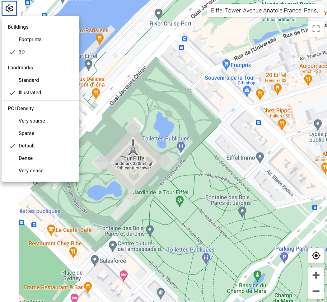
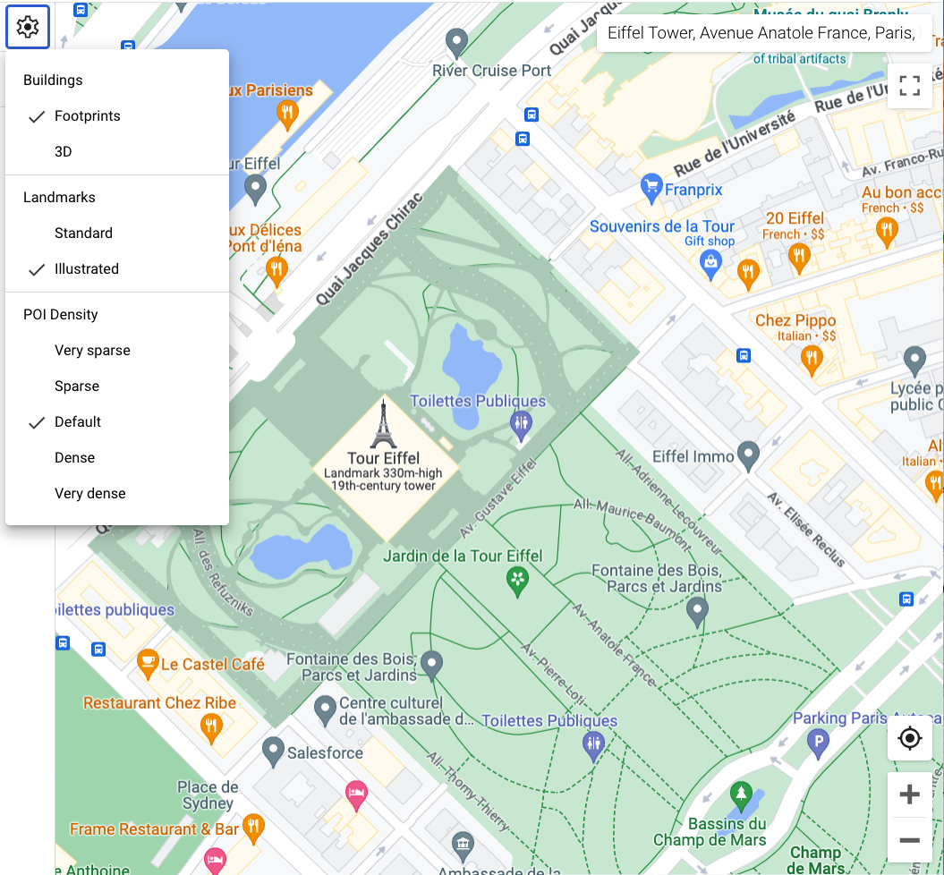
In the Map features panel, select the settings
gear icon to open the Map Settings menu.
To display buildings with a 3D outline, select 3D:
To display buildings with a 2D footprint, select Footprints:
[[["Easy to understand","easyToUnderstand","thumb-up"],["Solved my problem","solvedMyProblem","thumb-up"],["Other","otherUp","thumb-up"]],[["Missing the information I need","missingTheInformationINeed","thumb-down"],["Too complicated / too many steps","tooComplicatedTooManySteps","thumb-down"],["Out of date","outOfDate","thumb-down"],["Samples / code issue","samplesCodeIssue","thumb-down"],["Other","otherDown","thumb-down"]],["Last updated 2026-07-15 UTC."],[],[]]