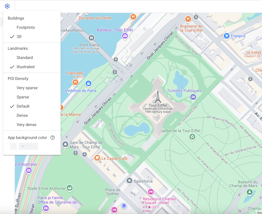
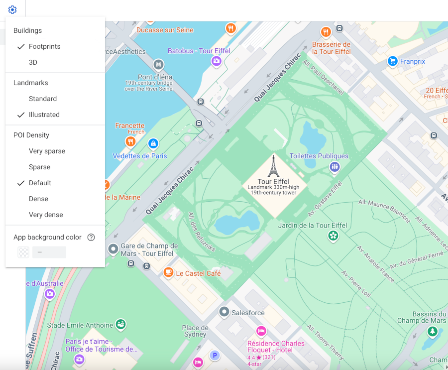
כשמשתמשים במפה וקטורית ב-Android, ב-iOS או ב-JavaScript, כברירת מחדל, בניינים מוצגים בסגנון תלת-ממדי החל מרמת זום 17 ומעלה. אם רוצים להציג רק את קווי המתאר הדו-ממדיים של הבניינים כדי שהמפה תיראה נקייה יותר, בוחרים בסגנון שטחי מבנים.
הגדרת סגנון המבנה
מגדילים את התצוגה במפה עד שרואים את המבנים.
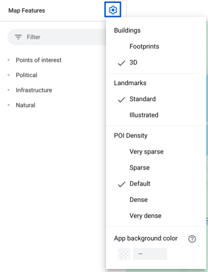
בחלונית תכונות המפה, לוחצים על סמל גלגל השיניים settings כדי לפתוח את התפריט הגדרות המפה.
כדי להציג מבנים עם קווי מתאר תלת-ממדיים, בוחרים באפשרות תלת-ממד:
כדי להציג מבנים עם סימון שטח דו-ממדי, בוחרים באפשרות סימוני שטח:
[[["התוכן קל להבנה","easyToUnderstand","thumb-up"],["התוכן עזר לי לפתור בעיה","solvedMyProblem","thumb-up"],["סיבה אחרת","otherUp","thumb-up"]],[["חסרים לי מידע או פרטים","missingTheInformationINeed","thumb-down"],["התוכן מורכב מדי או עם יותר מדי שלבים","tooComplicatedTooManySteps","thumb-down"],["התוכן לא עדכני","outOfDate","thumb-down"],["בעיה בתרגום","translationIssue","thumb-down"],["בעיה בדוגמאות/בקוד","samplesCodeIssue","thumb-down"],["סיבה אחרת","otherDown","thumb-down"]],["עדכון אחרון: 2026-10-16 (שעון UTC)."],[],["Vector maps on Android, iOS, and JavaScript offer two building styles: 3D and Footprints. 3D style, enabled by default at zoom level 17 and higher, displays buildings with a 3D outline; stroke customization is unavailable. Footprints style shows 2D building outlines. To change the style, access the Style Editor, select the \"Buildings\" feature under \"Landscape, Human-made,\" and choose either 3D or Footprints. Color customizations for fill and stroke are available for both types, excluding stroke for the 3D style.\n"]]