概要
コレクションでコンテンツを整理
必要に応じて、コンテンツの保存と分類を行います。
データセット用データドリブン スタイル設定を利用すれば、独自の地理空間データセットをアップロードし、データセットに含まれるデータ対象物にカスタム スタイルを適用して地図上に表示することができます。また、ポイント、ポリライン、およびポリゴンのジオメトリをもとにデータ可視化要素を作成し、データ対象物をクリック イベントに反応させることも可能です。データセット用データドリブン スタイル設定は、ベクターマップ専用の機能です(マップ ID が必要となります)。
データセット用データドリブン スタイル設定の利用を始める
カスタム地理空間データセットを追加する
Google Cloud コンソールまたは Google Cloud Shell を使って、カスタムデータを追加します。各データセットには固有の ID があり、この ID を地図のスタイルと関連付けることができます。サポートされるデータ形式は次のとおりです。
データセットの要件と制限事項の詳細については、データセットを作成・管理するをご覧ください。
データ対象物をスタイル設定する
カスタムデータをアップロードして地図スタイルとマップ ID に関連付けたら、データ対象物をスタイル設定して、視覚的インパクトを高め、対象物をクリック イベントに反応させることができます。
ポイントデータをスタイル設定して個々のスポットを地図上に表示させる
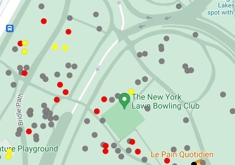
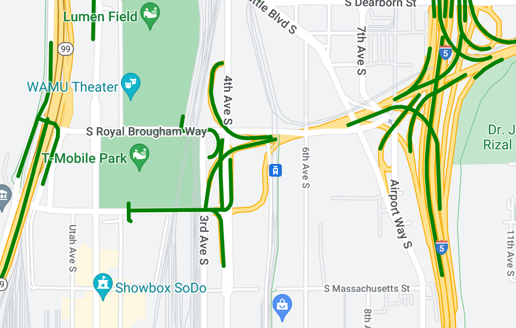
ポリライン データをスタイル設定して地理的な対象物をハイライトする
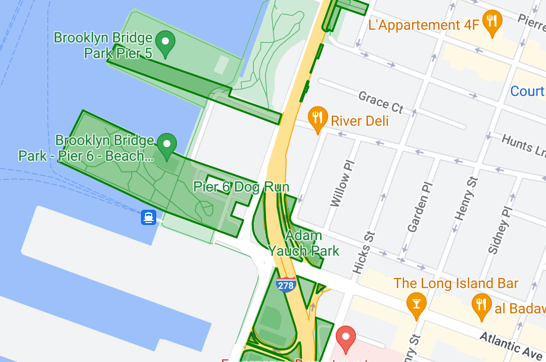
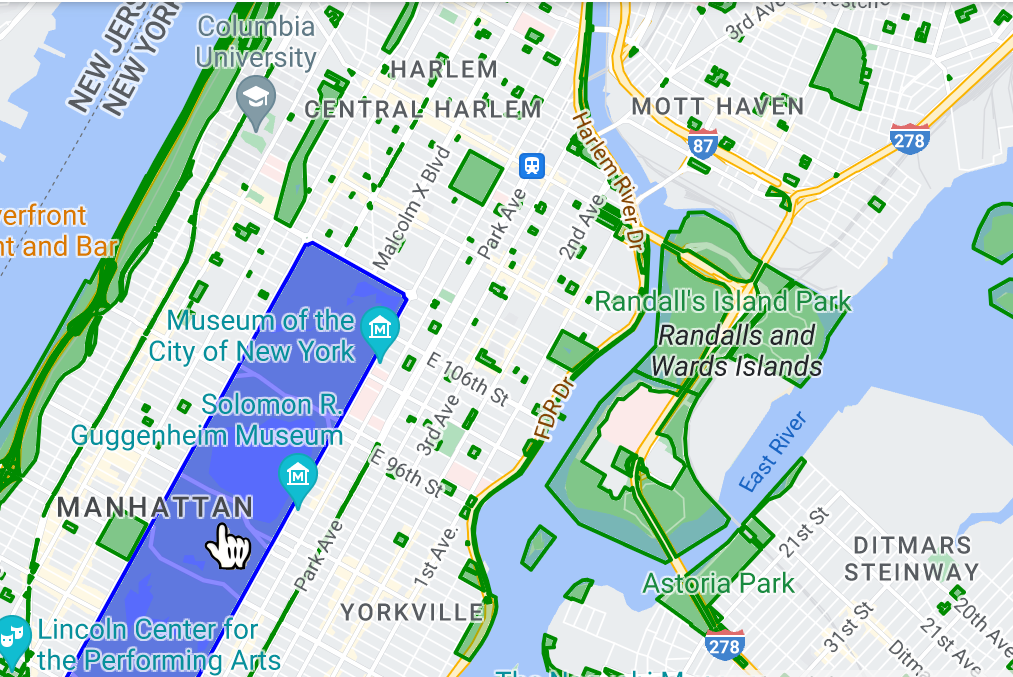
ポリゴンデータをスタイル設定して地理的な領域をハイライトする
イベント リスナーを追加してデータ対象物をクリック イベントに反応させる
特に記載のない限り、このページのコンテンツはクリエイティブ・コモンズの表示 4.0 ライセンスにより使用許諾されます。コードサンプルは Apache 2.0 ライセンスにより使用許諾されます。詳しくは、Google Developers サイトのポリシーをご覧ください。Java は Oracle および関連会社の登録商標です。
最終更新日 2025-11-02 UTC。
[[["わかりやすい","easyToUnderstand","thumb-up"],["問題の解決に役立った","solvedMyProblem","thumb-up"],["その他","otherUp","thumb-up"]],[["必要な情報がない","missingTheInformationINeed","thumb-down"],["複雑すぎる / 手順が多すぎる","tooComplicatedTooManySteps","thumb-down"],["最新ではない","outOfDate","thumb-down"],["翻訳に関する問題","translationIssue","thumb-down"],["サンプル / コードに問題がある","samplesCodeIssue","thumb-down"],["その他","otherDown","thumb-down"]],["最終更新日 2025-11-02 UTC。"],[],[]]