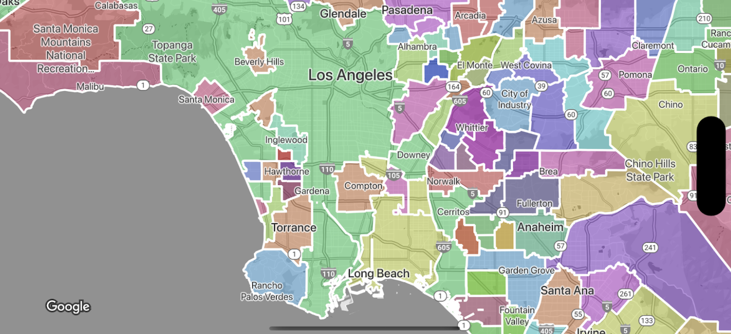
การจัดรูปแบบตามข้อมูลสำหรับขอบเขตช่วยให้คุณเข้าถึงรูปหลายเหลี่ยมของ Google สำหรับ ขอบเขตการบริหาร ใช้การจัดรูปแบบกับรูปหลายเหลี่ยมของขอบเขต และแสดงรูปหลายเหลี่ยมเหล่านั้นบน แผนที่ของคุณได้

การจัดรูปแบบตามข้อมูลสำหรับขอบเขตช่วยให้คุณกำหนดเป้าหมายภูมิภาคตามรหัสสถานที่ และใช้ การจัดรูปแบบที่กำหนดเองกับรูปหลายเหลี่ยมของขอบเขตบนแผนที่ได้ ฟีเจอร์แต่ละประเภทแสดงถึง ประเภทภูมิภาค คุณเลือกได้ว่าจะเปิดใช้ฟีเจอร์ประเภทใดเมื่อกำหนดค่ารูปแบบแผนที่ ดูขอบเขตที่ Google ครอบคลุมเพื่อดูขอบเขตที่ครอบคลุมในแต่ละประเทศ
ประเภทฟีเจอร์
การจัดรูปแบบตามข้อมูลช่วยให้เข้าถึงขอบเขตของ Google สำหรับประเภทฟีเจอร์ที่ แสดงพื้นที่การบริหาร พื้นที่การบริหารจะจัดหมวดหมู่ตาม ฟังก์ชัน เช่น ประเทศ รัฐ ท้องถิ่น และรหัสไปรษณีย์ ประเภทฟีเจอร์ จะจัดเรียงตามระดับการบริหาร ซึ่งโครงสร้างจะแตกต่างกันไปในแต่ละประเทศ ซึ่งได้แก่
GMSFeatureTypeCountry- หน่วยงานทางการเมืองระดับประเทศ ซึ่งโดยปกติจะเป็นประเภทคำสั่งซื้อระดับสูงสุดGMSFeatureTypeAdministrativeAreaLevel1- หน่วยงานพลเรือนระดับที่ 1 ที่ต่ำกว่าระดับประเทศ ในสหรัฐอเมริกา ระดับการบริหารเหล่านี้คือรัฐGMSFeatureTypeAdministrativeAreaLevel2— หน่วยงานพลเรือนระดับที่ 2 ที่ต่ำกว่าระดับประเทศ ในสหรัฐอเมริกา ระดับการบริหารเหล่านี้คือเทศมณฑลGMSFeatureTypeLocality— หน่วยงานทางการเมืองของเมืองหรือเทศบาลที่จดทะเบียนGMSFeatureTypePostalCode— รหัสไปรษณีย์ที่ใช้ในการส่งจดหมายภายในประเทศGMSFeatureTypeSchoolDistrict— เขตการศึกษา รวมถึงเขตการศึกษาแบบรวม เขตการศึกษาประถมศึกษา และเขตการศึกษามัธยมศึกษา
พื้นที่การปกครองจะแสดงบนแผนที่เป็นเลเยอร์ฟีเจอร์ โดยแต่ละประเภทจะมีเลเยอร์ของตัวเอง เปิดใช้เลเยอร์ฟีเจอร์ต่อรูปแบบแผนที่ คุณเลือกเลเยอร์ฟีเจอร์ที่จะเปิดใช้ได้เมื่อตั้งค่ารูปแบบแผนที่ใน Google Cloud Console
กำหนดรูปแบบรูปหลายเหลี่ยมขอบเขต
คุณสามารถใช้รูปแบบกับรูปหลายเหลี่ยมขอบเขตสำหรับการเติม (สี ความทึบแสง) และเส้นขอบ (สี ความทึบแสง น้ำหนักของเส้นขอบ) ใช้การจัดรูปแบบเพื่อทำสิ่งต่อไปนี้
- จัดรูปแบบรูปหลายเหลี่ยมขอบเขตหรือแสดงขอบเขตทั้งหมดสำหรับประเภทฟีเจอร์
- สร้างแผนที่โคโรเพลท
ความครอบคลุมของขอบเขตของ Google แสดงความพร้อมให้บริการของฟีเจอร์ ประเภทต่างๆ ในแต่ละประเทศ
