Page Summary
-
Vector to raster conversion in Earth Engine is performed using the
featureCollection.reduceToImage()method. -
This method assigns pixel values based on a specified property of the features.
-
An example is provided demonstrating how to create an image of county land area using the
TIGER/2018/Countiesdata andreduceToImage(). -
When using
reduceToImage(), a reducer should be specified to handle potential overlaps in features.
Vector to raster conversion in Earth Engine is handled by the
featureCollection.reduceToImage() method. This method assigns pixels under
each feature the value of the specified property. This example uses the counties data
to create an image representing the land area of each county:
Code Editor (JavaScript)
// Load a collection of US counties.
var counties = ee.FeatureCollection('TIGER/2018/Counties');

// Make an image out of the land area attribute.
var landAreaImg = counties
  .filter(ee.Filter.notNull(['ALAND']))
  .reduceToImage({
    properties: ['ALAND'],
    reducer: ee.Reducer.first()
});

// Display the county land area image.
Map.setCenter(-99.976, 40.38, 5);
Map.addLayer(landAreaImg, {
  min: 3e8,
  max: 1.5e10,
  palette: ['FCFDBF', 'FDAE78', 'EE605E', 'B63679', '711F81', '2C105C']
});
import ee
import geemap.core as geemap
Colab (Python)
# Load a collection of US counties.
counties = ee.FeatureCollection('TIGER/2018/Counties')

# Make an image out of the land area attribute.
land_area_img = counties.filter(ee.Filter.notNull(['ALAND'])).reduceToImage(
    properties=['ALAND'], reducer=ee.Reducer.first()
)

# Display the county land area image.
m = geemap.Map()
m.set_center(-99.976, 40.38, 5)
m.add_layer(
    land_area_img,
    {
        'min': 3e8,
        'max': 1.5e10,
        'palette': ['FCFDBF', 'FDAE78', 'EE605E', 'B63679', '711F81', '2C105C'],
    },
)
m
Specify a reducer to indicate how to aggregate properties of
overlapping features. In the previous example, since there is no overlap, an
ee.Reducer.first() is sufficient. As in this
example, pre-filter the data to eliminate nulls that can not be turned into an image.
The output should look something like Figure 1, which maps a color gradient to
county size. Like all image-outputting reducers in Earth Engine, the
scale is dynamically set by the output. In this case, the scale corresponds to the
zoom level in the Code Editor.
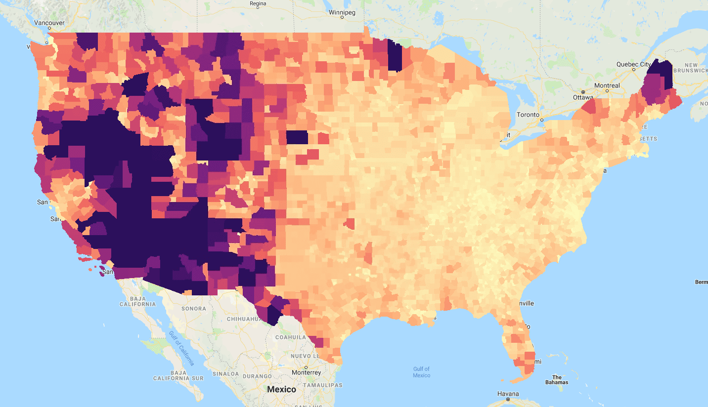
reduceToImage() using the ‘ALAND’ (land area)
property of the 'TIGER/2018/Counties' FeatureCollection.