
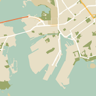
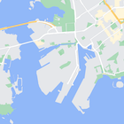
Oltre a modificare lo stile delle funzionalità sulla mappa, puoi anche nasconderle completamente. Questo esempio mostra come nascondere i punti di interesse delle attività e le icone del trasporto pubblico sulla mappa.
Lo stile funziona solo con il tipo di mappa normal. L'applicazione di stili non influisce sulle
mappe interne, pertanto l'utilizzo di stili per nascondere elementi non impedisce
la visualizzazione delle planimetrie interne sulla mappa.
Passare un oggetto di stile JSON alla mappa
Per applicare uno stile alla mappa, chiama GoogleMap.setMapStyle() passando un oggetto MapStyleOptions che contiene le dichiarazioni di stile in formato JSON. Puoi caricare il JSON da una risorsa non elaborata o da una stringa, come mostrato negli esempi seguenti:
Risorsa non elaborata
Il seguente esempio di codice presuppone che il tuo progetto contenga una risorsa non elaborata denominata
style_json:
// Copyright 2020 Google LLC
//
// Licensed under the Apache License, Version 2.0 (the "License");
// you may not use this file except in compliance with the License.
// You may obtain a copy of the License at
//
//      http://www.apache.org/licenses/LICENSE-2.0
//
// Unless required by applicable law or agreed to in writing, software
// distributed under the License is distributed on an "AS IS" BASIS,
// WITHOUT WARRANTIES OR CONDITIONS OF ANY KIND, either express or implied.
// See the License for the specific language governing permissions and
// limitations under the License.

package com.example.styledmap;

import android.content.res.Resources;
import android.os.Bundle;
import android.util.Log;
import androidx.appcompat.app.AppCompatActivity;

import com.google.android.gms.maps.CameraUpdateFactory;
import com.google.android.gms.maps.GoogleMap;
import com.google.android.gms.maps.OnMapReadyCallback;
import com.google.android.gms.maps.SupportMapFragment;
import com.google.android.gms.maps.model.LatLng;
import com.google.android.gms.maps.model.MapStyleOptions;

/**
 * A styled map using JSON styles from a raw resource.
 */
public class MapsActivityRaw extends AppCompatActivity
        implements OnMapReadyCallback {

    private static final String TAG = MapsActivityRaw.class.getSimpleName();

    @Override
    protected void onCreate(Bundle savedInstanceState) {
        super.onCreate(savedInstanceState);
        // Retrieve the content view that renders the map.
        setContentView(R.layout.activity_maps_raw);

        // Get the SupportMapFragment and register for the callback
        // when the map is ready for use.
        SupportMapFragment mapFragment =
                (SupportMapFragment) getSupportFragmentManager()
                        .findFragmentById(R.id.map);
        mapFragment.getMapAsync(this);
    }

    /**
     * Manipulates the map when it's available.
     * The API invokes this callback when the map is ready for use.
     */
    @Override
    public void onMapReady(GoogleMap googleMap) {

        try {
            // Customise the styling of the base map using a JSON object defined
            // in a raw resource file.
            boolean success = googleMap.setMapStyle(
                    MapStyleOptions.loadRawResourceStyle(
                            this, R.raw.style_json));

            if (!success) {
                Log.e(TAG, "Style parsing failed.");
            }
        } catch (Resources.NotFoundException e) {
            Log.e(TAG, "Can't find style. Error: ", e);
        }
        // Position the map's camera near Sydney, Australia.
        googleMap.moveCamera(CameraUpdateFactory.newLatLng(new LatLng(-34, 151)));
    }
}
Definisci una risorsa non elaborata in /res/raw/style_json.json, contenente
la seguente dichiarazione di stile JSON per nascondere i punti di interesse
(POI) delle attività:
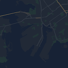
La seguente dichiarazione di stile nasconde i punti di interesse (PDI) delle attività e le icone del trasporto pubblico:
Il layout (activity_maps.xml) ha il seguente aspetto:
Risorsa stringa
Il seguente esempio di codice presuppone che il progetto contenga una risorsa stringa
denominata style_json:
package com.example.styledmap;

import android.os.Bundle;
import android.support.v7.app.AppCompatActivity;
import android.util.Log;

import com.google.android.gms.maps.CameraUpdateFactory;
import com.google.android.gms.maps.GoogleMap;
import com.google.android.gms.maps.OnMapReadyCallback;
import com.google.android.gms.maps.SupportMapFragment;
import com.google.android.gms.maps.model.LatLng;
import com.google.android.gms.maps.model.MapStyleOptions;

/**
 * A styled map using JSON styles from a string resource.
 */
public class MapsActivityString extends AppCompatActivity
        implements OnMapReadyCallback {

    private static final String TAG = MapsActivityString.class.getSimpleName();

    @Override
    protected void onCreate(Bundle savedInstanceState) {
        super.onCreate(savedInstanceState);
        // Retrieve the content view that renders the map.
        setContentView(R.layout.activity_maps_string);

        // Get the SupportMapFragment and register for the callback
        // when the map is ready for use.
        SupportMapFragment mapFragment =
                (SupportMapFragment) getSupportFragmentManager()
                        .findFragmentById(R.id.map);
        mapFragment.getMapAsync(this);
    }

    /**
     * Manipulates the map when it's available.
     * The API invokes this callback when the map is ready for use.
     */
    @Override
    public void onMapReady(GoogleMap googleMap) {

        // Customise the styling of the base map using a JSON object defined
        // in a string resource file. First create a MapStyleOptions object
        // from the JSON styles string, then pass this to the setMapStyle
        // method of the GoogleMap object.
        boolean success = googleMap.setMapStyle(new MapStyleOptions(getResources()
                .getString(R.string.style_json)));

        if (!success) {
            Log.e(TAG, "Style parsing failed.");
        }
        // Position the map's camera near Sydney, Australia.
        googleMap.moveCamera(CameraUpdateFactory.newLatLng(new LatLng(-34, 151)));
    }
}
Definisci una risorsa stringa in /res/values/style_strings.xml,
contenente la seguente dichiarazione di stile JSON per nascondere i punti di interesse (POI) delle attività. In questo file devi utilizzare una barra rovesciata per eseguire l'escape delle
virgolette:
La seguente dichiarazione di stile nasconde i punti di interesse (PDI) delle attività e le icone del trasporto pubblico:
Il layout (activity_maps.xml) ha il seguente aspetto:
Dichiarazioni di stile JSON
Le mappe con stili utilizzano due concetti per applicare colori e altre modifiche di stile a una mappa:
- I selettori specificano i componenti geografici a cui puoi applicare uno stile sulla mappa. Questi includono strade, parchi, specchi d'acqua e
altro ancora, nonché le relative etichette. I selettori includono funzionalità
ed elementi, specificati come proprietà
featureTypeeelementType. - Gli stili sono proprietà di colore e visibilità che puoi applicare agli elementi della mappa. Definiscono il colore visualizzato tramite una combinazione di valori di tonalità, colore e luminosità/gamma.
Consulta il riferimento allo stile per una descrizione dettagliata delle opzioni di stile JSON.
Procedura guidata degli stili di Maps Platform


Utilizza la procedura guidata degli stili di Maps Platform come modo rapido per generare un oggetto di stile JSON. L'SDK Maps per Android supporta le stesse dichiarazioni di stile dell'API Maps JavaScript.
Esempi di codice completi
Il repository ApiDemos su GitHub include esempi che dimostrano l'utilizzo degli stili.