Page Summary
-
Streetscape Geometry APIs provide geometry of terrain, buildings, and structures obtained from Google Street View imagery for use in AR applications.
-
To utilize Streetscape Geometry, you must set up and enable both the Geospatial API and Streetscape Geometry mode in your project configuration.
-
You can obtain Streetscape Geometry data within an ARCore session by filtering trackables by
AR_TRACKABLE_STREETSCAPE_GEOMETRY. -
ArStreetscapeGeometryprovides details like the type of structure (terrain or building), its mesh, mesh pose, and quality level. -
You can attach AR content to
ArStreetscapeGeometryeither by enabling Geospatial Depth and using a depth hit-test or by creating an anchor attached to the specific geometry.
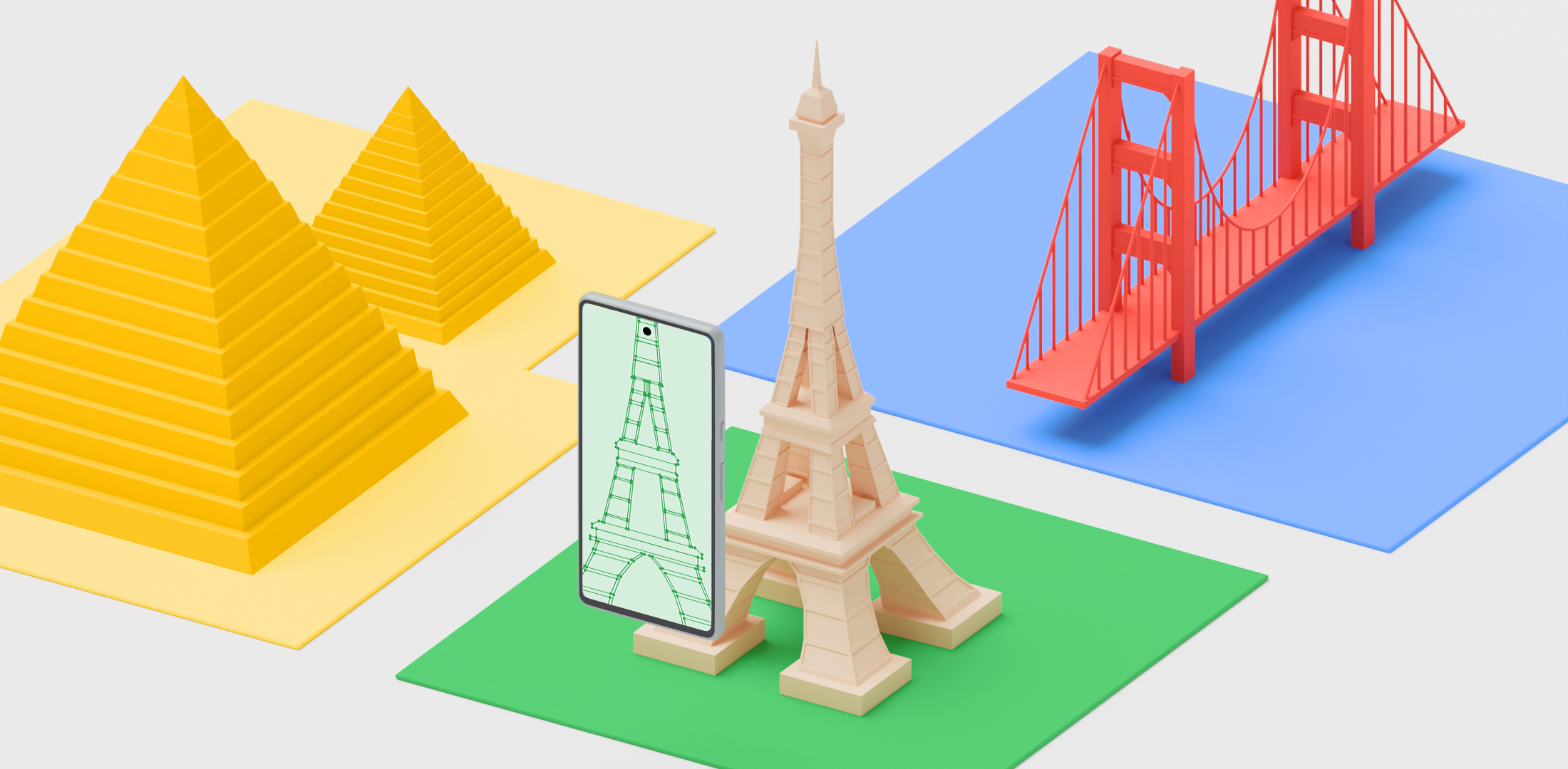
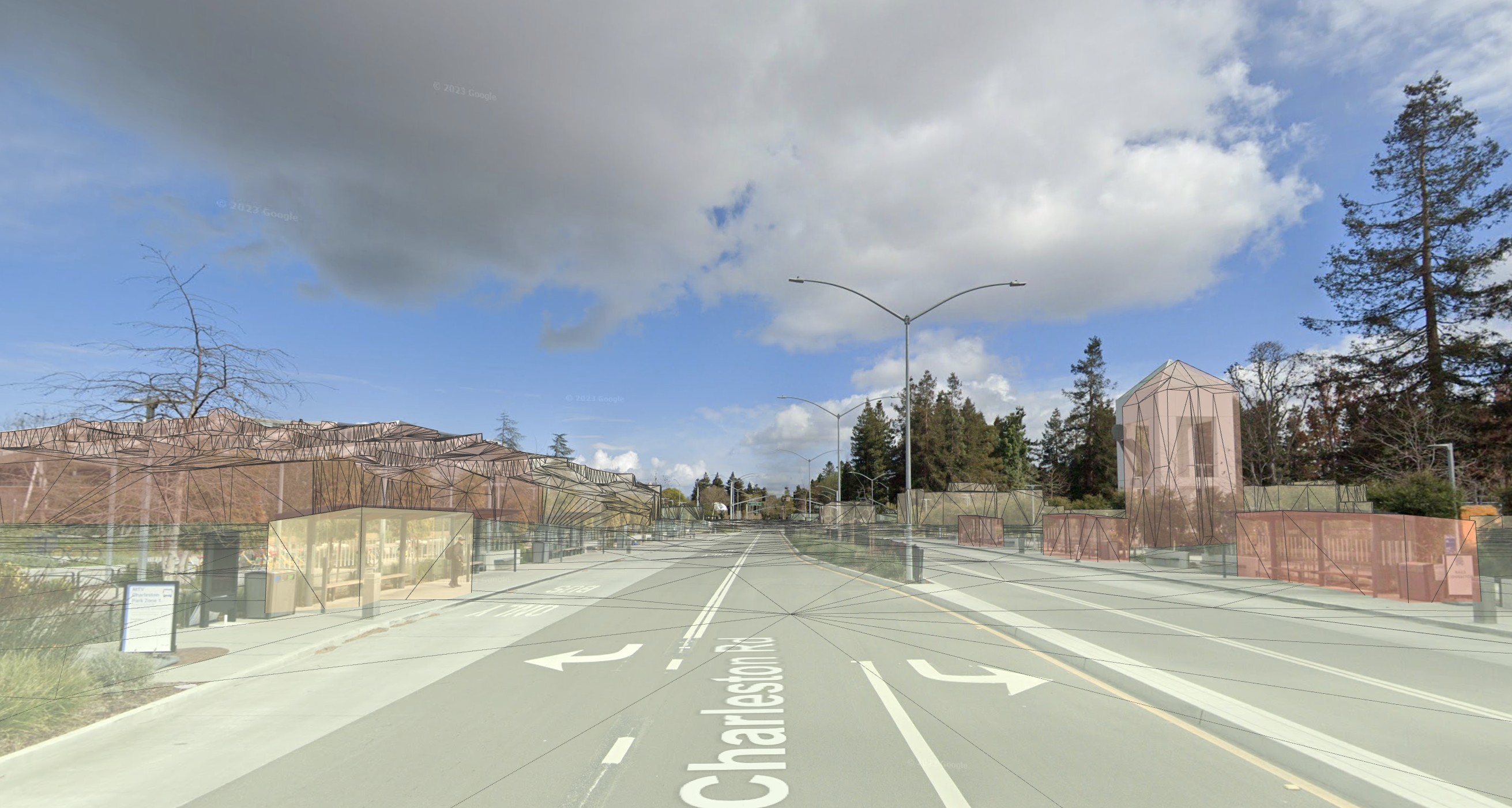
The Streetscape Geometry APIs provide the geometry of terrain, buildings, or other structures in a scene. The geometry can be used for occlusion, rendering, or placing AR content via hit-test APIs. Streetscape Geometry data is obtained through Google Street View imagery.
Set up the Geospatial API
To use Streetscape Geometry, you'll need to set up the Geospatial API in your project. Follow instructions on Enabling the Geospatial API to set up the Geospatial API.
Enable Streetscape Geometry
The Geospatial API obtains Streetscape Geometry data when the ArGeospatialMode is set to ArGeospatialModeEnabled and ArStreetscapeGeometryMode is set to ArStreetscapeGeometryModeEnabled.
// Create a session config.
ArConfig* ar_config = NULL;
ArConfig_create(ar_session, &ar_config);

// Enable the Geospatial API.
ArConfig_setGeospatialMode(ar_session, ar_config, AR_GEOSPATIAL_MODE_ENABLED);
CHECK(ArSession_configure(ar_session, ar_config) == AR_SUCCESS);

// Enable Streetscape Geometry.
ArConfig_setStreetscapeGeometryMode(ar_session, ar_config, AR_STREETSCAPE_GEOMETRY_MODE_ENABLED);
CHECK(ArSession_configure(ar_session, ar_config) == AR_SUCCESS);

// Release config resources.
ArConfig_destroy(ar_config);
Obtain Streetscape Geometry in an ARCore session
UseArSession_getAllTrackables() and use AR_TRACKABLE_STREETSCAPE_GEOMETRY to filter results.
ArTrackableList* trackable_list = NULL;
ArTrackableList_create(ar_session, &trackable_list);
ArSession_getAllTrackables(ar_session, AR_TRACKABLE_STREETSCAPE_GEOMETRY, trackable_list);
Understand ArStreetscapeGeometry
ArStreetscapeGeometry contains information about a building:
-
ArStreetscapeGeometry_getType()
Identifies the StreetscapeGeometry as either terrain or a building. -
ArStreetscapeGeometry_acquireMesh()
Obtain a polygonArMeshthat corresponds to this terrain or building. -
ArStreetscapeGeometry_getMeshPose()
Describes the origin of the geometry. All points in theArMeshshould be transformed byArStreetscapeGeometry_getMeshPose(). -
ArStreetscapeGeometry_getQuality()
Provides the quality of the mesh data. Levels of detail are described in the CityGML 2.0 standard.
Building LOD 1
AR_STREETSCAPE_GEOMETRY_QUALITY_BUILDING_LOD_1 consists of building footprints extruded upwards to a flat top. Building heights may be inaccurate.
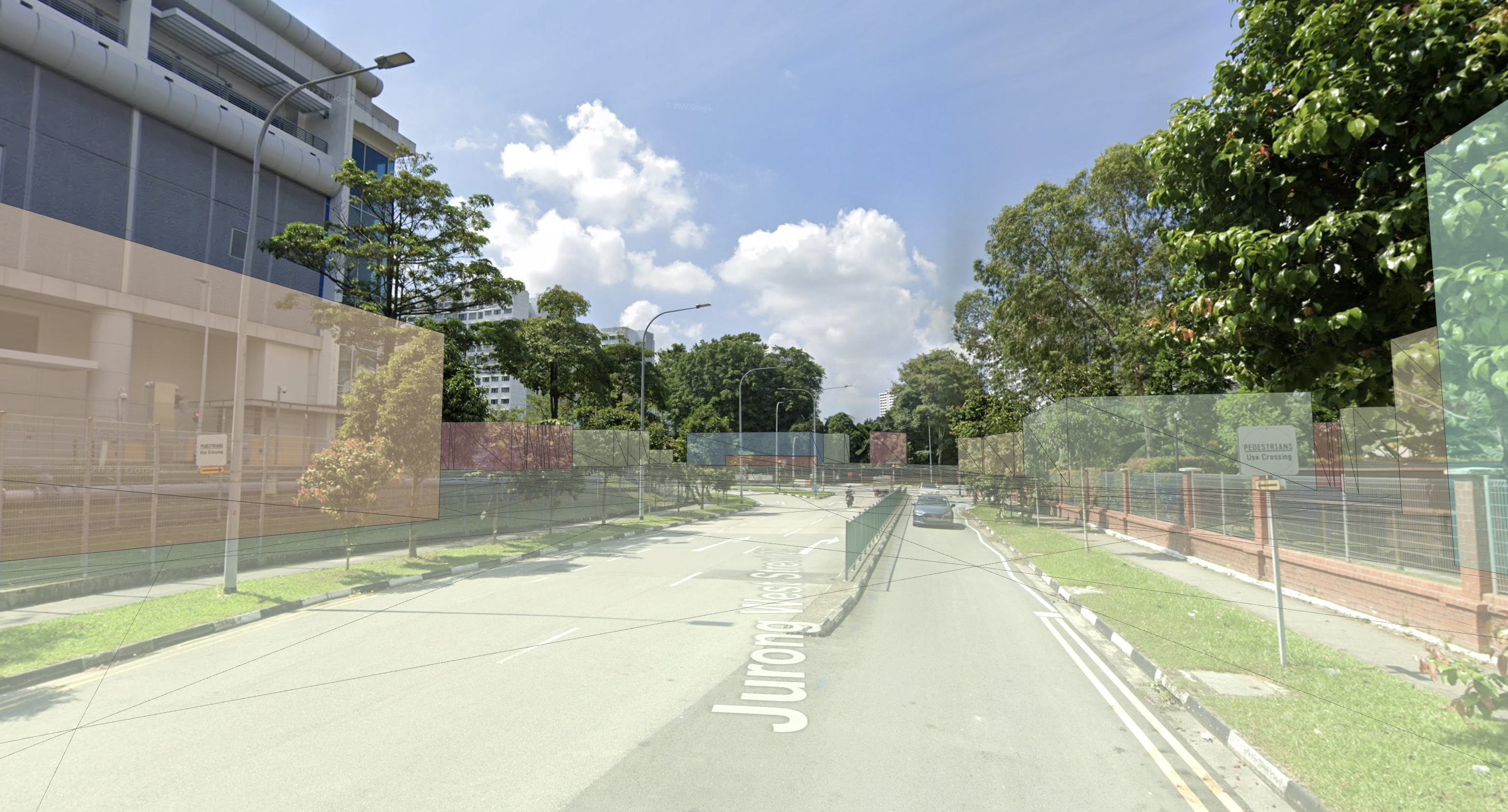
Building LOD 2
AR_STREETSCAPE_GEOMETRY_QUALITY_BUILDING_LOD_2 will have higher fidelity geometry. Mesh walls and roofs will more closely match the building's shape. Smaller features like chimneys or roof vents may still poke outside of the mesh.
Understand ArMesh
ArMesh is a polygon mesh representing a surface reconstruction of the Streetscape Geometry.
Each ArMesh includes a vertex buffer and index buffer:
ArMesh_getVertexListSize()
Retrieves the number of vertices in this mesh.ArMesh_getVertexList()
Obtain the concatenated positions of mesh vertices, in coordinates relative toArStreetscapeGeometry_getMeshPose().ArMesh_getIndexListSize()
Retrieves the number of indices in this mesh.ArMesh_getIndexList()
Obtain the indexes of vertices that make up a face.
Attach AR content to a ArStreetscapeGeometry
There are two ways to attach AR content to Streetscape Geometry:
- Enable Geospatial Depth and use a Depth hit-test. This is the recommended and easier method.
- Use
ArTrackable_acquireNewAnchor()to create an anchor at a given pose attached to aArStreetscapeGeometry. This anchor will inherit its tracking state from the parentArStreetscapeGeometry.
Perform a hit-test against ArStreetscapeGeometry
ArFrame_hitTest can be used to hit-test against Streetscape Geometry. If intersections are found, ArHitResult contains pose information about the hit location as well as a reference to the ArStreetscapeGeometry which was hit. This Streetscape Geometry can be passed to ArTrackable_acquireNewAnchor() to create an anchor attached to it.
ArHitResultList *hit_result_list = NULL;
ArHitResult *hit_result = NULL;
ArHitResultList_create(ar_session, &hit_result_list);
ArHitResult_create(ar_session, &hit_result);

ArFrame_hitTestRay(ar_session, ar_frame, origin, direction, hit_result_list);
ArHitResultList_getItem(ar_session, hit_result_list, 0, hit_result);

ArAnchor *out_anchor = NULL;
ArStatus status = ArHitResult_acquireNewAnchor(ar_session, hit_result, &out_anchor);
CHECK(status == AR_SUCCESS);
Enable Geospatial Depth
Geospatial Depth combines Streetscape Geometry with local sensor input to enhance depth data. When Geospatial Depth is enabled, the output depth and raw depth images are modified to include rasterized Streetscape Geometry in addition to locally observed depth. This may improve the accuracy of poses using Depth.