
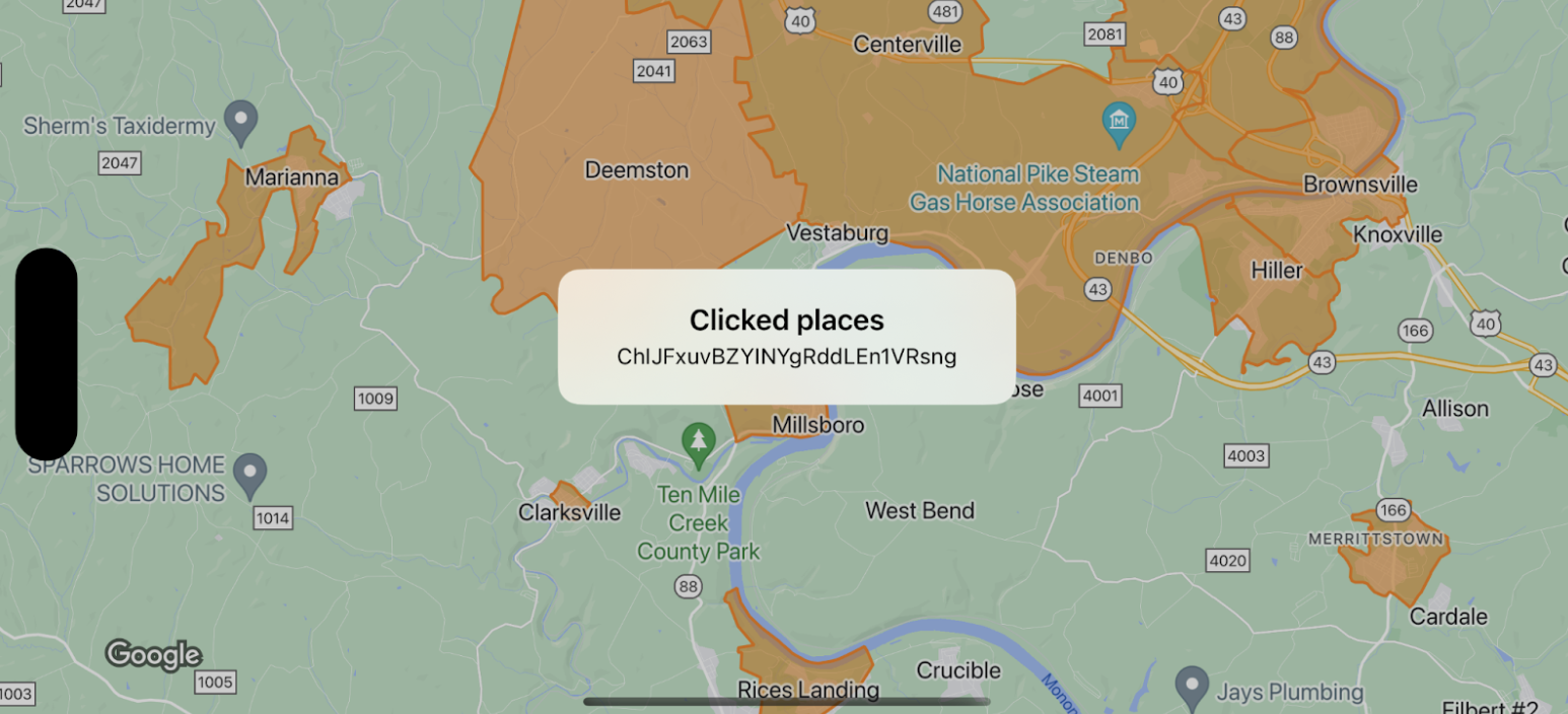
In diesem Beispiel sind Kartengrenzen für GMSFeatureTypeLocality zu sehen. Außerdem wird die Funktion delegate implementiert, mit der das angeklickte Polygon formatiert wird. Daraufhin wird ein Infofenster mit den Ereignisdaten angezeigt.
Swift
class SampleViewController: UIViewController {

  private lazy var mapView: GMSMapView = GMSMapView(frame: .zero, mapID: GMSMapID(identifier: "YOUR_MAP_ID"), camera: GMSCameraPosition(latitude: 40, longitude: -80, zoom: 12))

  override func loadView() {
    view = mapView
    let style = FeatureStyle(fill: .orange.withAlphaComponent(0.5), stroke: .orange, strokeWidth: 2)
    mapView.featureLayer(of: .locality).style = { _ in style }
    mapView.delegate = self
  }
}

extension SampleViewController: GMSMapViewDelegate {
  func mapView(_ mapView: GMSMapView, didTap features: [Feature], in featureLayer: FeatureLayer<Feature>, atLocation: CLLocationCoordinate2D) {
    let toast = UIAlertController(title: "Clicked places", message: (features.compactMap { ($0 as? PlaceFeature)?.placeID }).joined(separator: ", "), preferredStyle: .alert)
    present(toast, animated: true, completion: nil)
  }
}
Objective-C
@interface SampleViewController: UIViewController <GMSMapViewDelegate>
@end

@implementation SampleViewController
- (void)loadView {
    GMSMapView *mapView = [GMSMapView mapWithFrame:CGRectZero mapID:[GMSMapID mapIDWithIdentifier:@"YOUR_MAP_ID"] camera:[GMSCameraPosition cameraWithLatitude:40 longitude:-80 zoom:12]];
    mapView.delegete = self;

    GMSFeatureStyle *style = [GMSFeatureStyle styleWithFillColor:[[UIColor orangeColor] colorWithAlphaComponent:0.5] strokeColor:[UIColor orangeColor] strokeWidth:2.0];
    [mapView featureLayerOfFeatureType:GMSFeatureTypeLocality].style = ^(GMSPlaceFeature *feature) { return style; };

    self.view = mapView;
}

- (void)mapView:(GMSMapView *)mapView didTapFeatures:(NSArray<id<GMSFeature>> *)features inFeatureLayer:(GMSFeatureLayer *)featureLayer atLocation:(CLLocationCoordinate2D)location {
  NSMutableArray<NSString *> *places = [NSMutableArray array];

  for (id<GMSFeature> feature in features) {
    if (![feature isKindOfClass:[GMSPlaceFeature class]]) { continue; }
    NSString *placeID = ((GMSPlaceFeature *)feature).placeID;
    [places addObject:placeID];
  }

  UIAlertController *toast = [UIAlertController alertControllerWithTitle:@"Clicked places" message:[places componentsJoinedByString:@", "] preferredStyle:UIAlertControllerStyleAlert];
  [self presentViewController:toast animated:YES completion:nil];
}