
תכונות המפה שאפשר להתאים אישית מסודרות בהיררכיה, ולכל תכונת מפה יש רכיב סגנון אחד או יותר שאפשר להתאים אישית. לרוב התכונות ברמה העליונה יש תכונת מפה אחת או יותר מסוג צאצא. יש כמה אפשרויות להתאמה אישית של סגנונות המפה:
הורשה מסגנון המפה הבסיסית: אם לא מבצעים התאמה אישית של רכיב עיצובי של רכיב במפה, הסגנון שמוגדר כברירת מחדל מועבר ממפת הבסיס.
העברה בירושה מההורה: אפשר להתאים אישית רכיב עיצובי בתכונה של מפת הורה, כך שכל התכונות של מפת הצאצא שלא הותאמו אישית יקבלו בירושה את הסגנונות מההורה שלהן.
שינוי סגנון ההורה: כדי להתאים אישית רכיב עיצובי במפה צאצא, צריך לשנות את סגנון ההורה של רכיב זה.
התאמה אישית של רמות מרחק מתצוגה: בחלק מתכונות המפה, אפשר להתאים אישית את רכיבי הסגנון לרמות שונות של מרחק מהתצוגה. פרטים נוספים זמינים במאמר בנושא התאמה של רמות הזום של הסגנון.
מה אפשר לעצב בכל רכיב במפה
לרכיבי מפה יכולים להיות אחד או יותר מהאלמנטים הבאים של סגנון, שאפשר להתאים אישית בהתאם לסוג רכיב המפה:
חשיפה: האם להציג או להסתיר את התכונה הזו במפה.
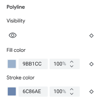
צבע מילוי: צבע המילוי של פוליגונים וקווי פוליגון.
צבע הקו: צבע קו המתאר של פוליגונים וקווי פוליגון.
רוחב הקו של האותיות: עובי המתאר של פוליגונים וקווי פוליגון. התוצאות עשויות להשתנות בהתאם לרמת הזום. אם לא רוצים קו מתאר, מגדירים את צבע הקו לאותו צבע של המילוי, או מגדירים את רוחב הקו ל-0.
צבע הסמל: צבע המילוי של סמלים שאינם סמלי נקודות עניין.
צבע קו המתאר של הסיכה: צבע קו המתאר של הסיכות של נקודות העניין.
צבע המילוי של הסיכה: צבע המילוי של הסיכות של נקודות העניין.
צבע הגליף של הסיכה: צבע הגליף של הסיכות של נקודות העניין.
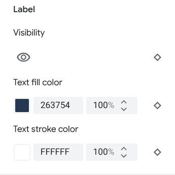
צבע מילוי הטקסט: צבע המילוי של תוויות הטקסט.
צבע קו הטקסט: צבע המתאר של תוויות הטקסט.
הגדרת הנראות של רכיבים במפה
כשמסתירים תכונות במפה או הופכים אותן לשקופות, יכול להיות שיוצגו אי דיוקים בגבולות. הגבולות של רכיבים במפה לא תמיד מדויקים, אבל הם מותאמים כך שייראו נכונים כשכל השכבות גלויות. כדי לקבל מידע נוסף על ההשפעה של שכבות מפה אחת על השנייה, אפשר לעיין במאמר בנושא ניהול סגנונות שחופפים.
יש שתי דרכים להציג או להסתיר תכונות במפה: נראות ואטימות.
חשיפה
כדי להציג או להסתיר רכיב במפה, משתמשים ברכיב העיצובי Visibility. פרטים נוספים מופיעים במאמר בנושא סינון הרכיבים במפה שיוצגו.
אטימות
אפשר גם להגדיר שרכיב במפה יהיה שקוף על ידי שינוי האטימות של רכיבי הסגנון הבאים: צבע המילוי, צבע הקו, צבע המילוי של הטקסט וצבע הקו של הטקסט.
כשמשנים את השקיפות של רכיב במפה, המראה שלו תלוי ברכיבי המפה שמתחתיו. כדי להימנע משינויי סגנון לא צפויים, צריך להגדיר סגנון מותאם אישית לכל התכונות החופפות.
פוליגונים וקווים פוליגוניים
לסוגים של רכיבים במפה שמיוצגים באמצעות צורה, כמו חוף, מדינה וכיכר העיר, או באמצעות קו, כמו מסילת רכבת, כביש מהיר ושביל, בדרך כלל אפשר לעצב את הרכיבים הבאים: נראות, צבע מילוי, צבע קו ורוחב קו.
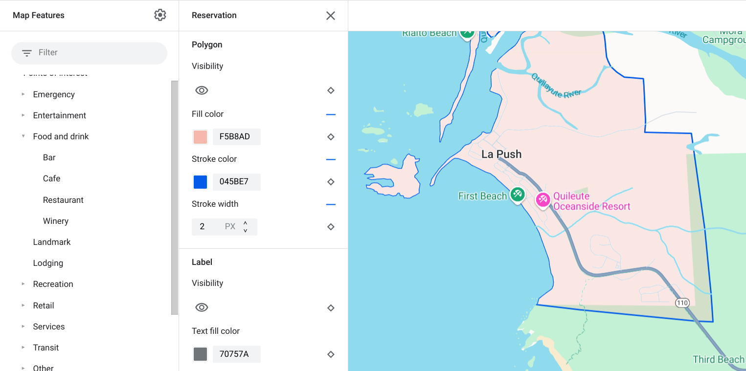
דוגמה להתאמה אישית של סגנון פוליגון – עבור סוג התכונה Reservation
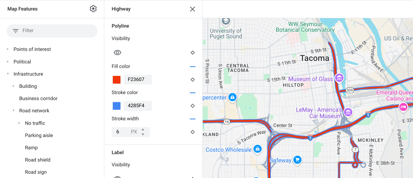
דוגמה להתאמה אישית של סגנון קו פוליגוני – עבור סוג הישות Highway
אי אפשר להתאים אישית את צבע הקו ואת רוחב הקו בתכונות המפה הבאות:
תכונות של מפה פוליטית: הסגנון שלהן מעביר משמעות במפה, כמו סוג השטח. הישויות במפה הפוליטית הן מדינה, גבול, מדינה או מחוז ויישוב משני.
בניינים בסגנון תלת-ממד.
סמלים ותוויות טקסט
עבור סוגי רכיבים במפה שמיוצגים באופן מלא או חלקי באמצעות תווית, כמו תחבורה וסוגים אחרים שאינם נקודות עניין, בדרך כלל אפשר לעצב את הרכיבים הבאים: חשיפה, צבע הסמל, צבע המילוי של הטקסט וצבע הקו של הטקסט.
![]()
דוגמה להתאמה אישית של סגנון הסמל וטקסט התווית
נעצים
אפשר לעצב את סוגי הרכיבים במפה נקודות עניין באמצעות הרכיבים הבאים: חשיפה, צבע קו המתאר של הסיכה, צבע המילוי של הסיכה, צבע הגליף של הסיכה, צבע המילוי של הטקסט וצבע קו המתאר של הטקסט.
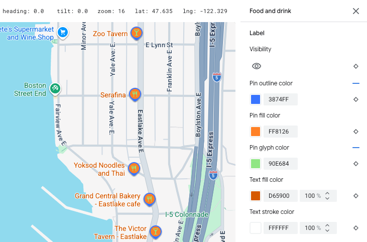
דוגמה להתאמה אישית של הסגנון של הסיכות והטקסט של התוויות
היררכיית הרכיבים במפה
בטבלאות האלה מוצגות התכונות של המפה ברמה העליונה, ומתחת לכל אחת מהן מוצגות התכונות של מפות הצאצא.
נקודת עניין |
||
|---|---|---|
| חירום | מכבי אש בית חולים בית מרקחת משטרה |
|
| בידור | אומנויות קזינו קולנוע היסטורי מוזיאון פארק שעשועים אטרקציה תיירותית |
|
| מזון ומשקאות | בר בית קפה מסעדה יקב |
|
| ציון דרך | ||
| לינה | ||
| נופש | חוף שיט דיג מסלול גולף מעיין חם שמורת טבע פארק פסגה מתחם ספורט מגרש ספורט נקודת התחלה של מסלול גן חיות |
|
| קמעונאות | קניות מוצרי מזון |
|
| שירות | כספומט בנק השכרת רכב טעינת רכב חשמלי תחנת דלק חניון דואר תחנת עצירה שירותים |
|
| תחבורה ציבורית | נמל תעופה | |
| אחר | גשר | |
| בית קברות | ||
| ממשל | ||
| ספרייה | ||
| צבא | ||
| בית תפילה | בודהיסט נוצרי הינדי מוסלמי ג'יין יהודי שינטו סיקי |
|
| בית ספר | ||
| כיכר העיר | ||
פוליטיקה |
|
|---|---|
| מדינה | |
| סקוטיש בורדרס | |
| הזמנה | |
| אזור | |
| עיר | |
| אזור משנה | |
| שכונה | |
| מגרש | |
תשתית |
|||
|---|---|---|---|
| * תכונות המפה עם פרטי הכבישים זמינות רק במוצרים של Google Maps Platform שבהם הופעלו פרטים ברמת הכביש. מידע נוסף זמין במאמר בנושא פרטים ברמת הכביש בפלטפורמה של Google Maps Platform. | |||
| מבנה | מסחרי בתוך מבנה |
||
| מסדרון עסקי | |||
| רשת דרכים | אין עומס תנועה | קניון של הולכי רגל | |
| שביל | סלול לא סלול |
||
| מקום חנייה | |||
| סוללה | |||
| תמרור מספר כביש | |||
| תמרור | |||
| כביש | עורק תחבורה כביש מהיר מקומי אין מוצא |
||
| פרטי הכביש* | Surface Crosswalk Sidewalk Intersection Direction arrow |
||
| מסילת רכבת | מסחרי נוסע |
||
| תחנה של תחבורה ציבורית | אופניים שיתופיים | ||
| תחנת אוטובוס | |||
| מסוף מעבורת | |||
| תחנת פוניקולר | |||
| תחנת רכבל | |||
| רכבת מונורייל | |||
| תחנת רכבת | תחנת רכבת תחתית תחנת חשמלית |
||
| אזור עירוני | |||
טבעי |
||
|---|---|---|
| † התכונות של מפת כיסוי הקרקע הן הערכות גסות שמבוססות על צבעים של צילומי לוויין, ויכול להיות שהן לא משקפות בצורה מדויקת את התנאים בעולם האמיתי. | ||
| יבשת | ||
| ארכיפלג | ||
| אי | ||
| קרקע | כיסוי השטח† | גידולים חקלאיים גידולים חקלאיים יבשים יער קרח חול שיחים טונדרה |
| מים | אוקיינוס אגם נהר אחר |
|
| בסיס | ||