
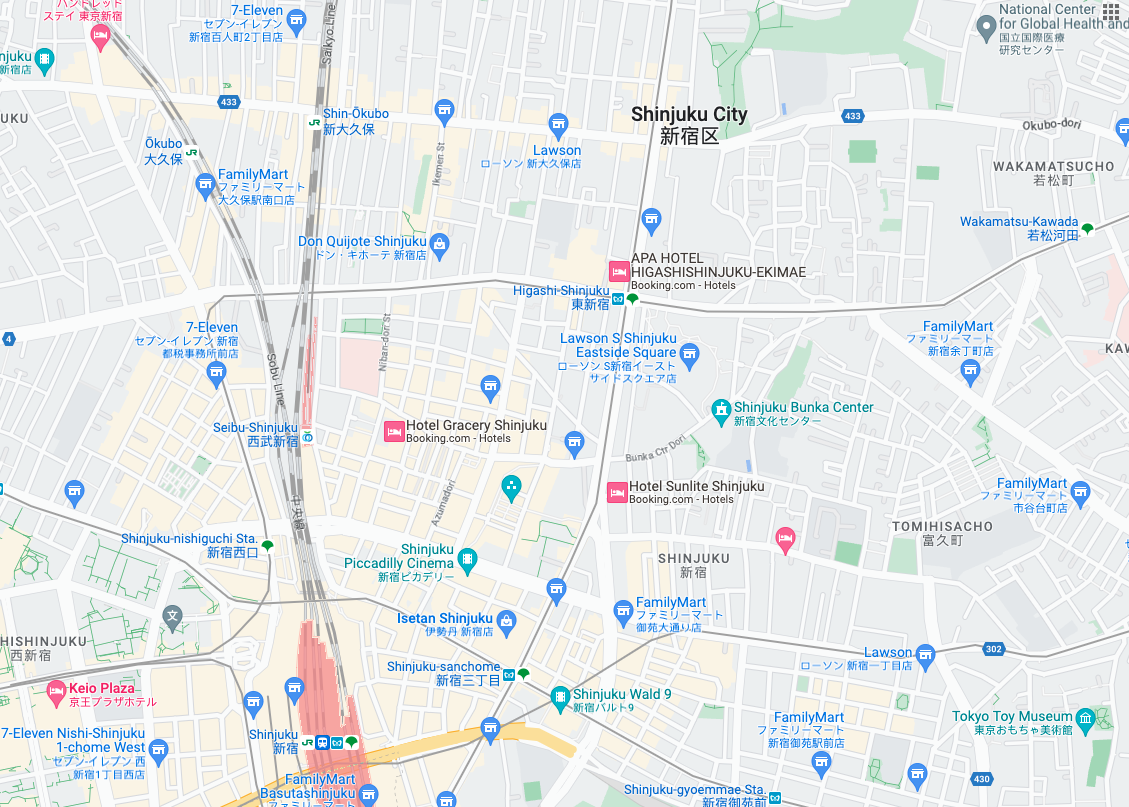
 ไทล์แผนที่ถนนคือไทล์รูปภาพที่อิงตามข้อมูลภูมิประเทศแบบเวกเตอร์
พร้อมด้วยการจัดรูปแบบแผนที่ของ Google ซึ่งรวมถึงถนน อาคาร จุดที่น่าสนใจ และเขตแดนทางการเมือง
ไทล์แผนที่ถนนคือไทล์รูปภาพที่อิงตามข้อมูลภูมิประเทศแบบเวกเตอร์
พร้อมด้วยการจัดรูปแบบแผนที่ของ Google ซึ่งรวมถึงถนน อาคาร จุดที่น่าสนใจ และเขตแดนทางการเมือง
รับการ์ดแผนกลยุทธ์
คุณเริ่มส่งคำขอไทล์แผนที่ได้หลังจากได้รับโทเค็นของเซสชัน เนื่องจากโทเค็นของเซสชันมีผลกับทั้งเซสชัน คุณจึงไม่จำเป็นต้องระบุตัวเลือกแผนที่พร้อมกับคำขอไทล์
ตัวอย่างโค้ดต่อไปนี้แสดงคำขอโทเค็นของเซสชันทั่วไปสำหรับ ไทล์แผนที่
curl -X POST -d '{
  "mapType": "roadmap",
  "language": "en-US",
  "region": "US"
}' \
-H 'Content-Type: application/json' \
"https://tile.googleapis.com/v1/createSession?key=YOUR_API_KEY"
คุณจะได้รับไทล์แผนงานโดยการส่งคำขอ HTTPS GET ดังที่แสดงในตัวอย่างต่อไปนี้
curl "https://tile.googleapis.com/v1/2dtiles/z/x/y?session=YOUR_SESSION_TOKEN &key=YOUR_API_KEY &orientation=0_or_90_or_180_or_270"
ในคำขอ GET ของ HTTPS นี้ z คือระดับการซูม (ตั้งแต่ 0 ถึง 22) และ x กับ y คือ พิกัดแผนที่ย่อย ของไทล์ที่คุณต้องการดึงข้อมูล
พารามิเตอร์ orientation จะใส่หรือไม่ใส่ก็ได้ ค่าของพารามิเตอร์นี้จะระบุจำนวน
องศาที่หมุนภาพไทล์ทวนเข็มนาฬิกา orientation รองรับไทล์ roadmap รวมถึงรองรับคำขอภาพถ่ายจากดาวเทียมและภูมิประเทศที่นำภาพพื้นฐานออกโดยใช้ "overlay": true และตั้งค่า layerTypes ค่า orientation ที่ใช้ได้คือ 0 (ค่าเริ่มต้น), 90, 180 และ 270
ระบบจะไม่หมุนตารางกริดพิกัดไทล์หากคุณใส่orientation
ค่า เช่น หากตั้งค่า orientation เป็น 90 พิกัด x จะยังคงกำหนดตำแหน่งจากซ้ายไปขวาของไทล์ ซึ่งในกรณีนี้คือจากเหนือไปใต้บนแผนที่
| การวางแนว 0 องศา | การวางแนว 90 องศา |
|---|---|
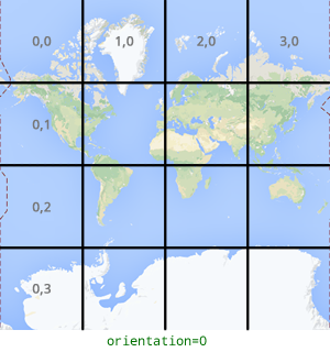 |
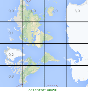 |
ตัวอย่างคำขอไทล์
ลองดูตัวอย่างต่อไปนี้ ซึ่งขอไทล์เดียวที่มี ทั้งโลก ในตัวอย่างนี้ ระดับการซูมคือ 0 และพิกัด x และ y คือ 0, 0
curl "https://tile.googleapis.com/v1/2dtiles/0/0/0?session=YOUR_SESSION_TOKEN&key=YOUR_API_KEY" --output /tmp/example_tile.png
ในตัวอย่างนี้ไม่มีข้อความตอบกลับจากเซิร์ฟเวอร์ แต่ระบบจะดาวน์โหลดไทล์ ไปยังไฟล์ในเครื่องพร้อมสถิติต่อไปนี้
  % Total    % Received % Xferd  Average Speed   Time    Time     Time  Current
                                 Dload  Upload   Total   Spent    Left  Speed
100  8335  100  8335    0     0  51471      0 --:--:-- --:--:-- --:--:-- 54835
ดูข้อมูลเกี่ยวกับส่วนหัวของข้อความตอบกลับได้ที่ การดึงข้อมูลล่วงหน้า การแคช หรือการจัดเก็บเนื้อหา