3D Area Explorer
The 3D Area Explorer solution allows you to explore neighborhoods and areas virtually and in 3D with a high degree of visual detail, identify points of interest, and create immersive, interactive experiences using Google Maps Platform Photorealistic 3D Tiles and the Places API.
Resources
-
Getting started
An overview of the 3D Area Explorer solution, which leverages Google Maps Platform Photorealistic 3D Tiles and the Places API to create immersive, interactive 3D environments for exploring neighborhoods and landmarks.
-
Customization guide
An overview of the customization capabilitiea of the 3D Area Explorer solution that lets users explore communities in 3D with various customization options, such as location, camera control, points of interest, and pre-loading exploration via URL customization.
View code on GitHub
Download the code and start building your 3D Area Explorer.
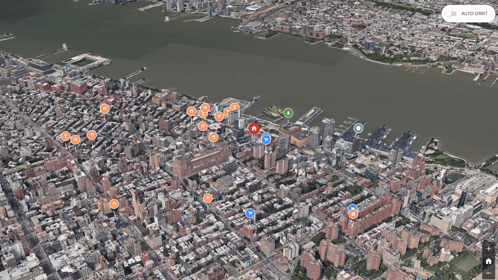
View source codeExplore the demo app of Chelsea neighborhood of NYC
Explore Chelsea neighborhood of NYC in rich 3D with various points of interests
See the demo in actionReport an issue
Use GitHub issue tracker to raise any feature requests or notify us of any bugs.
Submit an issue
Admin app
This web application provides a user-friendly interface that lets you customize the 3D experience:
- Location Search: Use the integrated Google Maps Platform Autocomplete search bar to easily find the neighborhood you want to showcase. After you select a location, the camera seamlessly flies to that area.
- Camera: Adjust the camera movement speed and orbit type to create the desired viewing experience.
- Places (POIs): Define the density, search radius, and types of points of interest (such as restaurants, cafes, landmarks) that you'd like to feature.
Demo apps: Chicago
Explore the Google Chicago office following a slow camera path, or see all of the Chicago area airports.
Demo apps: Las Vegas
See a dense view of all the tourist attractions around the Las Vegas strip, or explore Las vegas following a high speed sinusoidal camera path.
Demo apps: Grand Canyon
Explore the Grand Canyon with all of the key tourist attractions highlighted.