
標記是用來標出地圖上的某個位置。
標記預設會使用標準圖示,外觀和風格與 Google 地圖一致。如要自訂標記,可以變更預設標記的顏色、以自訂圖示取代標記圖片,或變更標記的其他屬性。
回應標記的點擊事件時,您可以開啟資訊視窗。資訊視窗會在標記上方的對話方塊視窗中顯示文字或圖片,您可以使用預設資訊視窗顯示文字,也可以建立自訂資訊視窗,完全掌控內容。
新增標記
如要新增標記,請建立包含 position 和 title 的 GMSMarker 物件,並設定其 map。
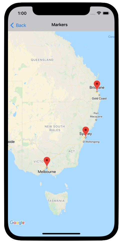
以下範例說明如何將標記加到現有的 GMSMapView 物件。標記是在座標 10,10 建立,使用者按一下標記時,資訊視窗中會顯示「Hello world」字串。
Swift
let position = CLLocationCoordinate2D(latitude: 10, longitude: 10)
let marker = GMSMarker(position: position)
marker.title = "Hello World"
marker.map = mapView
Objective-C
CLLocationCoordinate2D position = CLLocationCoordinate2DMake(10, 10);
GMSMarker *marker = [GMSMarker markerWithPosition:position];
marker.title = @"Hello World";
marker.map = mapView;
如要為地圖新增標記時加入動畫效果,請將 marker.appearAnimation 屬性設為:
kGMSMarkerAnimationPop,讓標記在新增時從groundAnchor彈出。kGMSMarkerAnimationFadeIn,讓標記在新增時淡入。
移除標記
如要從地圖中移除標記,請將 GMSMarker 的 map 屬性設為 nil。或者,您也可以呼叫 GMSMapView clear 方法,移除地圖上目前的所有疊加層 (包括標記)。
Swift
let camera = GMSCameraPosition.camera(
  withLatitude: -33.8683,
  longitude: 151.2086,
  zoom: 6
)
let mapView = GMSMapView.map(withFrame: .zero, camera: camera)
// ...
mapView.clear()
Objective-C
GMSCameraPosition *camera = [GMSCameraPosition cameraWithLatitude:-33.8683
                                                        longitude:151.2086
                                                             zoom:6];
mapView = [GMSMapView mapWithFrame:CGRectZero camera:camera];
// ...
[mapView clear];
如果您在標記加到地圖中之後,想要予以修改,請務必保留 GMSMarker 物件,這樣稍後您只要變更這個物件,就可以修改標記。
Swift
let position = CLLocationCoordinate2D(latitude: 10, longitude: 10)
let marker = GMSMarker(position: position)
marker.map = mapView
// ...
marker.map = nil
Objective-C
CLLocationCoordinate2D position = CLLocationCoordinate2DMake(10, 10);
GMSMarker *marker = [GMSMarker markerWithPosition:position];
marker.map = mapView;
// ...
marker.map = nil;
變更標記顏色
如要自訂預設標記圖片的顏色,請使用 markerImageWithColor: 要求預設圖示的著色版本,然後將產生的圖片傳遞至 GMSMarker 的 icon 屬性。
Swift
marker.icon = GMSMarker.markerImage(with: .black)
Objective-C
marker.icon = [GMSMarker markerImageWithColor:[UIColor blackColor]];
自訂標記圖片
如要變更預設標記圖片,可以使用標記的 icon 或 iconView 屬性設定自訂圖示。如果設定 iconView,API 會忽略 icon 屬性。
使用標記的 icon 屬性
下列程式碼片段會建立標記,並在 icon 屬性中以 UIImage 形式提供自訂圖示。圖示位於英國倫敦的中心位置。程式碼片段假設應用程式包含名為「house.png」的圖片。
Swift
let positionLondon = CLLocationCoordinate2D(latitude: 51.5, longitude: -0.127)
let london = GMSMarker(position: positionLondon)
london.title = "London"
london.icon = UIImage(named: "house")
london.map = mapView
Objective-C
CLLocationCoordinate2D positionLondon = CLLocationCoordinate2DMake(51.5, -0.127);
GMSMarker *london = [GMSMarker markerWithPosition:positionLondon];
london.title = @"London";
london.icon = [UIImage imageNamed:@"house"];
london.map = mapView;
如果您要使用同一張圖片建立多個標記,請為每個標記使用相同的 UIImage 執行個體。這有助於提升應用程式效能,並在顯示大量標記時,盡可能提高紋理快取的使用率。
這張圖片可能有多個影格。此外,系統也會遵守 alignmentRectInsets 屬性,如果標記有陰影或其他無法使用的區域,這項屬性就很有用。
使用標記的 iconView 屬性
下列程式碼片段會設定標記的 iconView 屬性,藉此建立具有自訂圖示的標記,並為標記的顏色變化加上動畫效果。The snippet assumes that your application contains an image named "house.png".
Swift
import CoreLocation
import GoogleMaps

class MarkerViewController: UIViewController, GMSMapViewDelegate {
  var mapView: GMSMapView!
  var london: GMSMarker?
  var londonView: UIImageView?

  override func viewDidLoad() {
    super.viewDidLoad()

    let camera = GMSCameraPosition.camera(
      withLatitude: 51.5,
      longitude: -0.127,
      zoom: 14
    )
    let mapView = GMSMapView.map(withFrame: .zero, camera: camera)
    view = mapView

    mapView.delegate = self

    let house = UIImage(named: "House")!.withRenderingMode(.alwaysTemplate)
    let markerView = UIImageView(image: house)
    markerView.tintColor = .red
    londonView = markerView

    let position = CLLocationCoordinate2D(latitude: 51.5, longitude: -0.127)
    let marker = GMSMarker(position: position)
    marker.title = "London"
    marker.iconView = markerView
    marker.tracksViewChanges = true
    marker.map = mapView
    london = marker
  }

  func mapView(_ mapView: GMSMapView, idleAt position: GMSCameraPosition) {
    UIView.animate(withDuration: 5.0, animations: { () -> Void in
      self.londonView?.tintColor = .blue
    }, completion: {(finished) in
      // Stop tracking view changes to allow CPU to idle.
      self.london?.tracksViewChanges = false
    })
  }
}
Objective-C
@import CoreLocation;
@import GoogleMaps;

@interface MarkerViewController : UIViewController <GMSMapViewDelegate>
@property (strong, nonatomic) GMSMapView *mapView;
@end

@implementation MarkerViewController {
  GMSMarker *_london;
  UIImageView *_londonView;
}

- (void)viewDidLoad {
  [super viewDidLoad];

  GMSCameraPosition *camera = [GMSCameraPosition cameraWithLatitude:51.5
                                                          longitude:-0.127
                                                               zoom:14];
  _mapView = [GMSMapView mapWithFrame:CGRectZero camera:camera];
  self.view = _mapView;

  _mapView.delegate = self;

  UIImage *house = [UIImage imageNamed:@"House"];
  house = [house imageWithRenderingMode:UIImageRenderingModeAlwaysTemplate];
  _londonView = [[UIImageView alloc] initWithImage:house];
  _londonView.tintColor = [UIColor redColor];

  CLLocationCoordinate2D position = CLLocationCoordinate2DMake(51.5, -0.127);
  _london = [GMSMarker markerWithPosition:position];
  _london.title = @"London";
  _london.iconView = _londonView;
  _london.tracksViewChanges = YES;
  _london.map = self.mapView;
}

- (void)mapView:(GMSMapView *)mapView idleAtCameraPosition:(GMSCameraPosition *)position {
  [UIView animateWithDuration:5.0
                   animations:^{
    self->_londonView.tintColor = [UIColor blueColor];
  }
                   completion:^(BOOL finished) {
    // Stop tracking view changes to allow CPU to idle.
    self->_london.tracksViewChanges = NO;
  }];
}

@end
由於 iconView 接受 UIView,因此您可以建立定義標記的標準 UI 控制項階層,每個檢視區塊都有一組標準組合的動畫功能。您可以變更標記大小、顏色和 Alpha 級別,以及套用任意轉換。iconView 屬性支援 UIView 的所有可設定動畫屬性,但 frame 和 center 除外。
- 如果
tracksViewChanges設為YES,UIView可能會耗用大量資源,導致電池用量增加。相較之下,單一影格UIImage是靜態的,不需要重新算繪。 - 如果畫面上有很多標記,且每個標記都有自己的
UIView,而且所有標記同時追蹤變更,部分裝置可能無法順利算繪地圖。 iconView是檢視區塊的快照,因此不會回應使用者互動。- 無論實際值為何,檢視畫面都會像
clipsToBounds設為YES一樣運作。您可以套用超出界線的變形,但繪製的物件必須在物件界線內。系統會監控並套用所有轉換/位移。簡而言之,子檢視區塊必須包含在檢視區塊內。 - 如要在
GMSMarker上使用-copyWithZone:,您必須先複製GMSMarker,然後在副本上設定新的iconView例項。UIView不支援NSCopying,因此無法複製iconView。
決定何時設定 tracksViewChanges 屬性時,請權衡效能考量,以及自動重新繪製標記的優點。例如:
- 如要進行一連串變更,可以將屬性變更為
YES,然後再改回NO。 - 如果動畫正在執行或內容是以非同步方式載入,您應將屬性設為
YES,直到動作完成為止。
變更標記不透明度
您可以使用標記的 opacity 屬性控制不透明度。您應將不透明度指定為介於 0.0 和 1.0 之間的浮動值,其中 0 表示完全透明,1 表示完全不透明。
Swift
marker.opacity = 0.6
Objective-C
marker.opacity = 0.6;
您可以使用 GMSMarkerLayer,透過 Core Animation 製作標記不透明度動畫。
將標記設為平放
標記圖示通常會根據裝置螢幕方向繪製,而非地圖表面,因此旋轉、傾斜或縮放地圖不一定會改變標記的方向。
你可以設置一個標記的方向是平貼在地上。地圖旋轉時,平放標記會跟著旋轉;地圖傾斜時,標記也會改變角度。和一般標記一樣,縮放地圖時,平放標記的大小不會改變。
如要變更標記的方向,請將標記的 flat 屬性設為 YES 或 true。
Swift
let positionLondon = CLLocationCoordinate2D(latitude: 51.5, longitude: -0.127)
let londonMarker = GMSMarker(position: positionLondon)
londonMarker.isFlat = true
londonMarker.map = mapView
Objective-C
CLLocationCoordinate2D positionLondon = CLLocationCoordinate2DMake(51.5, -0.127);
GMSMarker *londonMarker = [GMSMarker markerWithPosition:positionLondon];
londonMarker.flat = YES;
londonMarker.map = mapView;
旋轉標記
如要讓標記繞著錨點旋轉,請設定 rotation 屬性。以 CLLocationDegrees 型別指定旋轉角度,並以預設位置為基準,依順時針方向測量。如果標記平放在地圖上,則預設方向為朝北。
以下範例會將標記旋轉 90°。將 groundAnchor 屬性設為 0.5,0.5,標記將圍繞其中心旋轉,而非其基底。
Swift
let degrees = 90.0
londonMarker.groundAnchor = CGPoint(x: 0.5, y: 0.5)
londonMarker.rotation = degrees
londonMarker.map = mapView
Objective-C
CLLocationDegrees degrees = 90;
londonMarker.groundAnchor = CGPointMake(0.5, 0.5);
londonMarker.rotation = degrees;
londonMarker.map = mapView;
處理標記事件
您可以監聽地圖上發生的事件,例如使用者輕觸標記。如要監聽事件,請導入 GMSMapViewDelegate 通訊協定。請參閱標記事件和手勢,瞭解如何處理特定標記事件。事件指南也提供 GMSMapViewDelegate 的方法清單。如要瞭解街景服務活動,請參閱GMSPanoramaViewDelegate。