
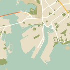
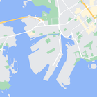
بالإضافة إلى تغيير نمط العناصر على الخريطة، يمكنك أيضًا إخفاءها تمامًا. يوضّح لك هذا المثال كيفية إخفاء نقاط الاهتمام الخاصة بالأنشطة التجارية ورموز وسائل النقل العام على خريطتك.
لا تعمل ميزة "تحديد الأسلوب" إلا على نوع الخريطة normal. لا يؤثر التنسيق في الخرائط الداخلية، لذا لن يؤدي استخدام التنسيق لإخفاء الميزات إلى منع ظهور المخططات الأرضية الداخلية على الخريطة.
تمرير عنصر نمط JSON إلى خريطتك
لتصميم الخريطة، استدعِ الدالة GoogleMap.setMapStyle() مع تمرير كائن MapStyleOptions يحتوي على تعريفات التصميم بتنسيق JSON. يمكنك تحميل ملف JSON من مصدر أولي أو سلسلة، كما هو موضّح في الأمثلة التالية:
مورد أوّلي
يفترض نموذج الرمز البرمجي التالي أنّ مشروعك يحتوي على مورد أولي باسم style_json:
// Copyright 2020 Google LLC
//
// Licensed under the Apache License, Version 2.0 (the "License");
// you may not use this file except in compliance with the License.
// You may obtain a copy of the License at
//
//      http://www.apache.org/licenses/LICENSE-2.0
//
// Unless required by applicable law or agreed to in writing, software
// distributed under the License is distributed on an "AS IS" BASIS,
// WITHOUT WARRANTIES OR CONDITIONS OF ANY KIND, either express or implied.
// See the License for the specific language governing permissions and
// limitations under the License.

package com.example.styledmap;

import android.content.res.Resources;
import android.os.Bundle;
import android.util.Log;
import androidx.appcompat.app.AppCompatActivity;

import com.google.android.gms.maps.CameraUpdateFactory;
import com.google.android.gms.maps.GoogleMap;
import com.google.android.gms.maps.OnMapReadyCallback;
import com.google.android.gms.maps.SupportMapFragment;
import com.google.android.gms.maps.model.LatLng;
import com.google.android.gms.maps.model.MapStyleOptions;

/**
 * A styled map using JSON styles from a raw resource.
 */
public class MapsActivityRaw extends AppCompatActivity
        implements OnMapReadyCallback {

    private static final String TAG = MapsActivityRaw.class.getSimpleName();

    @Override
    protected void onCreate(Bundle savedInstanceState) {
        super.onCreate(savedInstanceState);
        // Retrieve the content view that renders the map.
        setContentView(R.layout.activity_maps_raw);

        // Get the SupportMapFragment and register for the callback
        // when the map is ready for use.
        SupportMapFragment mapFragment =
                (SupportMapFragment) getSupportFragmentManager()
                        .findFragmentById(R.id.map);
        mapFragment.getMapAsync(this);
    }

    /**
     * Manipulates the map when it's available.
     * The API invokes this callback when the map is ready for use.
     */
    @Override
    public void onMapReady(GoogleMap googleMap) {

        try {
            // Customise the styling of the base map using a JSON object defined
            // in a raw resource file.
            boolean success = googleMap.setMapStyle(
                    MapStyleOptions.loadRawResourceStyle(
                            this, R.raw.style_json));

            if (!success) {
                Log.e(TAG, "Style parsing failed.");
            }
        } catch (Resources.NotFoundException e) {
            Log.e(TAG, "Can't find style. Error: ", e);
        }
        // Position the map's camera near Sydney, Australia.
        googleMap.moveCamera(CameraUpdateFactory.newLatLng(new LatLng(-34, 151)));
    }
}
حدِّد موردًا أوليًا في /res/raw/style_json.json يحتوي على بيان نمط JSON التالي لإخفاء نقاط الاهتمام الخاصة بالأنشطة التجارية:
يخفي تعريف النمط التالي نقاط الاهتمام الخاصة بالأنشطة التجارية ورموز النقل العام:
يبدو التنسيق (activity_maps.xml) على النحو التالي:
مصدر السلاسل النصية
تفترض عينة التعليمات البرمجية التالية أنّ مشروعك يحتوي على مصدر السلاسل النصية يُسمى style_json:
package com.example.styledmap;

import android.os.Bundle;
import android.support.v7.app.AppCompatActivity;
import android.util.Log;

import com.google.android.gms.maps.CameraUpdateFactory;
import com.google.android.gms.maps.GoogleMap;
import com.google.android.gms.maps.OnMapReadyCallback;
import com.google.android.gms.maps.SupportMapFragment;
import com.google.android.gms.maps.model.LatLng;
import com.google.android.gms.maps.model.MapStyleOptions;

/**
 * A styled map using JSON styles from a string resource.
 */
public class MapsActivityString extends AppCompatActivity
        implements OnMapReadyCallback {

    private static final String TAG = MapsActivityString.class.getSimpleName();

    @Override
    protected void onCreate(Bundle savedInstanceState) {
        super.onCreate(savedInstanceState);
        // Retrieve the content view that renders the map.
        setContentView(R.layout.activity_maps_string);

        // Get the SupportMapFragment and register for the callback
        // when the map is ready for use.
        SupportMapFragment mapFragment =
                (SupportMapFragment) getSupportFragmentManager()
                        .findFragmentById(R.id.map);
        mapFragment.getMapAsync(this);
    }

    /**
     * Manipulates the map when it's available.
     * The API invokes this callback when the map is ready for use.
     */
    @Override
    public void onMapReady(GoogleMap googleMap) {

        // Customise the styling of the base map using a JSON object defined
        // in a string resource file. First create a MapStyleOptions object
        // from the JSON styles string, then pass this to the setMapStyle
        // method of the GoogleMap object.
        boolean success = googleMap.setMapStyle(new MapStyleOptions(getResources()
                .getString(R.string.style_json)));

        if (!success) {
            Log.e(TAG, "Style parsing failed.");
        }
        // Position the map's camera near Sydney, Australia.
        googleMap.moveCamera(CameraUpdateFactory.newLatLng(new LatLng(-34, 151)));
    }
}
حدِّد مصدر السلاسل النصية في /res/values/style_strings.xml، يحتوي على تعريف نمط JSON التالي لإخفاء نقاط الاهتمام الخاصة بالأنشطة التجارية. في هذا الملف، يجب استخدام شرطة مائلة عكسية لإلغاء تأثير علامات الاقتباس:
يخفي تعريف النمط التالي نقاط الاهتمام الخاصة بالأنشطة التجارية ورموز النقل العام:
يبدو التنسيق (activity_maps.xml) على النحو التالي:
تعريفات نمط JSON
تستخدِم الخرائط ذات التصميم الخاص مفهومَين لتطبيق الألوان والتغييرات الأخرى على الأنماط في الخريطة، وهما:
- تحدّد أدوات الاختيار المكوّنات الجغرافية التي يمكنك
تنسيقها على الخريطة. وتشمل هذه العناصر الطرق والحدائق والمسطحات المائية وغيرها، بالإضافة إلى تصنيفاتها. تتضمّن أدوات الاختيار ميزات وعناصر، ويتم تحديدها كسمتَي
featureTypeوelementType. - أدوات التنسيق هي خصائص اللون والرؤية التي يمكنك تطبيقها على عناصر الخريطة. وتحدّد هذه القيم اللون المعروض من خلال مزيج من قيم التدرج اللوني واللون والسطوع/غاما.
راجِع مرجع الأنماط للحصول على وصف مفصّل لخيارات أنماط JSON.
أداة تصميم الخرائط في "منصة خرائط Google"


استخدِم أداة تصميم "منصة خرائط Google" كطريقة سريعة لإنشاء عنصر تصميم بتنسيق JSON. تتيح حزمة تطوير البرامج بالاستناد إلى بيانات خرائط Google للتطبيقات المتوافقة مع Android استخدام تعريفات الأنماط نفسها التي تتيحها Maps JavaScript API.
عيّنات التعليمات البرمجية الكاملة
يتضمّن مستودع ApiDemos على GitHub عيّنات توضّح كيفية استخدام الأنماط.