Page Summary
-
The Places UI Kit offers pre-built UI components for integrating Google Maps Places functionality into your apps and web pages.
-
It includes components like Place Details, Place List, and Elevation for displaying place information and elevation data.
-
This kit is cost-effective compared to the Places API and allows customization of data and display options.
-
This product or feature is currently in the Experimental (pre-GA) phase, which means it has limited support and potential for incompatibility.

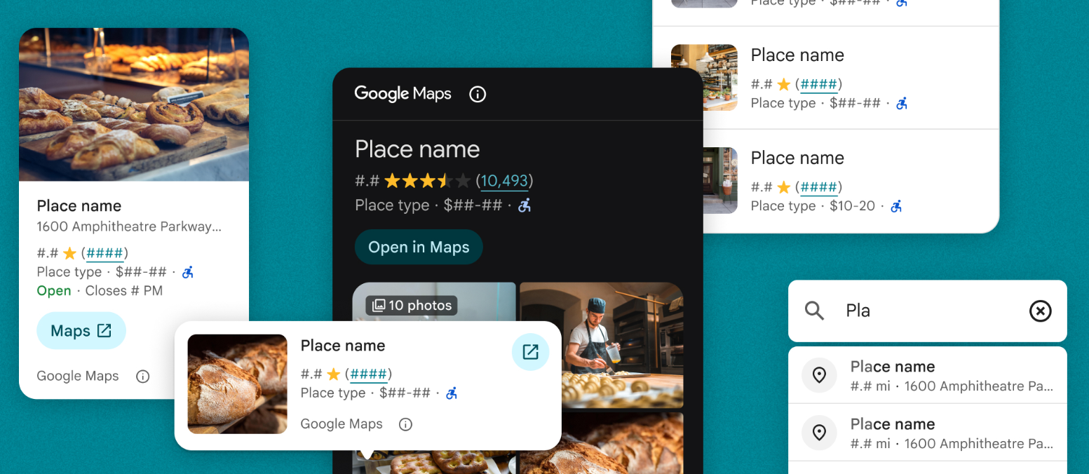
The Places UI Kit component library lets you bring the familiar Google Maps user experience for Places to your apps and web pages, using the same data that powers the Places API. It includes a set of individual UI components that can be used independently, together, and in conjunction with other Google Maps Platform APIs to deliver a Places-rich experience with minimal cost and code.
The Places UI Kit includes the following HTML elements for rendering Places data:
- Place Details Elements (Place Details and Place Details Compact) render details such as opening hours, website, and reviews for a selected place.
- Place Search Elements (Place Nearby Search and Place Text Search) render a list of places in response to either a nearby search or text search query.
- Basic Place Autocomplete Element renders a text input field, supplies place predictions in a UI pick list, and returns a place ID for the selected place.
Key features and capabilities
- Incorporate Google's trusted experience starting with minimal code.
- Bring Google Maps UI for Places to your apps at a lower cost than the Places API.
- Choose the data and display options that best suit your needs.
Billing
Places UI Kit requests are always billed at the Places UI Kit API rate, regardless of which search method they use or what data types they return. For example, a Places UI Kit Nearby Search won't incur any additional charges for Places API Nearby Search Pro. Similarly, a Places UI Kit Place Details request may return photos, price, and rating for a selected place, but you will only be billed for the Places UI Kit Place Details request.
