
Ta strona pokazuje, jak renderować dane geograficzne w KML.
używając formatu GMUKMLParser w formacie
spójnik z GMUGeometryRenderer. Format KML jest popularny
do renderowania danych geograficznych, takich jak punkty, linie i wielokąty.
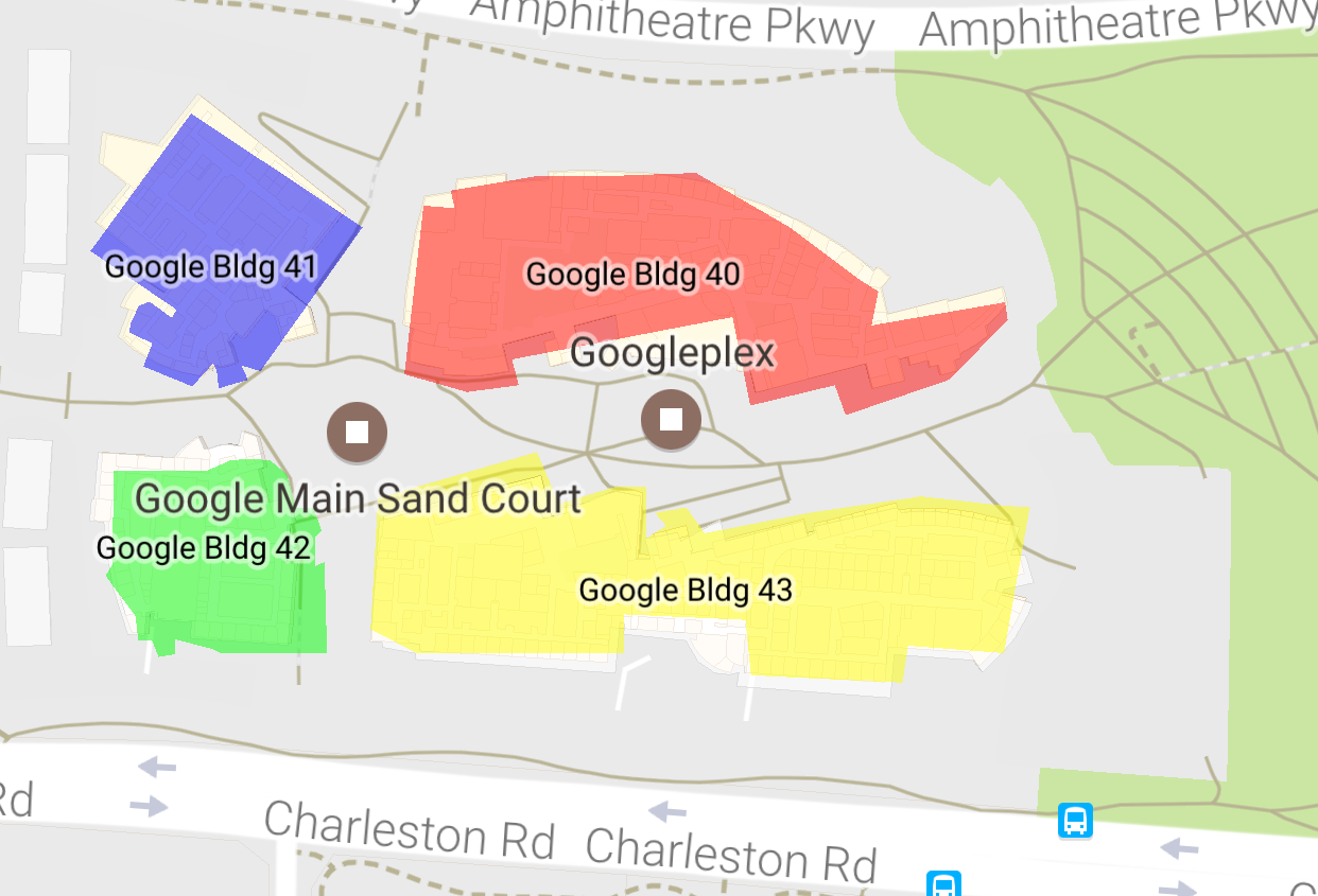
Na poniższym zrzucie ekranu widać przykładowe dane KML wyrenderowane na mapie:
Wymagania wstępne i uwagi
GMUKMLParser należy do:
bibliotekę narzędziową pakietu Maps SDK na iOS. Jeśli nie masz jeszcze skonfigurowanego
z biblioteki, postępuj zgodnie z przewodnikiem konfiguracji, zanim przeczytaj dalszą część tej strony.
Pełny przykładowy kod znajdziesz w sekcji z przykładowymi aplikacjami wł. GitHub.
Renderowanie danych KML
Aby wyrenderować dane KML na mapie, utwórz GMUKMLParser z
ścieżki do zasobu KML (w tym przykładzie KML_Sample.kml). Następnie:
utwórz GMUGeometryRenderer z wynikiem GMUKMLParser
instancji. Na koniec zadzwoń pod numer GMUGeometryRenderer.render().
następujący przykładowy kod pokazuje renderowanie danych KML na mapie:
Swift
import GoogleMapsUtils

class KML: NSObject {
  private var mapView: GMSMapView!

  func renderKml() {
    guard let path = Bundle.main.path(forResource: "KML_Sample", ofType: "kml") else {
      print("Invalid path")
      return
    }

    let url = URL(fileURLWithPath: path)

    let kmlParser = GMUKMLParser(url: url)
    kmlParser.parse()

    let renderer = GMUGeometryRenderer(
      map: mapView,
      geometries: kmlParser.placemarks,
      styles: kmlParser.styles
    )

    renderer.render()
  }
}
Objective-C
@import GoogleMapsUtils;

@implementation KML {
  GMSMapView *_mapView;
}

- (void)renderKml {
  NSString *path = [[NSBundle mainBundle] pathForResource:@"KML_Sample" ofType:@"kml"];
  NSURL *url = [NSURL fileURLWithPath:path];
  GMUKMLParser *parser = [[GMUKMLParser alloc] initWithURL:url];
  [parser parse];
  GMUGeometryRenderer *renderer = [[GMUGeometryRenderer alloc] initWithMap:_mapView
                                                                geometries:parser.placemarks
                                                                    styles:parser.styles];
  [renderer render];
}

@end