Page Summary
-
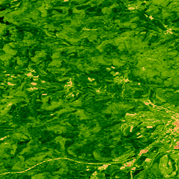
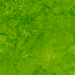
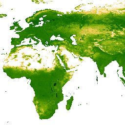
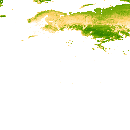
Multiple datasets are available that provide vegetation indices like NDVI and EVI at various spatial and temporal resolutions.
-
Several datasets are gap-filled to address missing data caused by factors such as cloud cover.
-
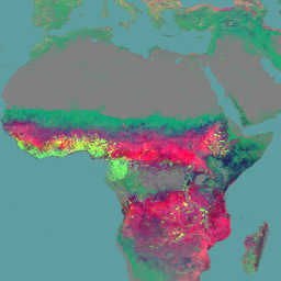
Leaf Area Index (LAI) data is also available from different satellite sensors.
-
Data products are provided by organizations such as the Malaria Atlas Project, JAXA, NASA, NOAA, and USGS.
-
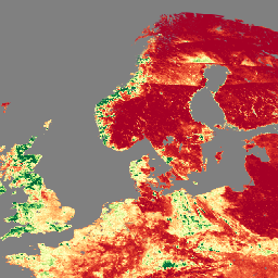
Tasseled Cap Brightness (TCB) and Tasseled Cap Wetness (TCW) datasets are available, some of which are gap-filled.
-
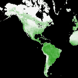
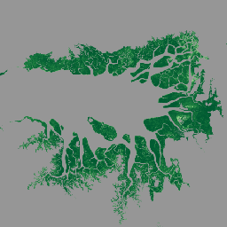
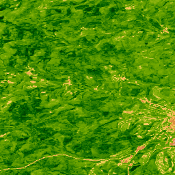
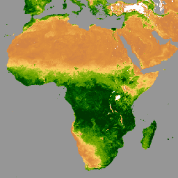
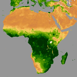
EVI: Malaria Atlas Project Gap-Filled Enhanced Vegetation Index (8-Daily 1km)
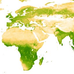
The underlying dataset for this Enhanced Vegetation Index (EVI) product is MODIS BRDF-corrected imagery (MCD43B4), which was gap-filled using the approach outlined in Weiss et al. (2014) to eliminate missing data caused by factors such as cloud cover. After gap-filling the data was clipped to … evi malariaatlasproject map publisher-dataset vegetation vegetation-indices -
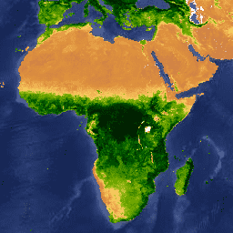
EVI: Malaria Atlas Project Gap-Filled Enhanced Vegetation Index (Annual 1km)
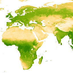
The underlying dataset for this Enhanced Vegetation Index (EVI) product is MODIS BRDF-corrected imagery (MCD43B4), which was gap-filled using the approach outlined in Weiss et al. (2014) to eliminate missing data caused by factors such as cloud cover. After gap-filling the data was clipped to … evi malariaatlasproject map publisher-dataset vegetation vegetation-indices -
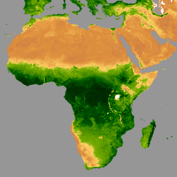
EVI: Malaria Atlas Project Gap-Filled Enhanced Vegetation Index (Monthly 1km)
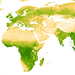
The underlying dataset for this Enhanced Vegetation Index (EVI) product is MODIS BRDF-corrected imagery (MCD43B4), which was gap-filled using the approach outlined in Weiss et al. (2014) to eliminate missing data caused by factors such as cloud cover. After gap-filling the data was clipped to … evi malariaatlasproject map publisher-dataset vegetation vegetation-indices -
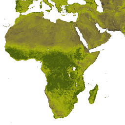
GCOM-C/SGLI L3 Leaf Area Index (V1)
This product is the sum of the one-sided green leaf area per unit ground area. A newer version JAXA/GCOM-C/L3/LAND/LAI/V3 is also available for this dataset which uses this algorithm for processing. GCOM-C conducts long-term and continuous global observation and data collection to elucidate the mechanism … g-portal gcom gcom-c jaxa lai land -
GCOM-C/SGLI L3 Leaf Area Index (V2)

This product is the sum of the one-sided green leaf area per unit ground area. For data after 2021-11-28, see the V3 dataset. GCOM-C conducts long-term and continuous global observation and data collection to elucidate the mechanism behind fluctuations in radiation budget and carbon cycle … g-portal gcom gcom-c jaxa lai land -
GCOM-C/SGLI L3 Leaf Area Index (V3)

This product is the sum of the one-sided green leaf area per unit ground area. This is an ongoing dataset with a latency of 3-4 days. GCOM-C conducts long-term and continuous global observation and data collection to elucidate the mechanism behind fluctuations in radiation budget … g-portal gcom gcom-c jaxa lai land -
GIMMS NDVI From AVHRR Sensors (3rd Generation)
GIMMS NDVI is generated from several NOAA's AVHRR sensors for a global 1/12-degree lat/lon grid. The latest version of the GIMMS NDVI dataset is named NDVI3g (third generation GIMMS NDVI from AVHRR sensors). avhrr nasa ndvi noaa vegetation vegetation-indices -
Global Annual Mangrove Fractional Canopy Cover (1984-2023)
This dataset provides global annual mangrove fractional canopy cover (FCC) at 30-m spatial resolution from 1984 to 2023 to support large-scale analyses of long-term mangrove dynamics, including canopy degradation and recovery, blue carbon assessment, and coastal ecosystem monitoring. FCC quantifies the proportion of each Landsat … annual coastal forest-biomass global landsat-derived mangrove -
Landsat Collection 2 Tier 1 Level 2 32-Day BAI Composite
These Landsat Collection 2 Tier 1 Level 2 composites are made from Tier 1 Level 2 orthorectified scenes. The Burn Area Index (BAI) is generated from the Red and Near-IR bands, and measures the spectral distance of each pixel from a reference spectral point (the … bai fire landsat landsat-composite usgs vegetation-indices -
Landsat Collection 2 Tier 1 Level 2 32-Day NBR Composite

These Landsat Collection 2 Tier 1 Level 2 composites are made from Tier 1 Level 2 orthorectified scenes. The Normalized Burn Ratio Thermal (NBRT) index is generated from the Near-IR, Mid-IR (2215 nm), and Thermal bands, and has a range from -1.0 to 1.0. See … fire landsat landsat-composite nbrt usgs vegetation-indices -
Landsat Collection 2 Tier 1 Level 2 32-Day NDVI Composite

These Landsat Collection 2 Tier 1 Level 2 composites are made from Tier 1 Level 2 orthorectified scenes. The Normalized Difference Vegetation Index is generated from the Near-IR and Red bands of each scene as (NIR - Red) / (NIR + Red), and ranges in … landsat landsat-composite ndvi usgs vegetation vegetation-indices -
Landsat Collection 2 Tier 1 Level 2 8-Day BAI Composite
These Landsat Collection 2 Tier 1 Level 2 composites are made from Tier 1 Level 2 orthorectified scenes. The Burn Area Index (BAI) is generated from the Red and Near-IR bands, and measures the spectral distance of each pixel from a reference spectral point (the … bai fire landsat landsat-composite usgs vegetation-indices -
Landsat Collection 2 Tier 1 Level 2 8-Day EVI Composite
These Landsat Collection 2 Tier 1 Level 2 composites are made from Tier 1 Level 2 orthorectified scenes. The Enhanced Vegetation Index (EVI) is generated from the Near-IR, Red and Blue bands of each scene, and ranges in value from -1.0 to 1.0. See Huete … evi landsat landsat-composite usgs vegetation vegetation-indices -
Landsat Collection 2 Tier 1 Level 2 8-Day NBR Composite
These Landsat Collection 2 Tier 1 Level 2 composites are made from Tier 1 Level 2 orthorectified scenes. The Normalized Burn Ratio Thermal (NBRT) index is generated from the Near-IR, Mid-IR (2215 nm), and Thermal bands, and has a range from -1.0 to 1.0. See … fire landsat landsat-composite nbrt usgs vegetation-indices -
Landsat Collection 2 Tier 1 Level 2 8-Day NDVI Composite
These Landsat Collection 2 Tier 1 Level 2 composites are made from Tier 1 Level 2 orthorectified scenes. The Normalized Difference Vegetation Index is generated from the Near-IR and Red bands of each scene as (NIR - Red) / (NIR + Red), and ranges in … landsat landsat-composite ndvi usgs vegetation vegetation-indices -
Landsat Collection 2 Tier 1 Level 2 Annual BAI Composite
These Landsat Collection 2 Tier 1 Level 2 composites are made from Tier 1 Level 2 orthorectified scenes. The Burn Area Index (BAI) is generated from the Red and Near-IR bands, and measures the spectral distance of each pixel from a reference spectral point (the … bai fire landsat landsat-composite usgs vegetation-indices -
Landsat Collection 2 Tier 1 Level 2 Annual EVI Composite
These Landsat Collection 2 Tier 1 Level 2 composites are made from Tier 1 Level 2 orthorectified scenes. The Enhanced Vegetation Index (EVI) is generated from the Near-IR, Red and Blue bands of each scene, and ranges in value from -1.0 to 1.0. See Huete … evi landsat landsat-composite usgs vegetation vegetation-indices -
Landsat Collection 2 Tier 1 Level 2 Annual NBR Composite
These Landsat Collection 2 Tier 1 Level 2 composites are made from Tier 1 Level 2 orthorectified scenes. The Normalized Burn Ratio Thermal (NBRT) index is generated from the Near-IR, Mid-IR (2215 nm), and Thermal bands, and has a range from -1.0 to 1.0. See … fire landsat landsat-composite nbrt usgs vegetation-indices -
Landsat Collection 2 Tier 1 Level 2 Annual NDVI Composite
These Landsat Collection 2 Tier 1 Level 2 composites are made from Tier 1 Level 2 orthorectified scenes. The Normalized Difference Vegetation Index is generated from the Near-IR and Red bands of each scene as (NIR - Red) / (NIR + Red), and ranges in … landsat landsat-composite ndvi usgs vegetation vegetation-indices -
MOD13A1.061 Terra Vegetation Indices 16-Day Global 500m

The MOD13A1 V6.1 product provides a Vegetation Index (VI) value at a per pixel basis. There are two primary vegetation layers. The first is the Normalized Difference Vegetation Index (NDVI) which is referred to as the continuity index to the existing National Oceanic and Atmospheric … 16-day evi global modis nasa ndvi -
MOD13A2.061 Terra Vegetation Indices 16-Day Global 1km

The MOD13A2 V6.1 product provides two Vegetation Indices (VI): the Normalized Difference Vegetation Index (NDVI) and the Enhanced Vegetation Index (EVI). The NDVI is referred to as the continuity index to the existing National Oceanic and Atmospheric Administration-Advanced Very High Resolution Radiometer (NOAA-AVHRR) derived NDVI. … 16-day evi global modis nasa ndvi -
MOD13A3.061 Vegetation Indices Monthly L3 Global 1 km SIN Grid
The MOD13A3 V6.1 product data is provided monthly at 1 kilometer (km) spatial resolution. In generating this monthly product, the algorithm ingests all the MOD13A2 products that overlap the month and employs a weighted temporal average. Vegetation indices are used for global monitoring of vegetation … evi global modis monthly nasa ndvi -
MOD13C1.061: Terra Vegetation Indices 16-Day L3 Global 0.05 Deg Climate Modeling Grid
The Terra Moderate Resolution Imaging Spectroradiometer (MODIS) Vegetation Indices 16-Day (MOD13C1) Version 6.1 product provides a Vegetation Index (VI) value at a per pixel basis. There are two primary vegetation layers. The first is the Normalized Difference Vegetation Index (NDVI), which maintains continuity with the … 16-day global nasa terra usgs vegetation -
MOD13Q1.061 Terra Vegetation Indices 16-Day Global 250m

The MOD13Q1 V6.1 product provides a Vegetation Index (VI) value at a per pixel basis. There are two primary vegetation layers. The first is the Normalized Difference Vegetation Index (NDVI) which is referred to as the continuity index to the existing National Oceanic and Atmospheric … 16-day evi global modis nasa ndvi -
MYD13A1.061 Aqua Vegetation Indices 16-Day Global 500m
The MYD13A1 V6.1 product provides a Vegetation Index (VI) value at a per pixel basis. There are two primary vegetation layers. The first is the Normalized Difference Vegetation Index (NDVI) which is referred to as the continuity index to the existing National Oceanic and Atmospheric … 16-day aqua evi global modis nasa -
MYD13A2.061 Aqua Vegetation Indices 16-Day Global 1km
The MYD13A2 V6.1 product provides two Vegetation Indices (VI): the Normalized Difference Vegetation Index (NDVI) and the Enhanced Vegetation Index (EVI). The NDVI is referred to as the continuity index to the existing National Oceanic and Atmospheric Administration-Advanced Very High Resolution Radiometer (NOAA-AVHRR) derived NDVI. … 16-day aqua evi global modis nasa -
MYD13A3.061 Aqua Vegetation Indices Monthly L3 Global 1 km SIN Grid
The Aqua Moderate Resolution Imaging Spectroradiometer (MODIS) Vegetation Indices (MYD13A3) Version 6.1 data are provided monthly at 1 kilometer (km) spatial resolution as a gridded Level 3 product in the sinusoidal projection. In generating this monthly product, the algorithm ingests all the MYD13A2 products that … aqua evi global modis monthly nasa -
MYD13C1.061: Aqua Vegetation Indices 16-Day L3 Global 0.05 Deg CMG
The Aqua Moderate Resolution Imaging Spectroradiometer (MODIS) Vegetation Indices 16-Day (MYD13C1) Version 6.1 product provides a Vegetation Index (VI) value at a per pixel basis. There are two primary vegetation layers. The first is the Normalized Difference Vegetation Index (NDVI), which maintains continuity with the … 16-day aqua global nasa usgs vegetation -
MYD13Q1.061 Aqua Vegetation Indices 16-Day Global 250m
The MYD13Q1 V6.1 product provides a Vegetation Index (VI) value at a per pixel basis. There are two primary vegetation layers. The first is the Normalized Difference Vegetation Index (NDVI) which is referred to as the continuity index to the existing National Oceanic and Atmospheric … 16-day aqua evi global modis nasa -
NOAA CDR AVHRR NDVI: Normalized Difference Vegetation Index, Version 5
The NOAA Climate Data Record (CDR) of AVHRR Normalized Difference Vegetation Index (NDVI) contains gridded daily NDVI derived from the NOAA AVHRR Surface Reflectance product. It provides a measurement of surface vegetation coverage activity, gridded at a resolution of 0.05° and computed globally over land … avhrr cdr daily land ndvi noaa -
NOAA CDR VIIRS NDVI: Normalized Difference Vegetation Index, Version 1

This dataset contains gridded daily Normalized Difference Vegetation Index (NDVI) derived from the NOAA Climate Data Record (CDR) of Visible Infrared Imaging Radiometer Suite (VIIRS) Surface Reflectance. The data record spans from 2014 onward using data from NOAA polar orbiting satellites. The data are projected … cdr daily land ndvi noaa vegetation-indices -
TCB: Malaria Atlas Project Gap-Filled Tasseled Cap Brightness (8-Daily 1km)
This gap-filled Tasseled Cap Brightness (TCB) dataset was created by applying the tasseled-cap equations defined in Lobser and Cohen (2007) to MODIS BRDF-corrected imagery (MCD43B4). The resulting data were gap-filled using the approach outlined in Weiss et al. (2014) to eliminate missing data caused by … brightness malariaatlasproject map publisher-dataset tasseled-cap tcb -
TCB: Malaria Atlas Project Gap-Filled Tasseled Cap Brightness (Annual 1km)
This gap-filled Tasseled Cap Brightness (TCB) dataset was created by applying the tasseled-cap equations defined in Lobser and Cohen (2007) to MODIS BRDF-corrected imagery (MCD43B4). The resulting data were gap-filled using the approach outlined in Weiss et al. (2014) to eliminate missing data caused by … brightness malariaatlasproject map publisher-dataset tasseled-cap tcb -
TCB: Malaria Atlas Project Gap-Filled Tasseled Cap Brightness (Monthly 1km)
This gap-filled Tasseled Cap Brightness (TCB) dataset was created by applying the tasseled-cap equations defined in Lobser and Cohen (2007) to MODIS BRDF-corrected imagery (MCD43B4). The resulting data were gap-filled using the approach outlined in Weiss et al. (2014) to eliminate missing data caused by … brightness malariaatlasproject map publisher-dataset tasseled-cap tcb -
TCW: Malaria Atlas Project Gap-Filled Tasseled Cap Wetness (8-Daily 1km)
This gap-filled Tasseled Cap Wetness (TCW) dataset was created by applying the tasseled-cap equations defined in Lobser and Cohen (2007) to MODIS BRDF-corrected imagery (MCD43B4). The resulting data were gap-filled using the approach outlined in Weiss et al. (2014) to eliminate missing data caused by … malariaatlasproject map publisher-dataset tasseled-cap tcw vegetation -
TCW: Malaria Atlas Project Gap-Filled Tasseled Cap Wetness (Annual 1km)
This gap-filled Tasseled Cap Wetness (TCW) dataset was created by applying the tasseled-cap equations defined in Lobser and Cohen (2007) to MODIS BRDF-corrected imagery (MCD43B4). The resulting data were gap-filled using the approach outlined in Weiss et al. (2014) to eliminate missing data caused by … malariaatlasproject map publisher-dataset tasseled-cap tcw vegetation -
TCW: Malaria Atlas Project Gap-Filled Tasseled Cap Wetness (Monthly 1km)
This gap-filled Tasseled Cap Wetness (TCW) dataset was created by applying the tasseled-cap equations defined in Lobser and Cohen (2007) to MODIS BRDF-corrected imagery (MCD43B4). The resulting data were gap-filled using the approach outlined in Weiss et al. (2014) to eliminate missing data caused by … malariaatlasproject map publisher-dataset tasseled-cap tcw vegetation -
VNP13A1.002: VIIRS Vegetation Indices 16-Day 500m

The Suomi National Polar-Orbiting Partnership (S-NPP) NASA Visible Infrared Imaging Radiometer Suite (VIIRS) Vegetation Indices (VNP13A1) data product provides vegetation indices by a process of selecting the best available pixel over a 16-day acquisition period at 500 meter resolution. The VNP13 data products are designed … 16-day evi nasa ndvi noaa npp -
VNP15A2H: LAI/FPAR 8-Day L4 Global 500m SIN Grid
The Visible Infrared Imaging Radiometer Suite (VIIRS) Leaf Area Index (LAI) and Fraction of Photosynthetically Active Radiation (FPAR) Version 1 data product provides information about the vegetative canopy layer at 500 meter resolution (VNP15A2H). The VIIRS sensor is located onboard the NOAA/NASA joint Suomi National … land nasa noaa surface vegetation-indices viirs -
VNP22Q2.002: Land Surface Phenology Yearly L3 Global 500m SIN Grid
The Suomi National Polar-Orbiting Partnership (Suomi NPP) NASA Visible Infrared Imaging Radiometer Suite (VIIRS) Land Surface Phenology Yearly (VNP22Q2) Version 2 data product provides global land surface phenology (GLSP) metrics at yearly intervals. The VNP22Q2 data product is derived from time series of the two-band … land nasa ndvi noaa npp onset-greenness