Gạch địa hình
Sử dụng bộ sưu tập để sắp xếp ngăn nắp các trang
Lưu và phân loại nội dung dựa trên lựa chọn ưu tiên của bạn.
Nhà phát triển ở Khu vực kinh tế Châu Âu (EEA)
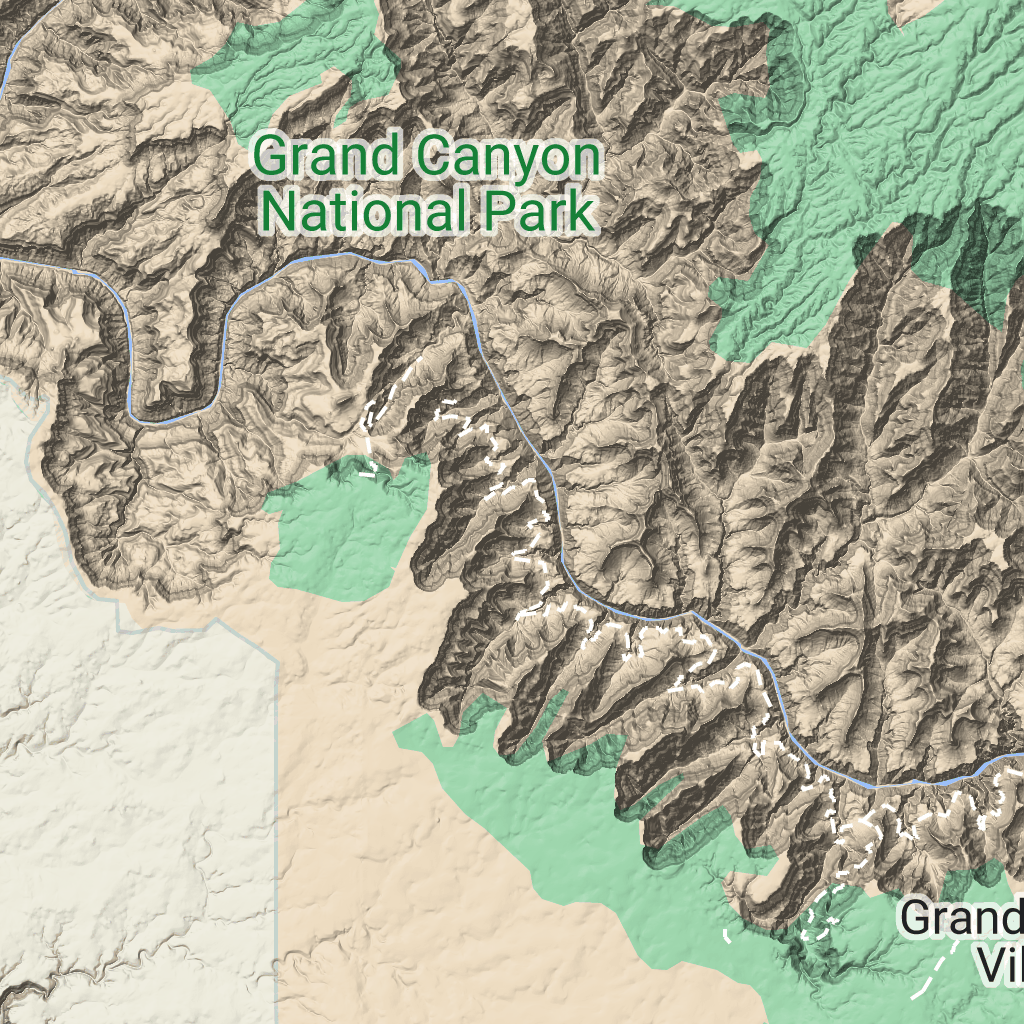
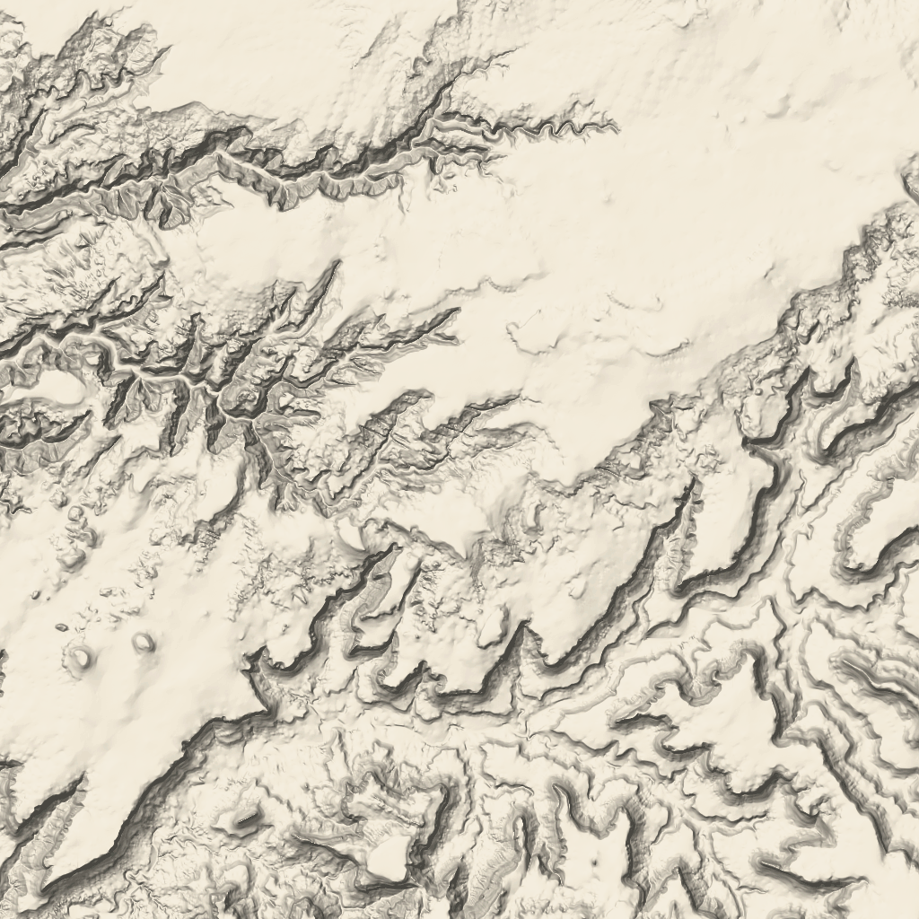
Ô địa hình là ô hình ảnh chứa thông tin ánh sáng địa hình và đường đồng mức. Chúng bao gồm các đặc điểm tự nhiên như thảm thực vật.
Nhận ô địa hình
Bạn có thể bắt đầu đưa ra yêu cầu về ô địa hình sau khi nhận được mã thông báo phiên.
Vì mã thông báo phiên áp dụng cho toàn bộ phiên, nên bạn không phải chỉ định các lựa chọn về bản đồ bằng yêu cầu về ô.
Mã mẫu sau đây minh hoạ một yêu cầu mã phiên điển hình cho các ô địa hình.
[[["Dễ hiểu","easyToUnderstand","thumb-up"],["Giúp tôi giải quyết được vấn đề","solvedMyProblem","thumb-up"],["Khác","otherUp","thumb-up"]],[["Thiếu thông tin tôi cần","missingTheInformationINeed","thumb-down"],["Quá phức tạp/quá nhiều bước","tooComplicatedTooManySteps","thumb-down"],["Đã lỗi thời","outOfDate","thumb-down"],["Vấn đề về bản dịch","translationIssue","thumb-down"],["Vấn đề về mẫu/mã","samplesCodeIssue","thumb-down"],["Khác","otherDown","thumb-down"]],["Cập nhật lần gần đây nhất: 2026-06-19 UTC."],[],["Terrain tiles, which include hillshade mapping, contour lines, and natural features, are accessed by first obtaining a session token via a POST request specifying the map type, language, region, and layer types. Subsequently, tiles are retrieved with HTTPS GET requests, providing the zoom level (z), x and y coordinates, and the session token. An example demonstrates requesting a tile at zoom level 10, with coordinates (192, 401). The tile data downloads to a local file, without a server response message.\n"]]

 Ô địa hình là ô hình ảnh chứa thông tin ánh sáng địa hình và đường đồng mức. Chúng bao gồm các đặc điểm tự nhiên như thảm thực vật.