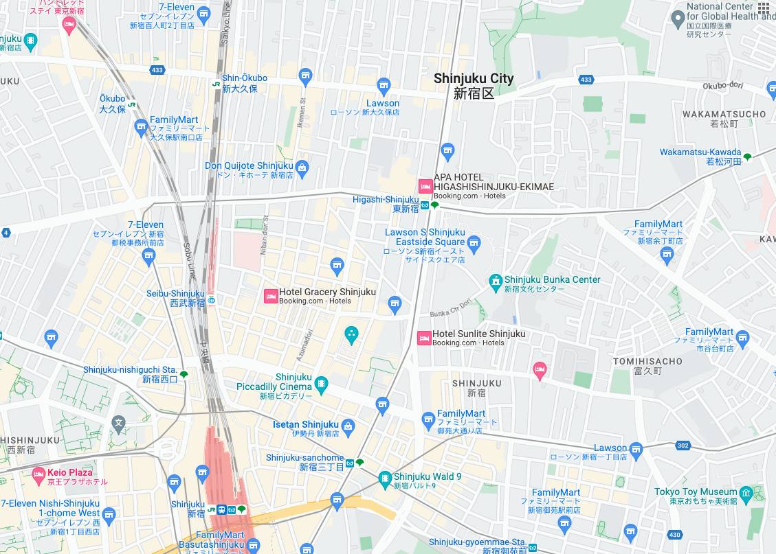
 路線圖圖塊是以向量地形資料為基礎的圖像圖塊,並採用 Google 的製圖樣式。包括道路、建築物、搜尋點和政治界線。
取得藍圖動態磚
取得工作階段權杖後,即可開始提出路線圖圖塊要求。由於工作階段權杖適用於整個工作階段,因此您不必在圖塊要求中指定地圖選項。
下列程式碼範例示範路線圖圖塊的典型工作階段權杖要求。
curl -X POST -d '{
  "mapType": "roadmap",
  "language": "en-US",
  "region": "US"
}' \
-H 'Content-Type: application/json' \
"https://tile.googleapis.com/v1/createSession?key=YOUR_API_KEY"
如以下範例所示,您可以發出 HTTPS GET 要求,取得路線圖資訊方塊。
curl "https://tile.googleapis.com/v1/2dtiles/z/x/y?session=YOUR_SESSION_TOKEN &key=YOUR_API_KEY &orientation=0_or_90_or_180_or_270"
在這個 HTTPS GET 要求中,z 是縮放等級 (範圍為 0 到 22),而 x 和 y 是要擷取圖塊的圖塊座標。
orientation 參數為選用參數。這個值會指定圖塊圖像逆時針旋轉的角度 (以度為單位)。orientation 支援 roadmap 圖塊,也支援衛星和地形要求,但必須使用 "overlay": true 移除基本圖像,並設定 layerTypes。有效 orientation 值為 0 (預設值)、90、180 和 270。
如果加入 orientation 值,圖塊座標格線就不會旋轉。舉例來說,如果將 orientation 設為 90,則 x 座標仍會定義圖塊的左右位置,在此情況下,地圖上為由北到南。
| 零度方向 | 90 度方向 |
|---|---|
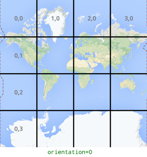 |
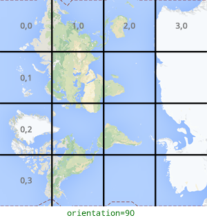 |
圖塊要求範例
請參考以下範例,要求包含整個世界的單一圖塊。在本例中,縮放等級為 0,x 和 y 座標為 0, 0。
curl "https://tile.googleapis.com/v1/2dtiles/0/0/0?session=YOUR_SESSION_TOKEN&key=YOUR_API_KEY" --output /tmp/example_tile.png
本例中,伺服器沒有傳送任何回應訊息。而是下載到本機檔案,並提供下列統計資料。
  % Total    % Received % Xferd  Average Speed   Time    Time     Time  Current
                                 Dload  Upload   Total   Spent    Left  Speed
100  8335  100  8335    0     0  51471      0 --:--:-- --:--:-- --:--:-- 54835
如要瞭解回應訊息標頭,請參閱「預先擷取、快取或儲存內容」。