
 रोडमैप टाइलें, वेक्टर टोपोग्राफ़िक डेटा पर आधारित इमेज टाइलें होती हैं
इनमें Google की कार्टोग्राफ़िक स्टाइलिंग का इस्तेमाल किया जाता है. इनमें सड़कें, इमारतें, दिलचस्पी की जगहें, और राजनैतिक सीमाएं शामिल होती हैं.
रोडमैप टाइलें, वेक्टर टोपोग्राफ़िक डेटा पर आधारित इमेज टाइलें होती हैं
इनमें Google की कार्टोग्राफ़िक स्टाइलिंग का इस्तेमाल किया जाता है. इनमें सड़कें, इमारतें, दिलचस्पी की जगहें, और राजनैतिक सीमाएं शामिल होती हैं.
रोडमैप टाइलें पाना
सेशन टोकन मिलने के बाद, रोडमैप टाइल के लिए अनुरोध किए जा सकते हैं. सेशन टोकन पूरे सेशन पर लागू होता है. इसलिए, टाइल के लिए किए जाने वाले अनुरोधों में, मैप के विकल्प बताने की ज़रूरत नहीं होती.
यहां दिए गए कोड सैंपल में, रोडमैप टाइल के लिए सेशन टोकन के सामान्य अनुरोध का तरीका बताया गया है.
curl -X POST -d '{
  "mapType": "roadmap",
  "language": "en-US",
  "region": "US"
}' \
-H 'Content-Type: application/json' \
"https://tile.googleapis.com/v1/createSession?key=YOUR_API_KEY"
रोडमैप टाइलें पाने के लिए, एचटीटीपीएस जीईटी अनुरोध किया जाता है. इसका तरीका यहां दिए गए उदाहरण में बताया गया है.
curl "https://tile.googleapis.com/v1/2dtiles/z/x/y?session=YOUR_SESSION_TOKEN &key=YOUR_API_KEY &orientation=0_or_90_or_180_or_270"
इस एचटीटीपीएस जीईटी अनुरोध में, z ज़ूम लेवल
(0 से 22 तक) है. वहीं, x और
y उस
टाइल के निर्देशांक
हैं जिसे आपको वापस पाना है.
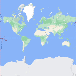
orientation पैरामीटर ज़रूरी नहीं है. इसकी वैल्यू, टाइल इमेज के घड़ी की उलटी दिशा में घूमने की डिग्री की संख्या बताती है. orientation पैरामीटर, roadmap टाइल के लिए काम करता है. साथ ही, यह सैटलाइट और इलाके के अनुरोधों के लिए भी काम करता है. इनमें "overlay": true का इस्तेमाल करके, बेस इमेज को हटाया जाता है और layerTypes सेट किए जाते हैं. orientation की मान्य वैल्यू 0 (डिफ़ॉल्ट), 90, 180, और 270 हैं.
अगर orientation की कोई वैल्यू शामिल की जाती है, तो टाइल के निर्देशांकों का ग्रिड रोटेट नहीं होता. उदाहरण के लिए, अगर orientation को 90 पर सेट किया जाता है, तो x निर्देशांक अब भी टाइल की बाएं से दाएं वाली पोज़िशन तय करता है. इस मामले में, यह मैप पर उत्तर से दक्षिण की ओर है.
| शून्य डिग्री ओरिएंटेशन | 90 डिग्री ओरिएंटेशन |
|---|---|
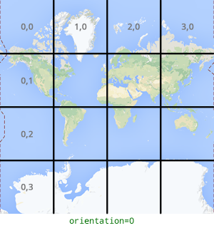 |
 |
टाइल के लिए अनुरोध का उदाहरण
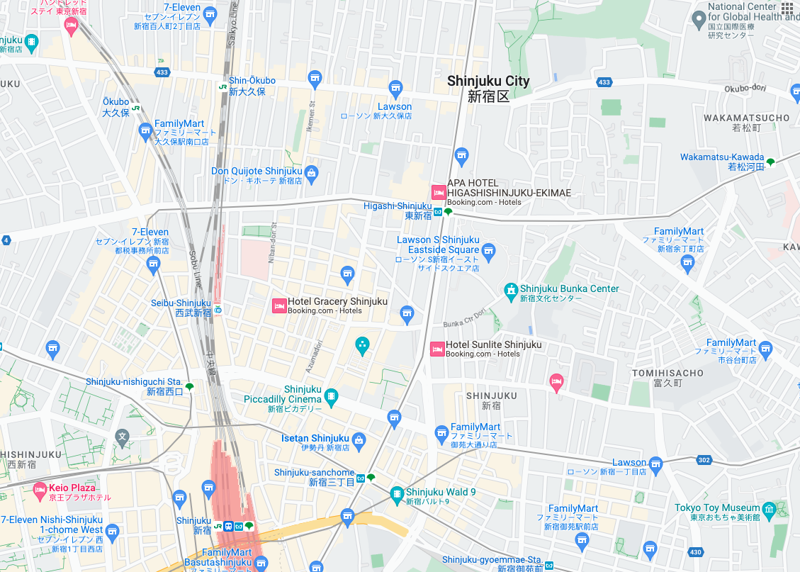
यहां दिए गए उदाहरण पर ध्यान दें. इसमें, एक ऐसी टाइल का अनुरोध किया गया है जिसमें पूरी दुनिया शामिल है. इस उदाहरण में, ज़ूम लेवल 0 है. साथ ही, x और y निर्देशांक 0, 0 हैं.
curl "https://tile.googleapis.com/v1/2dtiles/0/0/0?session=YOUR_SESSION_TOKEN&key=YOUR_API_KEY" --output /tmp/example_tile.png
इस उदाहरण में, सर्वर से कोई जवाब नहीं मिला है. इसके बजाय, टाइल को लोकल फ़ाइल में डाउनलोड किया जाता है. इसमें ये आंकड़े शामिल होते हैं.
  % Total    % Received % Xferd  Average Speed   Time    Time     Time  Current
                                 Dload  Upload   Total   Spent    Left  Speed
100  8335  100  8335    0     0  51471      0 --:--:-- --:--:-- --:--:-- 54835
जवाब के मैसेज के हेडर के बारे में जानने के लिए, कॉन्टेंट को पहले से फ़ेच करना, कैश मेमोरी में सेव करना या सेव करके रखना लेख पढ़ें.