仿真 3D 图块概览
使用集合让一切井井有条
根据您的偏好保存内容并对其进行分类。
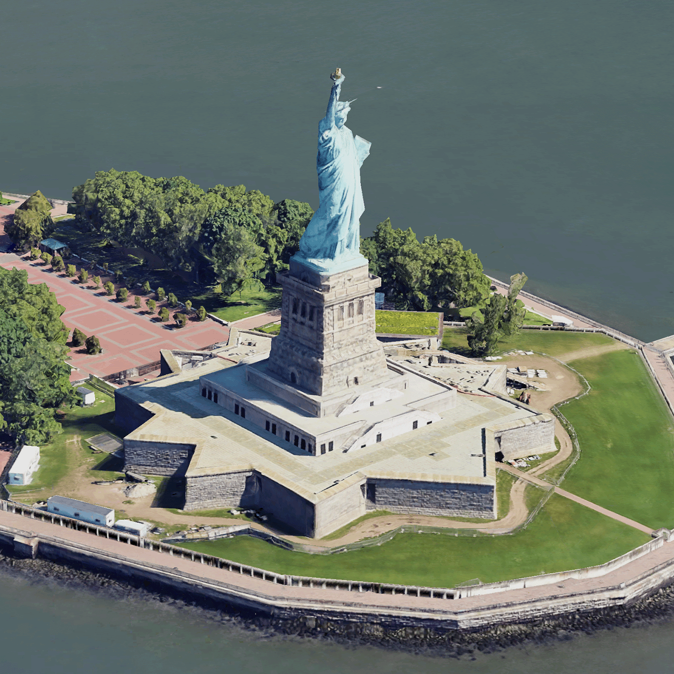
 仿真 3D 图块是包含 OGC 3D 图块格式的 Google 3D 地理位置数据的地图图块。
您可以使用自己的 3D 图块渲染器渲染 Google 的 3D 地图,也可以使用开源库进行 3D 地理空间可视化。
为什么要使用 3D 图块?
Google 针对新一代可视化用例提供 3D Tiles。您可以使用 3D 图块构建出色的 3D 透视视图,就像使用 Google 地球一样。这些视图有助于用户更好地了解地理位置背景信息,改进导航方式,并可展示用于叙事的地点。您还可以使用所选的渲染器在场景中平稳地移动相机,从不同角度查看场景。
覆盖区域
查看 Map Tiles API 的覆盖范围。Google 会定期更新和添加图像。
3D 解决方案
Google Maps Platform 架构中心包含一些 3D 解决方案示例,您可以查看这些示例,以便开始开发应用:
如未另行说明,那么本页面中的内容已根据知识共享署名 4.0 许可获得了许可,并且代码示例已根据 Apache 2.0 许可获得了许可。有关详情,请参阅 Google 开发者网站政策。Java 是 Oracle 和/或其关联公司的注册商标。
最后更新时间 (UTC):2026-02-07。
[[["易于理解","easyToUnderstand","thumb-up"],["解决了我的问题","solvedMyProblem","thumb-up"],["其他","otherUp","thumb-up"]],[["没有我需要的信息","missingTheInformationINeed","thumb-down"],["太复杂/步骤太多","tooComplicatedTooManySteps","thumb-down"],["内容需要更新","outOfDate","thumb-down"],["翻译问题","translationIssue","thumb-down"],["示例/代码问题","samplesCodeIssue","thumb-down"],["其他","otherDown","thumb-down"]],["最后更新时间 (UTC):2026-02-07。"],[],[]]
 仿真 3D 图块是包含 OGC 3D 图块格式的 Google 3D 地理位置数据的地图图块。
您可以使用自己的 3D 图块渲染器渲染 Google 的 3D 地图,也可以使用开源库进行 3D 地理空间可视化。