Kirim masukan
Ringkasan Ubin 2D
Tetap teratur dengan koleksi
Simpan dan kategorikan konten berdasarkan preferensi Anda.
Developer Wilayah Ekonomi Eropa (EEA)
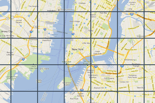
Petak Peta hanyalah pembagian dunia menjadi petak
yang diindeks. Fitur ini memungkinkan Anda mengakses dan memanfaatkan data peta secara efisien dan dinamis
pada beberapa skala kartografi. Map Tiles API memberi Anda akses ke
beberapa geodataset tematik, termasuk yang dikurasi Google:
Ubin gambar peta jalan berdasarkan data topografi vektor dengan gaya kartografi Google.
Ortophotography yang diambil oleh kamera satelit dan udara yang memberikan citra bumi dari atas (nadir).
Peta kontur bayangan bukit.
2D Map Tiles semuanya direferensikan secara geografis dan diselaraskan satu sama lain. Dipilih berdasarkan
cakupan geografis area tampilan dan tingkat zoom. Tingkat zoom berkisar dari nol (untuk melihat dunia secara keseluruhan) hingga 22 (untuk melihat jalan dan blok).
Tema peta
Anda bisa mendapatkan petak peta untuk tema peta berikut.
Tema peta
Deskripsi
Roadmap
Jalan, bangunan, lokasi menarik, dan batas politik
Satelit
Gambar fotografi yang diambil dari luar angkasa
Medan
Peta kontur yang menampilkan fitur alam seperti vegetasi
Catatan: Petak peta dapat terdiri dari satu atau beberapa lapisan. Misalnya, lapisan peta jalan
dapat di-overlay di atas tema peta satelit. Untuk mengetahui informasi selengkapnya, lihat
Kolom opsional .
Untuk meminta petak peta dari Map Tiles API, Anda harus meminta
token sesi terlebih dahulu. Token sesi melacak status peta dan area tampilan Anda saat ini. Saat menyiapkan token sesi, Anda harus menetapkan nilai mapType
agar sesuai dengan tema peta yang Anda inginkan.
Kemudian, Anda harus menyertakan token sesi di setiap permintaan ke
Map Tiles API.
Permintaan informasi area pandang
Area pandang menentukan ukuran kotak yang membingkai tampilan dunia. Permintaan informasi
area tampilan menampilkan detail tentang petak peta yang membentuk
area tampilan saat ini. Alasan Anda meminta informasi area tampilan adalah untuk memastikan
bahwa Anda menghindari permintaan gambar pada tingkat zoom yang tidak ada.
Misalnya, sebagian besar kota memiliki gambar pada tingkat zoom 22, tetapi tidak dengan lautan karena hanya akan menampilkan kotak biru tanpa fitur.
Catatan: Atribusi yang harus Anda tampilkan dengan peta, dan tingkat zoom maksimum disertakan dalam respons—sehingga Anda dapat membuat penggeser zoom. Untuk mengetahui informasi selengkapnya, lihat Kebijakan Map Tiles API .
Permintaan area tampilan adalah permintaan HTTPS GET dalam bentuk berikut.
curl "https://tile.googleapis.com/tile/v1/viewport ?session=YOUR_SESSION_TOKEN &key=YOUR_API_KEY &zoom=zoom &north=north &south=south &east=east &west=west "
Permintaan berisi kolom berikut:
zoom
Level zoom area pandang.
north
, south
, east
, west
Titik paling utara, selatan, timur, dan barat di area tampilan, dinyatakan dalam
derajat. Utara dan selatan harus dalam rentang (-90,90), timur dan barat harus dalam rentang (-180, 180). Untuk menyatakan batas yang melintasi antimeridian, barat bisa
positif (misalnya, 170) dan timur bisa negatif (misalnya, -170). Semua
parameter wajib diisi.
Respons informasi area pandang
Respons area pandang memberi tahu Anda area mana yang memiliki gambar, dan pada tingkat zoom berapa. Respons informasi area tampilan memiliki bentuk berikut.
{
"copyright" : "Map data ©2023" ,
"maxZoomRects" : [
{
"maxZoom" : 19 ,
"north" : 90 ,
"south" : -90 ,
"east" : 180 ,
"west" : -180
},
{
"maxZoom" : 9 ,
"north" : 90 ,
"south" : -90 ,
"east" : 180 ,
"west" : -180
},
{
"maxZoom" : 14 ,
"north" : 84.375 ,
"south" : -84.375 ,
"east" : 180 ,
"west" : -180
}, ...
]
}
Catatan: Dalam contoh ini, array maxZoomRects
berisi lebih banyak objek daripada yang
ditampilkan.
Isi respons berisi kolom berikut.
copyright
Berisi string atribusi yang harus Anda tampilkan di peta saat Anda menampilkan ubin peta jalan dan satelit. Untuk mengetahui informasi selengkapnya, lihat
Kebijakan Map Tiles API .
maxZoomRect
Berisi array persegi panjang pembatas yang tumpang-tindih dengan
area tampilan saat ini. Juga berisi tingkat zoom maksimum yang tersedia dalam setiap persegi panjang.
Fungsi koordinat petak peta
Alat (fungsi sederhana) tersedia di sebagian besar bahasa pemrograman untuk mengonversi
dari pasangan lintang/bujur ke koordinat ubin pada tingkat zoom tertentu.
Pertimbangkan contoh kode JavaScript berikut yang pertama-tama mengonversi dari
latLng
ke titik, lalu dari titik ke koordinat petak.
var TILE_SIZE = 256 ;
function fromLatLngToPoint ( latLng ) {
var mercator = - Math . log ( Math . tan (( 0.25 + latLng . lat () / 360 ) * Math . PI ));
return {
x : TILE_SIZE * ( latLng . lng () / 360 + 0.5 ),
y : TILE_SIZE / 2 * ( 1 + mercator / Math . PI )
};
}
function fromLatLngToTileCoord ( latLng , zoom ) {
var point = fromLatLngToPoint ( latLng );
var scale = Math . pow ( 2 , zoom );
return {
x : Math . floor ( point . x * scale / TILE_SIZE ),
y : Math . floor ( point . y * scale / TILE_SIZE ),
z : zoom
};
}
Kirim masukan
Kecuali dinyatakan lain, konten di halaman ini dilisensikan berdasarkan Lisensi Creative Commons Attribution 4.0 , sedangkan contoh kode dilisensikan berdasarkan Lisensi Apache 2.0 . Untuk mengetahui informasi selengkapnya, lihat Kebijakan Situs Google Developers . Java adalah merek dagang terdaftar dari Oracle dan/atau afiliasinya.
Terakhir diperbarui pada 2025-09-04 UTC.
Ada masukan untuk kami?
[[["Mudah dipahami","easyToUnderstand","thumb-up"],["Memecahkan masalah saya","solvedMyProblem","thumb-up"],["Lainnya","otherUp","thumb-up"]],[["Informasi yang saya butuhkan tidak ada","missingTheInformationINeed","thumb-down"],["Terlalu rumit/langkahnya terlalu banyak","tooComplicatedTooManySteps","thumb-down"],["Sudah usang","outOfDate","thumb-down"],["Masalah terjemahan","translationIssue","thumb-down"],["Masalah kode / contoh","samplesCodeIssue","thumb-down"],["Lainnya","otherDown","thumb-down"]],["Terakhir diperbarui pada 2025-09-04 UTC."],[[["\u003cp\u003eMap Tiles API allows access to various thematic geodatasets like roadmap, orthophotography, and hillshade, dividing the world into an indexed grid for efficient data utilization.\u003c/p\u003e\n"],["\u003cp\u003eMap tiles are available in roadmap, satellite, and terrain themes, and can be overlaid for richer visualizations.\u003c/p\u003e\n"],["\u003cp\u003eA session token is required for accessing Map Tiles API, which tracks the map state and desired theme.\u003c/p\u003e\n"],["\u003cp\u003eViewport information requests help determine available zoom levels and imagery for a specific area to avoid requesting non-existent data.\u003c/p\u003e\n"],["\u003cp\u003eTile coordinate functions can be used to convert latitude/longitude pairs into tile coordinates for specific zoom levels, enabling precise map tile retrieval.\u003c/p\u003e\n"]]],["Map Tiles API provides access to geodatasets, including roadmap, satellite, and terrain themes, divided into an indexed grid. Users request a session token and specify a map theme. Viewport information, obtained via HTTPS GET requests, determines the available imagery and zoom levels (0-22) within a defined area. Responses include copyright attribution and maximum zoom levels. Tile coordinate functions convert latitude/longitude to tile coordinates for specific zoom levels.\n"],null,["# 2D Tiles overview\n\n**European Economic Area (EEA) developers** If your billing address is in the European Economic Area, effective on 8 July 2025, the [Google\n| Maps Platform EEA Terms of Service](https://cloud.google.com/terms/maps-platform/eea) will apply to your use of the Services. [Learn more](/maps/comms/eea/faq). In addition, certain content from the Map Tiles API will no longer be returned. [Learn more](/maps/comms/eea/map-tiles).\n\nMap Tiles are simply the division of the world into an indexed\ngrid. It lets you access and utilize map data efficiently and dynamically\nat multiple cartographic scales. Map Tiles API gives you access to\nmultiple thematic geodatasets, including Google-curated:\n\n- Roadmap image tiles based on vector topographic data with Google's\n cartographic styling.\n\n- Orthophotography captured by both satellite and airborne cameras that deliver\n top down (nadir) imagery of the earth.\n\n- Hillshade contour maps.\n\n2D Map Tiles are all georeferenced and aligned to each other. They're selected\nbased on the geographic extent of the viewport and the zoom level. Zoom levels\nrange from zero (to view the world in its entirety) to 22 (to view streets and\nblocks).\n\nMap themes\n----------\n\nYou can get map tiles for the following map themes.\n\n| Map theme | Description |\n|-------------------------------------------------|----------------------------------------------------------------|\n| [Roadmap](/maps/documentation/tile/roadmap) | Roads, buildings, points of interest, and political boundaries |\n| [Satellite](/maps/documentation/tile/satellite) | Photographic imagery taken from space |\n| [Terrain](/maps/documentation/tile/terrain) | A contour map that shows natural features such as vegetation |\n\n| **Note:** Map tiles can consist of one or more layers. For example, a roadmap layer can be overlaid on top of a satellite map theme. For more information, see [Optional fields](/maps/documentation/tile/session_tokens#optional_fields).\n\nTo request map tiles from Map Tiles API, you must first request a\n[session token](/maps/documentation/tile/session_tokens). The session token\ntracks the current state of your map and viewport. When you set up your session\ntoken, you must set the `mapType` value to match the map theme that you want.\nThen, you must include the session token in each of your requests to\nMap Tiles API.\n\nViewport information requests\n-----------------------------\n\nThe viewport defines the size of the box that frames the world scene. Viewport\ninformation requests return details about the map tiles that make up your\ncurrent viewport. The reason that you request viewport information is to ensure\nthat you avoid requesting imagery at zoom levels that don't exist.\n\nFor example, most cities have imagery at zoom level 22, but not the ocean since\nit would just end up displaying featureless blue squares.\n| **Note:** Included in the response is the attribution that you must display with your map, and the maximum zoom level---so you can build a zoom slider. For more information, see the [Map Tiles API Policies](/maps/documentation/tile/policies#map-tiles-api).\n\nThe viewport request is an HTTPS GET request in the following form. \n\n```json\ncurl \"https://tile.googleapis.com/tile/v1/viewport?session=\u003cvar class=\"apiparam\" translate=\"no\"\u003eYOUR_SESSION_TOKEN\u003c/var\u003e&key=YOUR_API_KEY&zoom=\u003cvar class=\"apiparam\" translate=\"no\"\u003ezoom\u003c/var\u003e&north=\u003cvar class=\"apiparam\" translate=\"no\"\u003enorth\u003c/var\u003e&south=\u003cvar class=\"apiparam\" translate=\"no\"\u003esouth\u003c/var\u003e&east=\u003cvar class=\"apiparam\" translate=\"no\"\u003eeast\u003c/var\u003e&west=\u003cvar class=\"apiparam\" translate=\"no\"\u003ewest\u003c/var\u003e\"\n```\n\nThe request contains the following fields:\n\n`zoom`\n: The zoom level of the viewport.\n\n`north`, `south`, `east`, `west`\n: The furthest north, south, east, and west points in the viewport, expressed in\n degrees. North and south must be in the range (-90,90), east and west must be in\n the range (-180, 180). To express bounds crossing the antimeridian, west can be\n positive (for example, 170) and east can be negative (for example, -170). All\n parameters are required.\n\nViewport information responses\n------------------------------\n\nThe viewport response tells you which areas have imagery, and at which zoom\nlevels. A viewport information response has the following form. \n\n {\n \"copyright\": \"Map data ©2023\",\n \"maxZoomRects\": [\n {\n \"maxZoom\": 19,\n \"north\": 90,\n \"south\": -90,\n \"east\": 180,\n \"west\": -180\n },\n {\n \"maxZoom\": 9,\n \"north\": 90,\n \"south\": -90,\n \"east\": 180,\n \"west\": -180\n },\n {\n \"maxZoom\": 14,\n \"north\": 84.375,\n \"south\": -84.375,\n \"east\": 180,\n \"west\": -180\n }, ...\n ]\n }\n\n| **Note:** In this example, the `maxZoomRects` array contains more objects than is shown.\n\nThe response body contains the following fields.\n\n`copyright`\n: Contains an attribution string that you must display on your map when you\n display roadmap and satellite tiles. For more information, see the\n [Map Tiles API Policies](/maps/documentation/tile/policies#map-tiles-api).\n\n`maxZoomRect`\n: Contains an array of bounding rectangles that overlap with the current\n viewport. Also contains the maximum zoom level available within each rectangle.\n\nTile coordinate functions\n-------------------------\n\nTools (simple functions) are available in most programming languages to convert\nfrom latitude/longitude pairs to tile coordinates at a specific zoom level.\nConsider the following JavaScript code example that first converts from a\n`latLng` to a point, and then from a point to tile coordinates. \n\n var TILE_SIZE = 256;\n\n function fromLatLngToPoint(latLng) {\n var mercator = -Math.log(Math.tan((0.25 + latLng.lat() / 360) * Math.PI));\n return {\n x: TILE_SIZE * (latLng.lng() / 360 + 0.5),\n y: TILE_SIZE / 2 * (1 + mercator / Math.PI)\n };\n }\n\n function fromLatLngToTileCoord(latLng, zoom) {\n var point = fromLatLngToPoint(latLng);\n var scale = Math.pow(2, zoom);\n\n return {\n x: Math.floor(point.x * scale / TILE_SIZE),\n y: Math.floor(point.y * scale / TILE_SIZE),\n z: zoom\n };\n }"]]