Page Summary
-
The Solar API uses place data and satellite imagery to identify buildings and determine their solar potential, focusing on buildings classified as "premise" in Google Places.
-
The API primarily supports residential buildings with inclined roofs for accurate solar panel placement, while accuracy may vary for flat-roofed buildings.
-
If the
solarPanelConfigsfield is missing from the API response, it indicates the building was analyzed, but solar panel placement was not feasible due to roof size or shading. -
Users can identify buildings for solar analysis by converting addresses to coordinates using Geocoding or Place Autocomplete APIs and passing the coordinates to the Solar API.
-
A complementary approach involves users selecting a building directly on a map using the Maps JavaScript API, and using the extracted coordinates for solar analysis.
The Solar API uses place data to determine building type and identifies
buildings based on satellite imagery. This page describes how to determine which
building's solar information is returned in a
buildingInsights
request.
Building types
The Solar API supports buildings of type
premise. This type
indicates a named location, usually a building or collection of buildings with a
common name.
Other types, such as
subpremise or
compounds — for example, detached buildings located on a single property, unless
registered as a premise —
are not supported.
Building roofs
The Solar API identifies optimal rooftop solar panel placement based on satellite imagery. Residential buildings, particularly inclined or pitched roofs, are identified with a high degree of accuracy, while buildings with flat roofs (for example, apartment or commercial buildings) may vary in accuracy.
If the
buildingInsights response does not include the field solarPanelConfigs, the building was processed correctly, but we were unable to put panels on the roof. This may happen if the roof is too small to place panels or too shaded for panels to generate significant energy.
Searching from an address
You can convert an address to latitude and longitude coordinates using the Geocoding API or Place Autocomplete API.
Use the
place_idto refer to the matched place.Use the place latitude and longitude coordinates in your Solar API
buildingInsightsrequest.- If the Solar API finds a matching building, check that the
place_idin thebuildingInsightsresponse matches theplace_idfrom the Geocoding API or the Place Autocomplete API. - To limit results to places with type
premise, add a place type filter to Geocoding API or Places API responses.{ "name": "buildings/ChIJh0CMPQW7j4ARLrRiVvmg6Vs", "center": { "latitude": 37.4449739, "longitude": -122.13914659999998 },... }
- If the Solar API finds a matching building, check that the
You can use the open source sample
app or make a
buildingInsights request to
check the place_id for buildings covered by the Solar API.
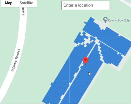
Selecting a location on a map
You can also offer a complementary experience by enabling users to select the
building on the map using the Maps JavaScript
API. Extract the building's latitude
and longitude from the mouse
event, then pass in
those coordinates in a
buildingInsights request.