-
Finland NRG NLS orthophotos 50 cm by Mavi
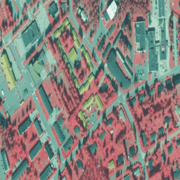
NLS Orthophotos are an aerial photo dataset covering the whole of Finland. This data is provided by Mavi(Agency for Rural Affairs). An orthophoto is a combination of several individual aerial photos. The aerial photo dataset in orthophoto format is available as the most recent dataset … falsecolor finland nrg orthophoto -
Finland NRG NLS orthophotos 50 cm by SMK
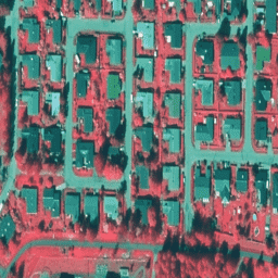
NLS Orthophotos are an aerial photo dataset covering the whole of Finland. This data is provided by SMK(The Energy Agency, formerly abbreviated SMK). An orthophoto is a combination of several individual aerial photos. The aerial photo dataset in orthophoto format is available as the most … falsecolor finland nrg orthophoto smk
[{
"type": "thumb-down",
"id": "missingTheInformationINeed",
"label":"Missing the information I need"
},{
"type": "thumb-down",
"id": "tooComplicatedTooManySteps",
"label":"Too complicated / too many steps"
},{
"type": "thumb-down",
"id": "outOfDate",
"label":"Out of date"
},{
"type": "thumb-down",
"id": "samplesCodeIssue",
"label":"Samples / code issue"
},{
"type": "thumb-down",
"id": "otherDown",
"label":"Other"
}]
[{
"type": "thumb-up",
"id": "easyToUnderstand",
"label":"Easy to understand"
},{
"type": "thumb-up",
"id": "solvedMyProblem",
"label":"Solved my problem"
},{
"type": "thumb-up",
"id": "otherUp",
"label":"Other"
}]