Page Summary
-
Orthophotos are aerial photo datasets.
-
The Finland NRG NLS orthophotos cover the whole of Finland and are provided by Mavi and SMK.
-
Latvian orthophoto maps are prepared in the Latvian coordinate system LKS-92 TM and cover the whole territory of Latvia.
-
Finland NRG NLS orthophotos 50 cm by Mavi
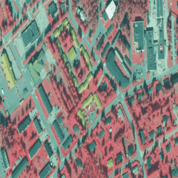
NLS Orthophotos are an aerial photo dataset covering the whole of Finland. This data is provided by Mavi(Agency for Rural Affairs). An orthophoto is a combination of several individual aerial photos. The aerial photo dataset in orthophoto format is available as the most recent dataset … falsecolor finland nrg orthophotos -
Finland NRG NLS orthophotos 50 cm by SMK
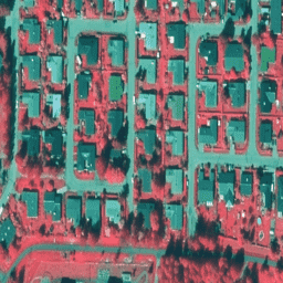
NLS Orthophotos are an aerial photo dataset covering the whole of Finland. This data is provided by SMK(The Energy Agency, formerly abbreviated SMK). An orthophoto is a combination of several individual aerial photos. The aerial photo dataset in orthophoto format is available as the most … falsecolor finland nrg orthophotos smk -
Latvia Color InfraRed (CIR) orthophotos
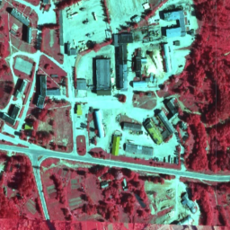
In Latvia, orthophoto maps are prepared in the Latvian coordinate system LKS-92 TM according to the TKS-93 map sheet division (scale 1:10000 map sheet corresponds to 5 x 5 kilometers in nature). Orthophoto maps are prepared for the whole territory of Latvia at the scale … latvia nrg orthophotos