
Einführung
Die Distance Matrix API (Legacy) ist ein Dienst, der eine HTTPS-Anfrage mit Start- und Zielorten für eine bestimmte Mobilitätsform akzeptiert. Für jede Kombination aus Start- und Zielort werden die Entfernung und die Dauer der Reise zurückgegeben.
Gründe für die Verwendung der Distance Matrix API (Legacy)
Mit der Distance Matrix API (Legacy) können Sie die effizientesten Routen zwischen mehreren möglichen Start- und Zielorten ermitteln. Zum Beispiel, welche Mitarbeiter zu Einsatzorten geschickt werden sollen oder aus welchen Lagern Pakete versendet werden sollen.
Funktionen der Distance Matrix API (Legacy)
Mit der Distance Matrix API (Legacy) können Sie Entfernung und Zeit für eine Matrix aus Start- und Zielorten abrufen. Sie können verschiedene Optionen angeben, z. B. Verkehrsmittel wie Auto, Fahrrad, öffentliche Verkehrsmittel oder zu Fuß sowie Verkehrsmittel wie Bus, U-Bahn, Zug, Straßenbahn oder Bahn.
Die Distance Matrix API (Legacy) liefert Informationen basierend auf der empfohlenen Route zwischen Start- und Endpunkten. Sie können die folgenden Arten von Distanzdaten anfordern:
- Entfernung für eine ausgewählte Mobilitätsform
- Entfernung in Kilometern oder Meilen
- Geschätzte Fahrzeit im Verkehr
Funktionsweise der Distance Matrix API (Legacy)
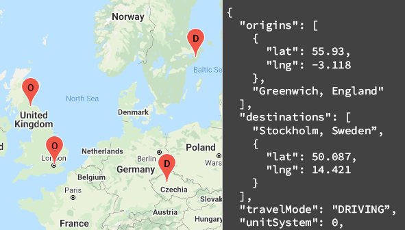
Die Distance Matrix API (Legacy) verwendet eine beliebige Anzahl von Start- und Zielorten und gibt die Entfernung und Reisezeit zwischen jedem Startort und allen angeforderten Zielorten zurück. Dabei wird mit dem ersten Startort in der Anfrage begonnen und schrittweise zum nächsten übergegangen.
Wenn Sie in Ihrer Anfrage beispielsweise A und B als Startpunkte und C und D als Zielorte angeben, werden die Entfernungen und die Fahrzeit in dieser Reihenfolge zurückgegeben:
- A bis C
- A bis D
- B2C
- B bis D
Das folgende Beispiel zeigt eine Anfrage für zwei Ausgangsorte: Washington, DC und Boston, mit einem einzigen Zielort, New York City, NY, im JSON-Format:
https://maps.googleapis.com/maps/api/distancematrix/json
  ?destinations=New%20York%20City%2C%20NY
  &origins=Washington%2C%20DC%7CBoston
  &units=imperial
  &key=YOUR_API_KEY
Ressourcen
In der folgenden Tabelle sind die über die Distance Matrix API (Legacy) verfügbaren Ressourcen sowie die zurückgegebenen Daten zusammengefasst.
| Datenressourcen | Zurückgegebene Daten | Rückgabeformat |
|---|---|---|
| Distanzmatrix
Geben Sie Start- und Zielorte in Form von Orts-IDs, Adressen oder Breiten-/Längengradkoordinaten an. |
|
|
Distance Matrix API (Legacy) verwenden
| 1 | Einrichten | Beginnen Sie mit Google Cloud-Projekt einrichten und folgen Sie der Einrichtungsanleitung. |
| 2 | „Distanzmatrix“-Anfrage ausprobieren | Sobald Sie einen API-Schlüssel haben, können Sie die Distance Matrix API (Legacy) direkt in Ihrem Browser testen. Beispiele finden Sie im Startleitfaden unter Beispielanfragen. |
| 3 | Komplexere Anfragen erstellen | Probieren Sie eine Anfrage mit mehreren Start- und Zielorten aus. Informationen zu optionalen Parametern zum Einschränken von Berechnungen, z. B. eine bestimmte Abfahrtszeit oder Routenbeschränkungen. Weitere Informationen finden Sie im Leitfaden Distance Matrix (Legacy) request and response im Abschnitt Optional parameters. |
| 4 | Grundlagen zu Antworten | Sehen Sie sich die Datenantworten an, um die Verwendung von Distanzmatrix-Daten für Ihre App vorzubereiten. Weitere Informationen finden Sie unter Distanzmatrix-Antworten. |
| 5 | Distanzmatrix-Daten in Ihre eigene App einbinden | Mit diesen Daten können Sie die Entfernung und Reisezeit berechnen. |
Verfügbare Clientbibliotheken
Rufen Sie diese API in der Sprache Ihrer Wahl über eine der folgenden Clientbibliotheken auf:
- Java-Client für Google Maps-Dienste
- Python-Client für Google Maps-Dienste
- Go-Client für Google Maps-Dienste
- Node.js-Client für Google Maps-Dienste
Die Java-, Python-, Go- und Node.js-Clients für Google Maps-Dienste sind von der Community unterstützte Clientbibliotheken, die unter der Apache 2.0-Lizenz als Open Source zur Verfügung gestellt werden. Sie können sie von GitHub herunterladen. Dort finden Sie auch Installationsanleitungen und Beispielcode.
Nächste Schritte
- Distance Matrix (Legacy) verwenden: Klicken Sie auf Erste Schritte.
- Erste Schritte mit Beispielanfragen und ‑antworten: Rufen Sie Distance Matrix-Anfrage und ‑antwort auf.
- Best Practices: Rufen Sie die Best Practices für Webservices auf.