-
GHSL: Degree of Urbanization 1975-2030 V2-0(P2023A)
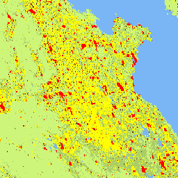
このラスター データセットは、国連統計委員会が推奨する「都市化の度合い」ステージ I の手法を適用した、グローバルな多時相の農村部と都市部の分類を表しています。これは、GHSL プロジェクトが 5 年間隔で 1975 ~ 2030 年の期間について生成したグローバルなグリッド化された人口と市街地表面データに基づいています。学位 … ghsl jrc population sdg settlement -
GHSL: Global built-up surface 10m(P2023A)
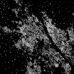
このラスター データセットは、S2 画像データから観測された 2018 年の建物表面の分布を、10 m グリッドセルあたりの平方メートルで表しています。データセットは、a) 総建築面積と、b) … のグリッド セルに割り当てられた建築面積を測定します。 built built-environment builtup copernicus ghsl jrc -
GHSL: Global built-up surface 1975-2030(P2023A)
このラスター データセットは、100 m グリッド セルあたりの平方メートルで表される、建物が建っている表面の分布を示しています。このデータセットでは、a) 総建築面積と、b) 主に非住宅(NRES)用途のグリッド セルに割り当てられた建築面積を測定します。データは空間的および時間的に補間されるか、… built built-environment builtup copernicus ghsl jrc -
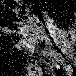
GHSL: Global settlement characteristics (10 m) 2018(P2023A)
この空間ラスター データセットは、10 m の解像度で人間の居住地を区切り、その内部特性を、構築された環境の機能的および高さ関連のコンポーネントの観点から記述します。GHSL データ プロダクトの詳細については、GHSL Data Package 2023 レポートをご覧ください。 building built builtup copernicus ghsl height -
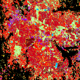
World Settlement Footprint 2015
World Settlement Footprint(WSF)2015 は、2014 ~ 2015 年のマルチテンポラル Landsat-8 および Sentinel-1 画像(それぞれ約 217,000 シーンと約 107,000 シーンが処理済み)を使用してグローバルに導出された、人間の居住地の範囲を示す 10 m 解像度のバイナリ マスクです。人間の居住地の時間的動態… landcover landsat-derived population sentinel1-derived settlement urban