- データセットの利用可能な期間
- 2015-01-01T00:00:00Z–2016-01-01T00:00:00Z
- データセット プロデューサー
- ドイツ航空宇宙センター(DLR)
- タグ
説明
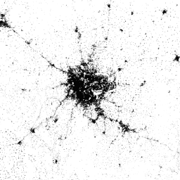
World Settlement Footprint(WSF)2015 は、2014 ~ 2015 年のマルチテンポラル Landsat-8 と Sentinel-1 の画像(それぞれ約 217,000 シーンと約 107,000 シーンが処理済み)を使用してグローバルに導出された、人間の居住地の範囲を示す 10 m 解像度のバイナリ マスクです。
人間の居住地の時間的変化は、他のすべての非居住地情報クラスの時間的変化とは明らかに異なります。したがって、選択した期間の対象地域で利用可能なすべてのマルチテンポラル画像が与えられると、次のキーとなる時間統計(時間平均、最小値、最大値など)が抽出されます。
- レーダーデータの場合の元の後方散乱値。
- 光学画像の場合、雲マスク処理後に導出されたさまざまなスペクトル指数(植生指数、建物指数など)。
次に、サポート ベクター マシン(SVM)に基づくさまざまな分類スキームが、光とレーダーの時間的特徴にそれぞれ個別に適用され、最後に 2 つの出力が適切に組み合わされます。
レイヤの高精度と信頼性を定量的に評価するために、Google との共同作業で、大量のグラウンド トゥルース サンプル(つまり、90 万件)をクラウドソーシングによる写真解釈でラベル付けしました。文献で現在推奨されている最先端のプラクティスに沿って、統計的に堅牢で透明性の高いプロトコルが定義されています。
技術的な詳細については、公開資料をご覧ください。
バンド
バンド
| 名前 | 最小 | 最大 | ピクセルサイズ | 説明 |
|---|---|---|---|---|
settlement |
255 | 255 | 10 メートル | 人間の居住地域 |
利用規約
利用規約
引用
Marconcini, M.、Metz-Marconcini, A.、Üreyen, S.、Palacios-Lopez, D.、Hanke, W.、Bachofer, F.、Zeidler, J.、Esch, T.、Gorelick, N.、Kakarla, A.、Paganini, M.、Strano, E. (2020 年)。World Settlement Footprint 2015 は、人類が居住する場所を概説しています。Scientific Data, 7(1), 1-14. doi:10.1038/s41597-020-00580-5
DOI
Earth Engine で探索する
コードエディタ(JavaScript)
var dataset = ee.Image('DLR/WSF/WSF2015/v1');

var opacity = 0.75;
var blackBackground = ee.Image(0);
Map.addLayer(blackBackground, null, 'Black background', true, opacity);

var visualization = {
  min: 0,
  max: 255,
};
Map.addLayer(dataset, visualization, 'Human settlement areas');

Map.setCenter(90.45, 23.7, 7);