-
MTBS 焼損面積の境界線
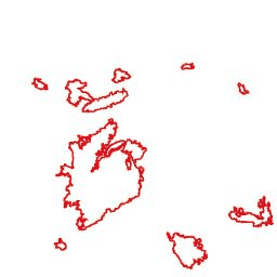
Monitoring Trends in Burn Severity(MTBS)の焼失面積境界データセットには、米国本土、アラスカ、ハワイ、プエルトリコで現在完了しているすべての MTBS 火災の焼失面積のポリゴンが含まれています。NBR は「正規化された燃焼率」を意味し、dNBR は… eros fire gtac mtbs table usda -
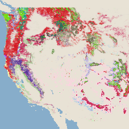
Monitoring Trends in Burn Severity(MTBS)の火傷の重症度画像

火傷の重症度モザイクは、米国本土、アラスカ、ハワイ、プエルトリコで現在完了しているすべての MTBS 火災の MTBS 火傷の重症度クラスのテーマ別ラスター画像で構成されています。モザイク処理された火傷の重症度画像は、米国各州と… eros fire forest gtac landcover landsat-derived -
USFS 景観変化監視システム v2024.10(CONUS および OCONUS)
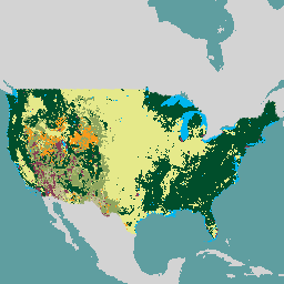
このプロダクトは、景観変化監視システム(LCMS)データ スイートの一部です。各年の LCMS モデルの変更、土地被覆、土地利用クラスを示し、米国本土(CONUS)と、アラスカ(AK)、プエルトリコなど、CONUS 外の地域(OCONUS)を対象としています。 change-detection forest gtac landcover landuse landuse-landcover -
USFS 樹木エリアの割合 v2023-5(CONUS と OCONUS)
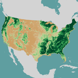
概要 米国農務省林野部(USFS)が作成した樹冠被覆率(TCC)データスイートは、1985 年から 2023 年までの年次リモート センシング ベースの地図出力です。これらのデータは、米国地質調査所が管理する National Land Cover Database(NLCD)プロジェクトをサポートしています。 forest gtac landuse-landcover redcastle-resources usda usfs -
USFS TreeMap v2016(米国本土)

このプロダクトは、TreeMap データ スイートの一部です。このデータセットは、2016 年の米国本土の森林全域における、生きた樹木と枯れた樹木の数、バイオマス、炭素などの森林特性に関する詳細な空間情報を提供します。TreeMap v2016 には 1 つの画像が含まれています。 バイオマス 炭素 気候変動 conus 森林 森林バイオマス -
USFS TreeMap v2020

このプロダクトは、TreeMap データ スイートの一部です。このデータセットは、2020 年の米国全土の森林の範囲における、生きた樹木と枯れた樹木の数、バイオマス、炭素などの森林の特性に関する詳細な空間情報を提供します。TreeMap v2020 には 22 バンドの 30 x 30 m の … aboveground biomass carbon climate-change conus forest -
USFS TreeMap v2022
このプロダクトは、TreeMap データ スイートの一部です。このデータセットは、2022 年の米国全土の森林の範囲における、生きた樹木と枯れた樹木の数、バイオマス、炭素などの森林の特徴に関する詳細な空間情報を提供します。TreeMap v2022 には、22 バンドの 30×30 m の… aboveground biomass carbon climate-change conus forest