-
排水された有機土壌の排出量(年間)1.0

排水された有機土壌に関する 2 つの関連する FAO データセットは、次の推定値を提供します。DROSA-A: 農業活動(耕作地と放牧地)のために排水された有機土壌の面積(ヘクタール単位)DROSE-A: 有機土壌の農業排水による炭素(C)と亜酸化窒素(N2O)の推定値(ギガグラム単位) 農業 気候 気候変動 排出量 FAO ghg -
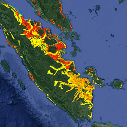
FireCCI51: MODIS Fire_cci 焼失面積ピクセル プロダクト、バージョン 5.1

MODIS Fire_cci Burned Area ピクセル プロダクト バージョン 5.1(FireCCI51)は、焼失面積と補助データに関する情報を含む、月単位のグローバルな空間解像度約 250 m のデータセットです。これは、MODIS 機器に搭載された近赤外線(NIR)帯域の表面反射率に基づいています。 burn climate-change copernicus esa fire fragmentation -
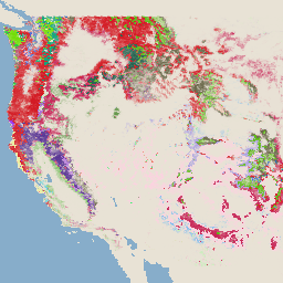
RCMAP Rangeland Component Timeseries(1985 ~ 2023 年)、v06

「RCMAP(Rangeland Condition Monitoring Assessment and Projection)データセットは、1985 年から 2023 年の Landsat 画像を使用して、北米西部の牧草地の構成要素の被覆率を定量化します。RCMAP プロダクト スイートは、10 個の分数コンポーネントで構成されています。年間の草本、裸地、草本、リター、セージブラシ以外の低木、多年生の草本、セージブラシなどです。 climate-change disturbance landsat-derived landuse-landcover nlcd rangeland -
RCMAP 牧草地の傾向のコンポーネント時系列の年(1985 ~ 2023 年)、v06

このコレクションには、1985 年から 2023 年までの RCMAP 年次プロダクトが含まれています。RCMAP(Rangeland Condition Monitoring Assessment and Projection)データセットは、1985 年から 2023 年の Landsat 画像を使用して、北米西部の牧草地の構成要素の被覆率を定量化します。RCMAP プロダクト スイートは、10 個のフラクショナル コンポーネントで構成されています。年間の… climate-change disturbance landsat-derived landuse-landcover nlcd rangeland -
RCMAP Rangeland Trends for Component Timeseries(1985 ~ 2023 年)、v06

RCMAP(Rangeland Condition Monitoring Assessment and Projection)データセットは、1985 年から 2023 年の Landsat 画像を使用して、北米西部の牧草地の構成要素の被覆率を定量化します。RCMAP プロダクト スイートは、10 個の分数コンポーネントで構成されています。年間の草本、裸地、草本、リター、セージブラシ以外の低木、多年生の草本、セージブラシなどです。 climate-change disturbance landsat-derived landuse-landcover nlcd rangeland -
SPEIbase: 標準化降水蒸発散指数データベース、バージョン 2.10
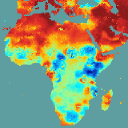
Global SPEI データベース(SPEIbase)は、0.5 度のピクセルサイズと月単位の頻度で、世界規模の干ばつ状況に関する長期にわたる堅牢な情報を提供します。SPEI のタイムスケールは 1 ~ 48 か月です。標準化降水蒸発散指数(SPEI)は、標準化された変量として表されます。 気候 気候変動 干ばつ 蒸発散 グローバル 月単位 -
国連 FAO 排水された有機土壌面積(年次)1.0
排水された有機土壌に関する 2 つの関連する FAO データセットは、次の推定値を提供します。DROSA-A: 農業活動(耕作地と放牧地)のために排水された有機土壌の面積(ヘクタール単位)DROSE-A: 有機土壌の農業排水による炭素(C)と亜酸化窒素(N2O)の推定値(ギガグラム単位) 農業 気候 気候変動 排出量 FAO ghg -
USFS TreeMap v2016(米国本土)

このプロダクトは、TreeMap データ スイートの一部です。このデータセットは、2016 年に米国本土の森林全域で、生きた樹木と枯れた樹木の数、バイオマス、炭素など、森林の特性に関する詳細な空間情報を提供します。TreeMap v2016 には 1 つの画像が含まれています。 バイオマス 炭素 気候変動 円錐 森林 森林バイオマス -
USFS TreeMap v2020

このプロダクトは、TreeMap データ スイートの一部です。このデータセットは、2020 年の米国全土の森林の特性(生きた樹木と枯れた樹木の数、バイオマス、炭素など)に関する詳細な空間情報を提供します。TreeMap v2020 には 22 バンドの 30 x 30 m の … aboveground biomass carbon climate-change conus forest -
USFS TreeMap v2022
このプロダクトは、TreeMap データ スイートの一部です。このデータセットは、2022 年の米国全土の森林の範囲にわたる、生きた樹木と枯れた樹木の数、バイオマス、炭素などの森林の特徴に関する詳細な空間情報を提供します。TreeMap v2022 には、22 バンドの 30 x 30 m の … aboveground biomass carbon climate-change conus forest