-
IPCC 地上バイオマス ティア 1 推定値のグローバル 2020 年森林分類、V1
このデータセットは、2020 年のステータス/状態別に分類された世界の森林のクラスを約 30 m の解像度で提供します。このデータは、2006 年の IPCC の国別温室効果ガスインベントリに関するガイドラインの 2019 年の改訂版で、天然林の地上部乾燥木質バイオマス密度(AGBD)のティア 1 推定値を生成するために使用されています。 地上バイオマス バイオマス 炭素 分類 森林 森林バイオマス -
地上バイオマスと地下バイオマスの炭素密度に関するグローバル マップ
このデータセットは、2010 年の地上バイオマスと地下バイオマスの炭素密度の時間的に一貫性のある調和されたグローバル マップを 300 m の空間分解能で提供します。地上バイオマス地図は、森林、草原、農地、ツンドラのバイオマスの土地被覆固有の遠隔探査地図を統合したものです。入力マップは … 地上バイオマス バイオマス 炭素 密度 森林 森林バイオマス -
グリッド化された GEDI 植生構造指標とバイオマス密度(COUNTS 指標付き)、ピクセル サイズ 12 km

このデータセットは、NASA Global Ecosystem Dynamics Investigation(GEDI)レベル 2 および 4A のプロダクトから導出された、ほぼグローバルな分析対応の多重解像度グリッド植生構造指標で構成されています。これらの指標は、直径 25 m の LiDAR フットプリントに関連付けられています。このデータセットは、… を含む、ほぼ地球規模の植生構造を包括的に表現しています。 biomass canopy forest forest-biomass gedi larse -
グリッド化された GEDI 植生構造指標とバイオマス密度(COUNTS 指標付き)、1 km ピクセルサイズ

このデータセットは、NASA Global Ecosystem Dynamics Investigation(GEDI)レベル 2 および 4A のプロダクトから導出された、ほぼグローバルな分析対応の多重解像度グリッド植生構造指標で構成されています。これらの指標は、直径 25 m の LiDAR フットプリントに関連付けられています。このデータセットは、… を含む、ほぼ地球規模の植生構造を包括的に表現しています。 biomass canopy forest forest-biomass gedi larse -
グリッド化された GEDI 植生構造指標とバイオマス密度(COUNTS 指標付き)、6 km のピクセルサイズ

このデータセットは、NASA Global Ecosystem Dynamics Investigation(GEDI)レベル 2 および 4A のプロダクトから導出された、ほぼグローバルな分析対応の多重解像度グリッド植生構造指標で構成されています。これらの指標は、直径 25 m の LiDAR フットプリントに関連付けられています。このデータセットは、… を含む、ほぼ地球規模の植生構造を包括的に表現しています。 biomass canopy forest forest-biomass gedi larse -
グリッド化された GEDI 植生構造指標とバイオマス密度、12 km のピクセルサイズ

このデータセットは、NASA Global Ecosystem Dynamics Investigation(GEDI)レベル 2 および 4A のプロダクトから導出された、ほぼグローバルな分析対応の多重解像度グリッド植生構造指標で構成されています。これらの指標は、直径 25 m の LiDAR フットプリントに関連付けられています。このデータセットは、… を含む、ほぼ地球規模の植生構造を包括的に表現しています。 biomass canopy forest forest-biomass gedi larse -
グリッド化された GEDI の植生構造指標とバイオマス密度、1 km のピクセルサイズ

このデータセットは、NASA Global Ecosystem Dynamics Investigation(GEDI)レベル 2 および 4A のプロダクトから導出された、ほぼグローバルな分析対応の多重解像度グリッド植生構造指標で構成されています。これらの指標は、直径 25 m の LiDAR フットプリントに関連付けられています。このデータセットは、… を含む、ほぼ地球規模の植生構造を包括的に表現しています。 biomass canopy forest forest-biomass gedi larse -
グリッド化された GEDI 植生構造指標とバイオマス密度、6 km のピクセルサイズ

このデータセットは、NASA Global Ecosystem Dynamics Investigation(GEDI)レベル 2 および 4A のプロダクトから導出された、ほぼグローバルな分析対応の多重解像度グリッド植生構造指標で構成されています。これらの指標は、直径 25 m の LiDAR フットプリントに関連付けられています。このデータセットは、… を含む、ほぼ地球規模の植生構造を包括的に表現しています。 biomass canopy forest forest-biomass gedi larse -
USFS TreeMap v2016(米国本土)

このプロダクトは、TreeMap データ スイートの一部です。このデータセットは、2016 年に米国本土の森林全域で、生きた樹木と枯れた樹木の数、バイオマス、炭素など、森林の特性に関する詳細な空間情報を提供します。TreeMap v2016 には 1 つの画像が含まれています。 バイオマス 炭素 気候変動 円錐 森林 森林バイオマス -
USFS TreeMap v2020

このプロダクトは、TreeMap データ スイートの一部です。このデータセットは、2020 年の米国全土の森林の特性(生きた樹木と枯れた樹木の数、バイオマス、炭素など)に関する詳細な空間情報を提供します。TreeMap v2020 には 22 バンドの 30 x 30 m の … aboveground biomass carbon climate-change conus forest -
USFS TreeMap v2022
このプロダクトは、TreeMap データ スイートの一部です。このデータセットは、2022 年の米国全土の森林の範囲にわたる、生きた樹木と枯れた樹木の数、バイオマス、炭素などの森林の特徴に関する詳細な空間情報を提供します。TreeMap v2022 には、22 バンドの 30 x 30 m の … aboveground biomass carbon climate-change conus forest -
WCMC 地上および地下バイオマス炭素密度
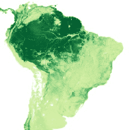
このデータセットは、2010 年頃の地上および地下の陸上炭素貯留量(炭素トン(t)/ ヘクタール(ha))を表しています。このデータセットは、最も信頼性の高い一般公開データセットを組み合わせて、2010 年の ESA CCI 土地被覆マップ(ESA、… biomass carbon forest-biomass wcmc -
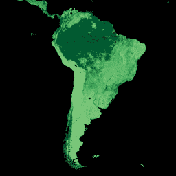
WHRC Pantropical National Level Carbon Stock Dataset

熱帯諸国の地上生木質バイオマス密度を 500 m の解像度で表した全国レベルの地図。このデータセットは、同じ場所で測定されたデータ、LiDAR 観測データ、中分解能撮像分光放射計(MODIS)で記録された画像データを組み合わせて作成されました。 aboveground biomass carbon forest-biomass geophysical umd