-
Google Global Landsat-based CCDC Segments(1999 ~ 2019 年)
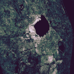
このコレクションには、20 年間の Landsat 地表反射率データに対して継続的変化検出と分類(CCDC)アルゴリズムを実行して事前に計算された結果が含まれています。CCDC は、動的 RMSE しきい値で調和関数を当てはめて時系列データのブレークポイントを検出するブレークポイント検出アルゴリズムです。カラーは、RGB 値とアルファ チャンネルで指定します。 change-detection google landcover landsat-derived landuse landuse-landcover -
JRC 地表水マッピング レイヤ v1.4

このデータセットには、1984 年から 2021 年までの地表水の位置と時間分布の地図が含まれており、これらの水面の範囲と変化に関する統計情報が提供されています。詳細については、関連するジャーナル記事「High-resolution mapping of global surface water and its …」をご覧ください。 change-detection geophysical google jrc landsat-derived surface -
MCD64A1.061 MODIS 焼失面積月次グローバル 500 m

Terra と Aqua を組み合わせた MCD64A1 バージョン 6.1 の焼失面積データ プロダクトは、月単位のグローバルな 500 m グリッド プロダクトで、ピクセルごとの焼失面積と品質情報が含まれています。MCD64A1 の焼失面積マッピング アプローチでは、500 m の MODIS 地表反射率画像と 1 km の MODIS 火災観測を組み合わせて使用します。アルゴリズムは… burn change-detection fire geophysical global mcd64a1 -
USFS 景観変化監視システム v2024.10(CONUS および OCONUS)
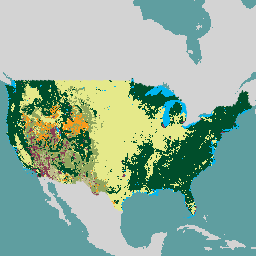
このプロダクトは、景観変化監視システム(LCMS)データスイートの一部です。各年の LCMS モデルの変更、土地被覆、土地利用クラスを示し、米国本土(CONUS)と、アラスカ(AK)、プエルトリコなど、CONUS 外の地域(OCONUS)を対象としています。 change-detection forest gtac landcover landuse landuse-landcover -
VNP64A1: Burned Area Monthly L4 Global 500m SIN Grid

Suomi National Polar-Orbiting Partnership(Suomi NPP)NASA Visible Infrared Imaging Radiometer Suite(VIIRS)Burned Area(VNP64A1)バージョン 1 のデータ プロダクトは、月単位のグローバルな 500 m グリッド プロダクトで、ピクセルごとの焼失面積と品質情報が含まれています。VNP64 の焼失面積マッピング アプローチでは、750 m の VIIRS を使用します。 burn change-detection fire land nasa noaa