Page Summary
-
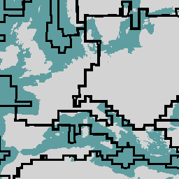
The dataset contains 106 Agro-Ecological Zones (AEZ) globally stratified based on crop calendars for generating WorldCereal products.
-
Each AEZ has unique crop calendars described by the start and end of season (SOS and EOS) in day of year (DOY).
-
Properties for each AEZ include a unique ID, a group ID based on crop calendar similarity, and SOS/EOS for various crop types.
-
The dataset is available from 2020 to 2022 and provided by the ESA WorldCereal Consortium under a CC-BY-4.0 license.

- Dataset Availability
- 2020-01-01T00:00:00Z–2022-01-01T00:00:00Z
- Dataset Producer
- ESA WorldCereal Consortium
- Tags
Description
The European Space Agency (ESA) WorldCereal classification system aims for product generation within one month after the end of a particular growing season. Due to the dynamic nature of these growing seasons across the globe, a global stratification into Agro-Ecological Zones (AEZ) was performed based on the global crop calendars created within the project [1]. The feature collection in this dataset contains the 106 AEZ for which WorldCereal products were generated. Each AEZ has unique crop calendars, described based on their start of season (SOS) and end of season (EOS). SOS and EOS are given in day of year (DOY). More information on the AEZ stratification and the subsequent WorldCereal product generation is described in [2].
AEZ properties:
- aez_id: the unique ID of each AEZ. WorldCereal products can be filtered based on this ID
- aez_groupid: the group ID combines several unique AEZ into a group based on crop calendar similarity.
- tc-annual_sos: SOS of the tc-annual season (DOY)
- tc-annual_eos: EOS of the tc-annual season (DOY)
- tc-wintercereals_sos: SOS of the tc-wintercereals season (DOY)
- tc-wintercereals_eos: EOS of the tc-wintercereals season (DOY)
- tc-springcereals_sos: SOS of the tc-springcereals season (DOY)
- tc-springcereals_eos: EOS of the tc-springcereals season (DOY)
- tc-maize-main_sos: SOS of the tc-maize-main season (DOY)
- tc-maize-main_eos: EOS of the tc-maize-main season (DOY)
- tc-maize-second_sos: SOS of the tc-maize-second season (DOY)
- tc-maize-second_eos: EOS of the tc-maize-second season (DOY)
Missing values of SOS and EOS indicate the absence of the respective growing season in a particular AEZ.
References:
WorldCereal datasets:
- Version 100 for year 2021
Table Schema
Table Schema
| Name | Type | Description |
|---|---|---|
| aez_id | INT | The unique ID of an AEZ. |
| aez_groupid | INT | The group ID combines several unique AEZ into a group based on crop calendar similarity. |
| tc-annual_sos | INT | SOS of the tc-annual season (DOY). |
| tc-annual_eos | INT | EOS of the tc-annual season (DOY). |
| tc-wintercereals_sos | INT | SOS of the tc-wintercereals season (DOY). |
| tc-wintercereals_eos | INT | EOS of the tc-wintercereals season (DOY). |
| tc-springcereals_sos | INT | SOS of the tc-springcereals season (DOY). |
| tc-springcereals_eos | INT | EOS of the tc-springcereals season (DOY). |
| tc-maize-main_sos | INT | SOS of the tc-maize-main season (DOY). |
| tc-maize-main_eos | INT | EOS of the tc-maize-main season (DOY). |
| tc-maize-second_sos | INT | SOS of the tc-maize-second season (DOY). |
| tc-maize-second_eos | INT | EOS of the tc-maize-second season (DOY). |
Terms of Use
Terms of Use
Citations
Van Tricht, K., Degerickx, J., Gilliams, S., Zanaga, D., Battude, M., Grosu, A., Brombacher, J., Lesiv, M., Bayas, J. C. L., Karanam, S., Fritz, S., Becker-Reshef, I., Franch, B., Mollà-Bononad, B., Boogaard, H., Pratihast, A. K., and Szantoi, Z.: WorldCereal: a dynamic open-source system for global-scale, seasonal, and reproducible crop and irrigation mapping, Earth Syst. Sci. Data Discuss. [preprint], doi:10.5194/essd-2023-184, in review, 2023.,
DOIs
Explore with Earth Engine
Code Editor (JavaScript)
var aez = ee.FeatureCollection('ESA/WorldCereal/AEZ/v100');

// Find the AEZs with multiple growing seasons for maize and cereal.
var twoMaizeAez =
    aez.filter(ee.Filter.notNull(['tc-maize-main_eos', 'tc-maize-second_eos']));
var twoCerealAez = aez.filter(
    ee.Filter.notNull(['tc-wintercereals_eos', 'tc-springcereals_eos']));

Map.addLayer(
    twoMaizeAez.draw('ff0000', 1, 2), {}, 'AEZ with two maize seasons');
Map.addLayer(
    twoCerealAez.draw('0000ff', 1, 2), {}, 'AEZ with two cereal seasons');
Visualize as a FeatureView
A FeatureView is a view-only, accelerated representation of a
FeatureCollection. For more details, visit the
FeatureView documentation.
Code Editor (JavaScript)
var aezLayer = ui.Map.FeatureViewLayer('ESA/WorldCereal/AEZ/v100_FeatureView');
var visParams = {
  opacity: 0.5,
  lineWidth: 5,
  polygonFillColor: 'red'
};

aezLayer.setVisParams(visParams);
aezLayer.setName('Agro-Ecological Zones');

Map.setCenter(15.5, 35.5, 3);
Map.add(aezLayer);