Page Summary
-
The HYCOM dataset provides interpolated oceanographic data including salinity, temperature, velocity, and elevation on a uniform grid.
-
The MEaSUREs Greenland Ice Velocity dataset offers mean monthly velocity maps for selected glacier areas, derived from optical image tracking.
-
HYCOM: Hybrid Coordinate Ocean Model, Water Velocity
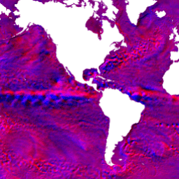
The Hybrid Coordinate Ocean Model (HYCOM) is a data-assimilative hybrid isopycnal-sigma-pressure (generalized) coordinate ocean model. The subset of HYCOM data hosted in EE contains the variables salinity, temperature, velocity, and elevation. They have been interpolated to a uniform 0.08 degree lat/long grid between 80.48°S and … hycom nopp oceans velocity water -
MEaSUREs Greenland Ice Velocity: Selected Glacier Site Velocity Maps from Optical Images Version 2
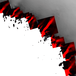
This dataset, part of the NASA Making Earth System Data Records for Use in Research Environments (MEaSUREs) program, consists of mean monthly velocity maps for selected glacier outlet areas. The maps are generated by tracking visible features between optical image pairs acquired by the Landsat … arctic cryosphere gimp greenland ice nasa